Situation Summary
Slovenia remains at minimal global security risk (rank #180, composite threat score 3) with no significant escalations recorded. The country continues to experience routine policing activity and infrastructure disruptions from natural hazards; the most significant recent event is flash flooding in northwestern regions following heavy thunderstorms on 2026-08-08. Border migration pressure persists at moderate levels, with police handling irregular crossings primarily in the south and east.
Key Developments
- Bovec, northwestern Slovenia — 2026-08-08: Flash floods following heavy thunderstorms caused significant damage to garages, a hotel, and a cultural center; recovery operations underway.
- Dragomelj, near Ljubljana — 2026-08-08: Two workers fell after panels destabilized their ladders at a worksite; one sustained serious injury, the other light injury; incident under police investigation.
- Črnomelj district, southeastern Slovenia — night of Friday–Saturday (date not fully specified): Police handled approximately 20 foreign nationals, including 18 Egyptians, 1 Afghan, and 1 Pakistani, in the Črnomelj area near a church and event space; asylum processing underway.
- Pince, Pomurje — recent date (referenced as "the previous day" in source): Police detained eight foreign nationals after illegal entry into Slovenia; transferred for asylum processing.
- Kamnik — recent evening (specific date not fully detailed): Police, including special units, conducted a multi-hour intervention resulting in the arrest of a man alleged to have threatened and held a child with a sharp object inside a building.
- Nationwide border areas — last 24 hours: Slovenian police processed 106 people for illegal border crossings from Croatia; highest concentrations recorded in Novo Mesto, followed by Ljubljana and Koper districts.
- Ljubljana — 2026-08-10: India formally condemned the defacement of its embassy in Ljubljana, demanding identification of perpetrators and accountability from Slovenian authorities.
- Nationwide — last 24 hours: Police logged 691 intervention events, including 143 traffic accidents, 85 public-order violations, and 48 crimes; no major escalation flagged in official summary.
Highest-Risk Areas
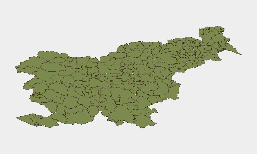
All twelve tracked sub-national regions report zero composite risk scores, indicating uniform low threat levels across Slovenia. Northwestern border municipalities (Bovec, Kobarid, Tolmin, and Bohinj) and southwestern regions (Brda, Miren-Kostanjevica) show marginally elevated attention due to cross-border migration flows and natural-hazard exposure, particularly flood vulnerability in alpine and karst terrain. Southern and eastern districts nearest Croatian and Hungarian borders (Novo Mesto, Črnomelj areas) experience routine but sustained irregular-crossing activity without security escalation.
How GeoBit Would Assist
Security teams with personnel or assets in Slovenia would employ AOI Monitoring & Early Warning to track recurring migration routes and flash-flood zones in northwestern regions, coupled with Intel Sweep and multi-language OSINT to detect early signals of labor-site accidents, civil unrest, or organized trafficking. GIS & Spatial Analysis and Routing & Network Analysis capabilities would support contingency planning around border crossings and flood-prone infrastructure, enabling rapid alternative-route identification during disruptions.
7-Day Outlook
No material security escalation is anticipated over the next seven days. Routine border migration processing, occasional workplace incidents, and residual recovery from the 2026-08-08 flooding will likely continue at current low levels. Weather monitoring for further thunderstorms in alpine areas remains prudent for organizations with field operations in northwestern Slovenia.
Highest-Risk Areas — Ranked
| # | State / Region | Risk |
|---|---|---|
| 1 | Bovec | 0 |
| 2 | Kobarid | 0 |
| 3 | Kanal | 0 |
| 4 | Kranjska Gora | 0 |
| 5 | Gorje | 0 |
| 6 | Tolmin | 0 |
| 7 | Bohinj | 0 |
| 8 | Cerkno | 0 |
| 9 | Brda | 0 |
| 10 | Šempeter-Vrtojba | 0 |
| 11 | Renče-Vogrsko | 0 |
| 12 | Miren-Kostanjevica | 0 |
Sources
Previous Daily Briefs
A new Slovenia brief is written every day — each with its own risk map and downloadable CSV. Here's the last week; use the calendar to go further back.
📅 Browse every day by calendar →
Highlighted days have a brief. Tap a day for that day's map & analysis, or “csv” for that day's dataset ($5).
Atlas — our AI intelligence desk — emails them this snapshot personally. Nothing else, no list.