Situation Summary
Taiwan faces elevated military and political risk as of 27 July 2026, driven by sustained Chinese People's Liberation Army air and naval activity around the island's air-defense identification zone (ADIZ) and median line, coupled with recent domestic political friction over presidential authority. Chinese live-fire exercises in the Taiwan Strait (23–24 July) have concluded but left residual maritime transit warnings and heightened baseline military posture. The composite threat score of 18 reflects multiple concurrent event signals—including military maneuvers, political disapproval votes, and U.S.–Taiwan diplomatic friction—rather than a single acute crisis.
Key Developments
- PLA aircraft and naval sorties near Taiwan ADIZ (25–26 July, northern ADIZ and median line). Taiwan Ministry of National Defense reported 2 PLA aircraft crossing the median line into the northern ADIZ, supported by 7 PLAN vessels and 1 PRC official ship, up to 06:00 UTC+8 on 26 July. Previous day (25 July) saw 10 aircraft sorties with 8 crossing the median line.
- Chinese live-fire exercises in Taiwan Strait and East China Sea (23–24 July, Fujian coast). China's Maritime Safety Administration conducted two days of scheduled live-fire drills (06:00–18:00 local time each day), restricting vessel access to designated zones. Taiwan's defense ministry remained on high alert but assessed the exercises as part of routine military pressure rather than immediate operational threat.
- Sustained elevated PLA presence post-drills (24–26 July, waters and airspace near Taiwan). Continued reporting of 20+ aircraft and 8+ naval vessels operating near Taiwan in single 24-hour windows, with multiple median-line crossings recorded. This sustained tempo increases risk of accidental airspace or maritime incidents.
- Failed presidential impeachment motion (date within past week, Legislative Yuan, Taipei). Opposition motion to remove President William Lai secured only 56 votes, well below the two-thirds threshold required. While unsuccessful, the move signals domestic political friction and potential for legislative confrontation and public dissent.
- Chinese vessel maneuver into Taiwan's restricted maritime zone (mid-to-late July, Taiwan's coastal waters). Hull 3501 reportedly executed a sharp maneuver to enter a restricted zone—the second such incident in under two weeks. Incident timing cannot be firmly placed within 48-hour window but contributes to elevated maritime safety risk.
Highest-Risk Areas
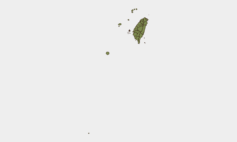
Penghu County dominates the sub-national ranking (risk 31.3), likely reflecting its proximity to Chinese-controlled waters and strategic position in the Taiwan Strait; the archipelago faces elevated exposure to both military activity and maritime incidents. Taipei (risk 14) follows, driven by political event density, legislative activity, and government/infrastructure concentration. Nantou County (risk 5.9) remains elevated, though causes are less clear from current signals. All other tracked regions show composite scores below 2.5, indicating risk is heavily concentrated in the Strait-adjacent and capital-area zones.
How GeoBit Would Assist
Maritime & Aviation Tracking and AOI Monitoring & Early Warning would enable real-time surveillance of PLA aircraft, naval movements, and vessel transits near Taiwan's ADIZ and restricted zones, with automated alerting on median-line crossings or unusual maneuvers. Conflict & Military battle-mapping and force-structure tracking would contextualize the scale and composition of reported sorties and ship formations. Routing & Network Analysis would help identify alternative maritime and air corridors for corporate operations during periods of heightened military activity.
7-Day Outlook
Chinese military activity is expected to remain elevated through early August, with continued air and naval sorties near the ADIZ as part of broader strategic pressure. Domestic political friction may surface in public demonstrations or legislative sessions, particularly if opposition parties escalate impeachment or no-confidence efforts. Maritime transit delays and airspace routing disruptions should be anticipated; companies operating logistics, shipping, or aviation assets should monitor daily PLA activity reports and Chinese notices-to-airmen (NOTAMs).
Highest-Risk Areas — Ranked
| # | State / Region | Risk |
|---|---|---|
| 1 | Penghu | 31.3 |
| 2 | Taipei | 14 |
| 3 | Nantou County | 5.9 |
| 4 | Taichung | 2.4 |
| 5 | Kaohsiung | 1.3 |
| 6 | Pingtung County | 1.3 |
| 7 | Taitung County | 1.3 |
| 8 | Lienchiang County | 1.3 |
| 9 | Kinmen | 1.3 |
| 10 | Changhua County | 1.3 |
| 11 | Miaoli County | 1.3 |
| 12 | Yunlin County | 1.3 |
Sources
Previous Daily Briefs
A new Taiwan brief is written every day — each with its own risk map and downloadable CSV. Here's the last week; use the calendar to go further back.
📅 Browse every day by calendar →
Highlighted days have a brief. Tap a day for that day's map & analysis, or “csv” for that day's dataset ($5).
Atlas — our AI intelligence desk — emails them this snapshot personally. Nothing else, no list.