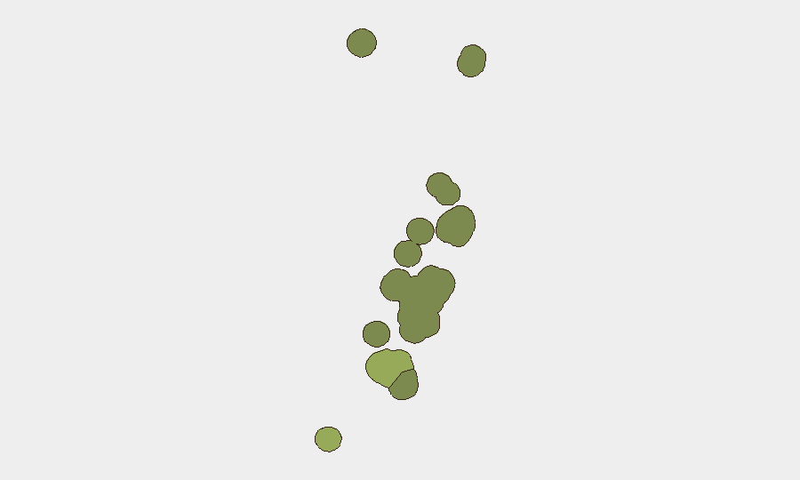
Situation Summary
Tonga remains in a period of relative security stability with no verified incidents of civil unrest, armed conflict, major crime spikes, or infrastructure failures reported in the last 24–48 hours. The country continues to experience elevated seismic activity in surrounding waters (12 earthquakes magnitude 4.9–5.4 recorded recently, primarily south of the archipelago), though none have triggered tsunami warnings or caused reported damage to populated areas. The overall national threat composite score remains minimal, with risk concentrated in Tongatapu and secondary population centers.
Key Developments
No verified security, civil-unrest, crime, or infrastructure incidents have been reported in Tonga in the last 24–48 hours.
The most recent credible incident reports date to July 21–24, 2026 and include a police custody escape and manhunt in Nuku'alofa and an investigation into an unidentified male body near Masefield Naval Base; however, neither event has generated dated updates within the current 48-hour window. The GeoBit Tonga Security Brief of July 24 explicitly confirmed the absence of new protests, armed conflict, civil unrest, or major crime spikes in the preceding 48-hour period.
Seismic activity continues: multiple magnitude 5.0–5.4 earthquakes have been recorded in the Tonga Trench and adjacent ocean areas in recent days, consistent with the region's high tectonic activity. No corresponding damage reports or tsunami alerts have been issued.
Highest-Risk Areas
Tongatapu (composite risk score 45) dominates the national profile, reflecting its status as the capital region and seat of government, highest population density, and concentration of commercial infrastructure. Vavaʻu (risk 28) and Haʻapai (risk 22) represent secondary population and economic centers and are more geographically dispersed, lowering their individual risk profiles. Smaller island groups (ʻEua, Ongo Niua) carry minimal tracked risk. The elevation of Tongatapu risk reflects structural factors—urbanization, administrative concentration, and maritime-trade dependency—rather than acute current threats.
How GeoBit Would Assist
Corporate security teams operating in Tonga should employ AOI Monitoring & Early Warning on Tongatapu and Vavaʻu to detect emerging civil unrest, port disruptions, or localized criminal activity. Maritime & Aviation tracking and Environmental & Health monitoring provide persistent awareness of seismic and maritime hazard evolution, critical for supply-chain continuity in an island economy. Intel Sweep and OSINT fusion across regional news, social media, and specialist security feeds ensure rapid detection of incidents the moment they are reported, reducing detection lag for operational decision-making.
7-Day Outlook
No material change in Tonga's security posture is anticipated over the next 7 days. Seismic activity in surrounding waters is expected to remain elevated but non-threatening to populated zones based on historical patterns; monitoring should focus on official tsunami and civil-protection alerts rather than raw earthquake counts. Duty-of-care protocols for personnel and asset protection should remain aligned with baseline Tonga country risk, with heightened attention to weather and maritime hazard forecasts during the regional wet season.
Highest-Risk Areas — Ranked
| # | State / Region | Risk |
|---|---|---|
| 1 | Tongatapu | 45 |
| 2 | Vavaʻu | 28 |
| 3 | Haʻapai | 22 |
| 4 | ʻEua | 18 |
| 5 | Ongo Niua | 12 |
Sources
Previous Daily Briefs
A new Tonga brief is written every day — each with its own risk map and downloadable CSV. Here's the last week; use the calendar to go further back.
📅 Browse every day by calendar →
Highlighted days have a brief. Tap a day for that day's map & analysis, or “csv” for that day's dataset ($5).
Atlas — our AI intelligence desk — emails them this snapshot personally. Nothing else, no list.