Situation Summary
Turkey remains at composite threat rank #46 globally with a stable 37-point threat score across 222 tracked events. Current security posture is dominated by pre-NATO summit (7–8 July) preventive measures—gathering bans, detention operations, checkpoint expansion, and elevated air-defense alert—rather than active violent incidents or terrorism. The overall risk trajectory is elevated but contained, with disruption concentrated in Ankara and select border regions; no major attacks, riots, or terror events have been corroborated in the past 24–48 hours.
Key Developments
- Ankara Province (active as of 1 July): Police presence substantially expanded with vehicle checkpoints and restricted-access zones around government complexes, airports, and summit venues, causing localized travel disruption and heightened stop-and-search activity.
- Ankara Province (30 June–1 July): Authorities imposed a two-week ban on public gatherings—demonstrations, concerts, public events—across the province as a summit security measure, directly restricting civil assembly and protest activity.
- Ankara and multi-province operations (30 June–1 July): Coordinated detentions of more than 200 individuals (activists, journalists, lawyers, alleged extremist suspects) in counter-terrorism and pre-summit security operations; approximately 178 remained in pre-trial detention as of 1 July, raising human-rights and future protest-mobilization concerns.
- National airspace and air-defense posture (active as of 1 July): Turkey has placed air defenses on high alert and is deploying tens of thousands of police nationwide, with intensified screening at airports and critical infrastructure ahead of the NATO summit.
- Ankara Province (late June to 1 July): Authorities blocked access to websites critical of NATO/the summit and denied accreditation to opposition-leaning journalists, citing security and public-order grounds, indicating information-control escalation.
- Greece/Bulgaria border regions (late June 2026): Turkish security forces detained at least 66 irregular migrants at multiple locations near unauthorized crossing points, signaling potential for ad hoc enforcement checks and detentions in border areas.
Highest-Risk Areas
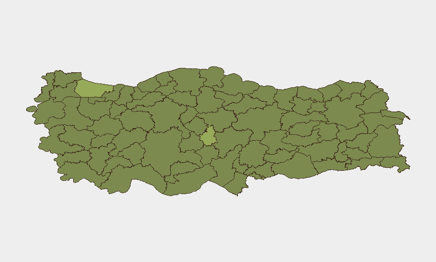
Nevşehir (55.6), Istanbul (40.4), and Ankara (39.1) are the three highest-risk provinces, with Nevşehir's elevated score reflecting regional instability factors. Istanbul and Ankara drive risk through a combination of summit-related security operations, protest restriction, detention activity, and expanded policing. Mersin (31.5) and Şırnak (30.7) follow, with Şırnak reflecting ongoing south-eastern security pressures; southeastern and central provinces (Tunceli, Bingöl, Erzurum) remain moderately elevated. The concentration of current operational risk is Ankara-centric due to the NATO summit, but Istanbul remains a secondary focus due to its scale and population density.
How GeoBit Would Assist
Security teams would employ AOI Monitoring & Early Warning to track checkpoint locations, detention facilities, and assembly-ban enforcement across Ankara in real time, with alerting for checkpoint expansions affecting corporate travel corridors. Intel Sweep and X/Telegram OSINT would provide continuous monitoring of protest mobilization, civil-liberties responses, and journalist detentions to anticipate secondary demonstrations or unrest post-summit. Routing & Network Analysis would support alternative journey planning around checkpoints and restricted zones for personnel in transit, while Conflict & Military tracking would monitor NATO summit security posture and any unplanned force movements or airspace restrictions.
7-Day Outlook
The NATO summit (7–8 July) will sustain elevated security operations and movement restrictions through at least mid-July. Ankara will remain the primary risk concentration, with secondary attention to Istanbul. Risk is forecast to decline sharply after 9 July absent major incidents; however, post-summit detention reviews and potential rights-group mobilization could extend minor civil-unrest risk into late July.
Highest-Risk Areas — Ranked
| # | State / Region | Risk |
|---|---|---|
| 1 | Nevşehir | 55.6 |
| 2 | Istanbul | 40.4 |
| 3 | Ankara | 39.1 |
| 4 | Mersin | 31.5 |
| 5 | Şırnak | 30.7 |
| 6 | Tunceli | 26.5 |
| 7 | Bingöl | 26.5 |
| 8 | Sinop | 26.5 |
| 9 | Erzurum | 25.6 |
| 10 | Kars | 25.6 |
| 11 | Yozgat | 25.6 |
| 12 | Niğde | 25.6 |
Sources
Previous Daily Briefs
A new Turkey brief is written every day — each with its own risk map and downloadable CSV. Here's the last week; use the calendar to go further back.
📅 Browse every day by calendar →
Highlighted days have a brief. Tap a day for that day's map & analysis, or “csv” for that day's dataset ($5).
Atlas — our AI intelligence desk — emails them this snapshot personally. Nothing else, no list.