Situation Summary
Vanuatu maintains a stable security environment with no verified incidents of civil unrest, serious crime, or infrastructure failure reported in the last 24–48 hours. The country's composite threat score of 7 (rank #143 globally) reflects a low-risk baseline, though sub-national variation is significant, with Shefa Province representing elevated risk. The most recent documented natural hazard—a magnitude 6.1 offshore earthquake on 16 August northeast of Espiritu Santo—caused no casualties or significant damage and does not alter the near-term security trajectory.
Key Developments
- No new security, civil-unrest, crime, or infrastructure incidents reported in Vanuatu for 19–20 August 2026 in multi-source open reporting. The security environment remains stable with no verified travel alerts, port disruptions, or aviation incidents.
- Political governance development (17–18 August): Prime Minister announced creation of an advisory committee on presidential pardons following controversy over clemency decisions for sexual-assault convictions. No associated protests, unrest, or security incidents have been verified; development is constitutional/governance-focused rather than acute threat-related.
- Earthquake monitoring (post-16 August): The 6.1 magnitude offshore event near Port Olry at intermediate depth (188 km) generated no tsunami warning and no reported aftershocks of concern. Continued seismic monitoring remains standard protocol in the region.
Highest-Risk Areas
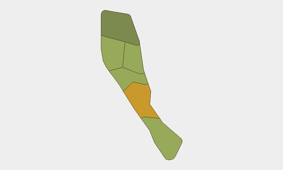
Shefa Province (risk score 72) dominates the sub-national threat landscape, driven by concentration of urban infrastructure, maritime activity, and historical petty crime in Port Vila and surrounding settlements. Penama (58) and Sanma (52) carry elevated composite risk, likely reflecting isolation, limited law-enforcement presence, and weather/maritime hazards. Malampa, Tafea, and Torba present lower but non-negligible risk, with Torba's score (35) the lowest. The variation reflects geographic dispersion, infrastructure density, and capacity constraints rather than active conflict or organized violence; duty-of-care priorities should weight Shefa operations and personnel accordingly.
How GeoBit Would Assist
Teams with personnel or assets in Vanuatu should employ Intel Sweep and multi-language OSINT fusion to maintain real-time awareness of civil, political, and crime developments, supplemented by X/Twitter and Telegram OSINT to detect early signals of unrest or emergencies. AOI Monitoring & Early Warning services can provide persistent, automated alerts on Shefa Province and other designated high-risk areas, flagging new incidents or political statements within hours of occurrence. For travel and supply-chain security, maritime tracking and alternative routing analysis support contingency planning around weather, port disruption, or regional instability.
7-Day Outlook
Vanuatu's security environment is forecast to remain stable over the next seven days absent new natural hazards or political triggers. The recent presidential-pardon governance announcement carries low acute risk but warrants continued monitoring for public response. Seasonal weather and seismic activity remain endemic hazards; organizations should maintain standard tropical-cyclone and earthquake preparedness protocols.
Highest-Risk Areas — Ranked
| # | State / Region | Risk |
|---|---|---|
| 1 | Shefa Province | 72 |
| 2 | Penama | 58 |
| 3 | Sanma | 52 |
| 4 | Malampa | 48 |
| 5 | Tafea | 45 |
| 6 | Torba | 35 |
Sources
Previous Daily Briefs
A new Vanuatu brief is written every day — each with its own risk map and downloadable CSV. Here's the last week; use the calendar to go further back.
- August 18, 2026
- August 16, 2026
- August 14, 2026
- August 12, 2026
- August 10, 2026
- August 8, 2026
- August 6, 2026
📅 Browse every day by calendar →
Highlighted days have a brief. Tap a day for that day's map & analysis, or “csv” for that day's dataset ($5).
Atlas — our AI intelligence desk — emails them this snapshot personally. Nothing else, no list.