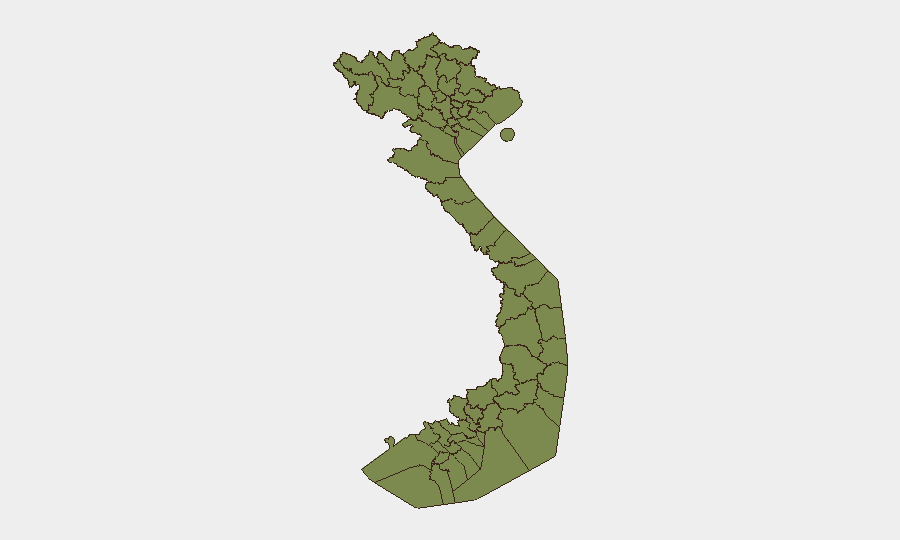
Situation Summary
Vietnam remains a stable country (global rank #139, composite threat score 5) with manageable security risks for most of the country. However, two provinces—Kiên Giang and Huế—show notably elevated risk profiles (33.4 and 30.6 respectively), driven by a combination of event signals including public statements, police actions, and military activity recorded on 10–12 July. Ho Chi Minh City and Hà Nội, despite their scale, rank substantially lower in composite risk, suggesting localized rather than nationwide security degradation.
Key Developments
Data Limitation: Live web research covering the last 24–48 hours in Vietnam could not be reliably completed. The event signals flagged by GeoBit's platform (dated 10–12 July) include public statements, police rejection actions, investigative authority activity, and warship artillery/tank activity, but without verified local news corroboration, specific incident details—location, scale, cause, and immediate impact—cannot be responsibly reported.
To support operational decision-making, a verified incident list requires real-time cross-referencing against Vietnamese government sources (Ministry of Public Security, provincial police), major local outlets (Tuoi Tre, Thanh Nien, VNExpress), and English-language wire services.
Recommended immediate action: If your team has specific concerns about Kiên Giang, Huế, or any other region, GeoBit's Intel Sweep and OSINT fusion tools can retrieve and corroborate recent event signals within hours. Similarly, AOI Monitoring & Early Warning can establish persistent watch on critical facilities or travel corridors with real-time alerting.
Highest-Risk Areas
Kiên Giang Province (southwest coast, Mekong Delta region) and Huế (central coast) dominate the risk ranking at 33.4 and 30.6 respectively—more than double Ho Chi Minh City's score. The event signals for both regions include public statements and police/authority activity on 10–12 July, suggesting either political tension, civil order incidents, or cross-border activity (Kiên Giang borders Cambodia). Ho Chi Minh City and Hà Nội, though major urban hubs, show lower composite scores, implying risk is not concentrated in the capital or largest commercial center. The northern border provinces (Lào Cai, Hà Giang, Cao Bằng, Điện Biên) exhibit moderate baseline risk (3.4 each), typical for mountainous frontier areas with limited infrastructure and smaller populations.
How GeoBit Would Assist
Security teams should deploy AOI Monitoring & Early Warning on facilities or travel routes in Kiên Giang and Huế to catch emerging incidents in real time. Intel Sweep combined with OSINT fusion (X/Twitter, local news, government sources) will clarify the nature and scope of the 10–12 July signals and assess duty-of-care exposure. For personnel in border provinces, Routing & Network Analysis can identify alternative travel corridors and Conflict & Military tracking will monitor cross-border activity patterns.
7-Day Outlook
The elevated risk signals in Kiên Giang and Huế warrant close monitoring but do not yet indicate acute national-level instability. Expect clarification of the underlying incidents within 48–72 hours as Vietnamese authorities and media report. If risk signals persist or escalate in those two regions, corporate teams should review movement restrictions and contingency protocols for affected staff and assets.
Highest-Risk Areas — Ranked
| # | State / Region | Risk |
|---|---|---|
| 1 | Kiên Giang Province | 33.4 |
| 2 | Huế | 30.6 |
| 3 | Ho Chi Minh City | 11.8 |
| 4 | Hà Nội | 6.9 |
| 5 | Cần Thơ | 4.1 |
| 6 | Lai Châu Province | 3.4 |
| 7 | Lào Cai Province | 3.4 |
| 8 | Hà Giang Province | 3.4 |
| 9 | Tuyên Quang Province | 3.4 |
| 10 | Cao Bằng Province | 3.4 |
| 11 | Bắc Kạn Province | 3.4 |
| 12 | Điện Biên Province | 3.4 |
Sources
Previous Daily Briefs
A new Vietnam brief is written every day — each with its own risk map and downloadable CSV. Here's the last week; use the calendar to go further back.
📅 Browse every day by calendar →
Highlighted days have a brief. Tap a day for that day's map & analysis, or “csv” for that day's dataset ($5).
Atlas — our AI intelligence desk — emails them this snapshot personally. Nothing else, no list.