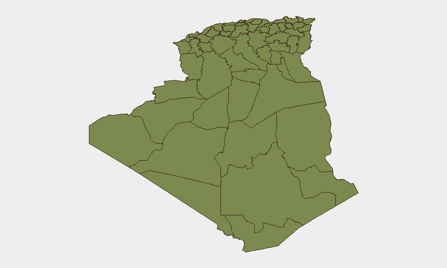
Situation Summary
Algeria faces a fragmented security environment dominated by wildfire risk across multiple regions and persistent counterterrorism and narcotics activity in the south and northwest. The country's composite threat score remains moderate (16/100), but geographic concentration—particularly in Algiers (31.3) and southern border zones—creates localized exposure for corporate operations. Recent ANP operations against militants and drug networks indicate active security force engagement, though the scale of organized terrorist presence remains contained relative to regional peers.
Key Developments
Algiers wildfire activity (late July 2026): Multiple active fires reported across the Algiers region over the past week; at least ten distinct wildfire events tracked by GeoBit in the reporting period. Civilian evacuation and air-quality impacts likely; corporate facilities and staff travel corridors warrant real-time air-quality and road-closure monitoring.
Chlef counterterrorism operation (27 July 2026): ANP killed two militants in Chlef wilaya (1st Military Region) and recovered two Kalashnikov submachine guns and ammunition. Operation conducted in afternoon of 27 July; no civilian casualties reported. Indicates persistent low-level militant presence in northwest highlands.
Southwest drug-trafficking enforcement (26 July 2026): ANP arrested five traffickers and seized 45+ kg of cocaine and large quantities of psychotropic tablets in coordinated operations across Adrar, Béchar, and Timimoun (3rd Military Region). Reflects ongoing smuggling activity via Saharan border zones; corporate supply-chain and staff-movement risks in these areas remain elevated.
Highest-Risk Areas
Algiers dominates the risk profile at 31.3—a factor of 24× higher than any other region—driven by wildfire hazard, urban density, and concentration of foreign corporate presence. The southern tier (Béchar, Adrar, Bordj Badji Mokhtar) and interior highland zones (Tizi Ouzou, Chlef) carry secondary but consistent risk (1.3 each) from militant activity, cross-border narcotics trafficking, and limited state capacity in remote areas. Northern coastal and central zones show lower baseline risk but remain subject to seasonal hazard escalation (wildfires, flooding). Companies with personnel or assets in Algiers should prioritize air-quality, evacuation-route, and facility-integrity monitoring; those in southern and border regions should maintain enhanced vetting of local staff and supply-chain partners.
How GeoBit Would Assist
AOI Monitoring & Early Warning on Algiers and other high-risk wilaya enables real-time detection of fire spread, road closures, and air-quality degradation affecting staff and supply routes. Intel Sweep, X/Twitter & Telegram OSINT, and multi-language search provide rapid corroboration of ANP security operations, militant activity, and trafficking enforcement, allowing duty-of-care teams to assess emerging threats before they affect operations. GIS & Spatial Analysis and Satellite & Imagery support facility-level risk assessment and route-planning alternatives for staff movement in wildfire or conflict zones.
7-Day Outlook
Wildfire activity in Algiers and surrounding regions will likely persist given seasonal summer heat and reported fire density; corporate teams should expect intermittent air-quality alerts and potential transit disruptions. Counterterrorism and anti-narcotics operations are expected to continue at current operational tempo in the northwest and south, with no indication of imminent escalation. Overall security trajectory remains stable but operationally fragmented by environmental hazard.
Highest-Risk Areas — Ranked
| # | State / Region | Risk |
|---|---|---|
| 1 | Algiers | 31.3 |
| 2 | Bechar | 1.3 |
| 3 | Beni Abbes | 1.3 |
| 4 | Adrar | 1.3 |
| 5 | Bordj Badji Mokhtar | 1.3 |
| 6 | El Bayadh | 1.3 |
| 7 | Ghardaia | 1.3 |
| 8 | Saïda | 1.3 |
| 9 | Boumerdes | 1.3 |
| 10 | Tizi Ouzou | 1.3 |
| 11 | Chlef | 1.3 |
| 12 | Relizane | 1.3 |
Sources
Previous Daily Briefs
A new Algeria brief is written every day — each with its own risk map and downloadable CSV. Here's the last week; use the calendar to go further back.
📅 Browse every day by calendar →
Highlighted days have a brief. Tap a day for that day's map & analysis, or “csv” for that day's dataset ($5).
Atlas — our AI intelligence desk — emails them this snapshot personally. Nothing else, no list.