Situation Summary
Antigua and Barbuda faces a composite threat score of 3 (global ranking: unranked), reflecting low systemic risk but localized criminal activity concentrated in Antigua's urban and suburban zones. No verified security incidents have been corroborated in the last 24–48 hours; however, sporadic armed violence in the preceding week (7 incidents across multiple locations, 26–27 July and prior) indicates an underlying pattern of gang-related and interpersonal shootings. The twin-island state remains stable at the macro level, with no civil unrest, infrastructure collapse, or travel advisories in effect, but duty-of-care teams should maintain awareness of micro-level crime concentration in specific neighborhoods.
Key Developments
- No verified incidents in the last 24–48 hours. Cross-source OSINT and local news monitoring identified no corroborated security events, crime reports, or infrastructure disruptions during the current reporting window.
- Preceding week pattern (7–23 July): 5+ armed incidents in Antigua. Fatalities and injuries reported in Potters/Ladoo Road (20 July), Freeman's Village (23 July), and Villa/Mount Joy (21 July) reflect ongoing localized gang and interpersonal violence; none of these are current developments but indicate persistent sub-surface risk.
- Coast Guard search operation ongoing (26 July, social media unconfirmed). Reports of three missing fishermen near Point Wharf/offshore area circulated via social media; official incident confirmation and status remain pending independent corroboration.
- V.C. Bird International Airport infrastructure update (26 July, non-risk). Phase 9 runway and taxiway rehabilitation reportedly completed; this is operational progress, not a disruption or threat event.
Highest-Risk Areas
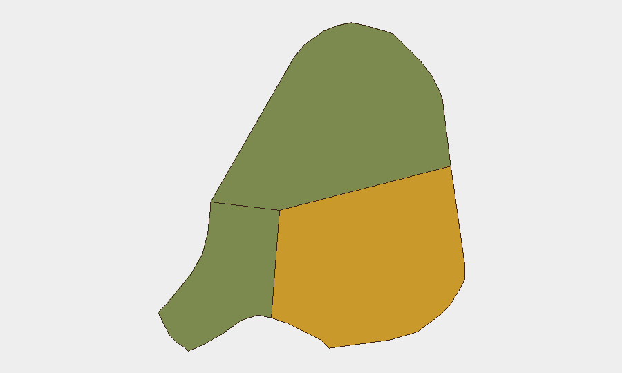
Antigua (composite risk score 72) dominates the island-nation threat picture, accounting for the vast majority of recorded and reported criminal violence. Urban and semi-urban zones—including Potters, Freeman's Village, Villa, and Mount Joy—emerge as focal points for armed incidents, suggesting localized gang territorial or dispute-driven activity. Barbuda (risk 18) and Redonda (risk 8) remain peripheral to the current risk profile. Corporate and NGO personnel based in or traveling to Antigua should apply heightened situational awareness in these neighborhoods, particularly after dark; Barbuda and Redonda pose negligible incremental risk at present.
How GeoBit Would Assist
AOI Monitoring & Early Warning with persistent watch on Antigua's high-risk neighborhoods (Potters, Freeman's Village, Villa, Mount Joy) would enable near-real-time alerting of shooting incidents, police operations, and social-media escalation signals before they affect staff or assets. OSINT Fusion & Corroboration across local news, police radio, journalist social feeds, and emergency-services announcements would disambiguate unconfirmed reports (e.g., the missing-fishermen incident) and filter false alarms from actionable threat data. Routing & Network Analysis would support duty-of-care teams in identifying safe transit corridors and alternative routes around active incident zones, reducing exposure during peak crime periods.
7-Day Outlook
Armed violence in Antigua is expected to remain episodic and spatially localized, with no indication of escalation to organized criminal turf warfare or gang confederation. Weather, seasonal tourism flows, and local law-enforcement activity are likely to remain neutral or stabilizing factors over the near term. No material change to overall threat posture is anticipated; monitoring should remain granular and neighborhood-specific rather than island-wide.
Highest-Risk Areas — Ranked
| # | State / Region | Risk |
|---|---|---|
| 1 | Antigua | 72 |
| 2 | Barbuda | 18 |
| 3 | Redonda | 8 |
Sources
Previous Daily Briefs
A new Antigua and Barbuda brief is written every day — each with its own risk map and downloadable CSV. Here's the last week; use the calendar to go further back.
📅 Browse every day by calendar →
Highlighted days have a brief. Tap a day for that day's map & analysis, or “csv” for that day's dataset ($5).
Atlas — our AI intelligence desk — emails them this snapshot personally. Nothing else, no list.