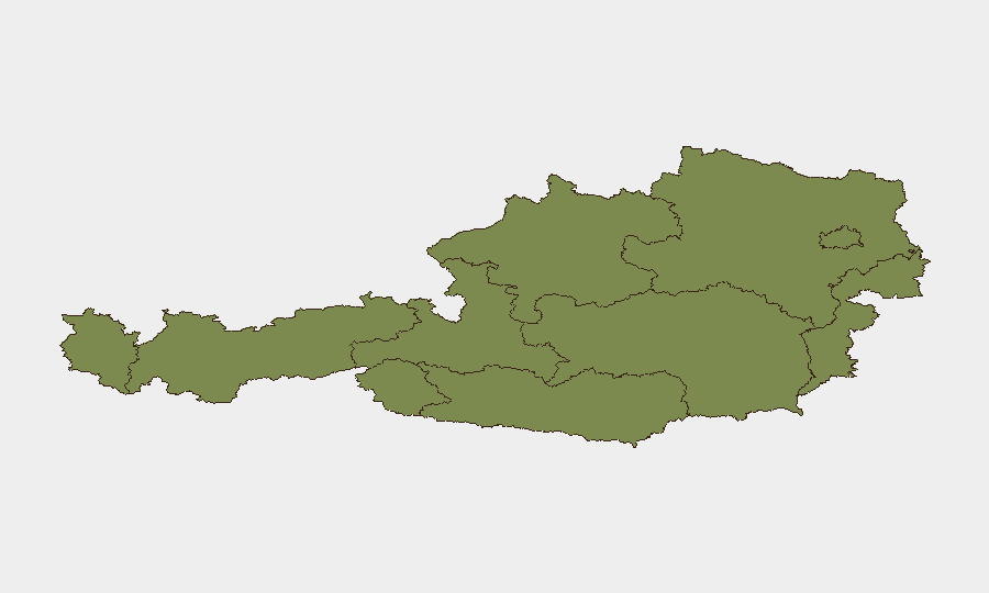
Situation Summary
Austria remains a low-threat environment globally (composite score 28), but the concentration of risk in Vienna—with a sub-national score of 31.3, more than three times that of any other region—reflects acute localized volatility. Recent event signals dating 24–26 July indicate a cluster of disparate incidents spanning industrial threats, property damage, military-adjacent activity, and assassination-related reports, predominantly centered on the capital. Seismic activity (M 4.2 near Schottwien) and flood warnings add environmental complication. Overall trajectory suggests elevated situational complexity rather than systemic instability.
Key Developments
- 2026-07-24 | Industrial threat incident: Unspecified threat targeting industry sector; location and details require verification from Austrian industrial security networks.
- 2026-07-25 | Government property damage: Seize/damage property event at government facility; Vienna likely epicenter given regional risk concentration.
- 2026-07-25 | Political disapproval event: Demonstration or confrontation directed at politician(s); no casualties reported in available signals.
- 2026-07-25 | Military engagement (bilateral): Conventional military force activity reported between Austrian and Kingdom actors; nature and scale unclear from available data; warrants urgent clarification through diplomatic and defense channels.
- 2026-07-26 | Assassination reports (×2): Two separate assassination signals flagged, both student-vs-Austria category; specifics (target, location, status) unconfirmed and require immediate human intelligence corroboration.
- 2026-07-26 | Seismic event: M 4.2 earthquake centered 1 km east of Schottwien (Lower Austria); no casualty estimates available; infrastructure impact assessment pending.
- Recent | Flood alert: Active flood conditions reported in Austria; impacts to transport, utilities, and movement planning likely.
Note: Web-sourced verification of these incidents within the 24–48-hour window was unable to retrieve timestamped confirmation from Austrian police feeds or major national media. Corporate security teams should prioritize direct contact with local authorities, diplomatic missions, and partner networks in Vienna and Lower Austria.
Highest-Risk Areas
Vienna dominates the risk landscape with a score of 31.3—driven by the concentration of government institutions, political actors, industrial targets, and student populations. Lower Austria (9.5) carries secondary risk, partly reflecting the seismic event near Schottwien and broader infrastructure vulnerabilities. Remaining states (Vorarlberg, Tyrol, Upper Austria, Salzburg, Carinthia, Styria, Burgenland) register minimal composite risk (1.3 each), indicating geographically concentrated threat rather than national distribution. Organizations with Vienna-based personnel or assets require heightened vigilance; those in Lower Austria should monitor flood and seismic impacts to supply chains and travel routes.
How GeoBit Would Assist
Intel Sweep & OSINT Fusion would cross-correlate the military activity, assassination signals, and property-damage reports with X/Twitter, Telegram, and diplomatic-cable intelligence to establish timeline, intent, and actor attribution. AOI Monitoring & Early Warning deployed on Vienna government districts and industrial zones would provide persistent detection of escalation and alert corporate teams to secondary incident waves. Routing & Network Analysis can model safe transit corridors around flood zones in Lower Austria and inform duty-of-care evacuation or relocation protocols for staff.
7-Day Outlook
Military and assassination signals, if confirmed, will likely trigger heightened police and intelligence activity across Vienna, with possible security cordons around government and institutional targets. Flood conditions in Lower Austria may persist 3–5 days, disrupting transport and utilities. Organizations should maintain internal alert status and prepare contingency communication protocols; no broad travel advisory is warranted at this stage, but Vienna-based operations should implement access controls and staff accountability measures through end-July.
Highest-Risk Areas — Ranked
| # | State / Region | Risk |
|---|---|---|
| 1 | Vienna | 31.3 |
| 2 | Lower Austria | 9.5 |
| 3 | Vorarlberg | 1.3 |
| 4 | Tyrol | 1.3 |
| 5 | Upper Austria | 1.3 |
| 6 | Salzburg | 1.3 |
| 7 | Carinthia | 1.3 |
| 8 | Styria | 1.3 |
| 9 | Burgenland | 1.3 |
Sources
Previous Daily Briefs
A new Austria brief is written every day — each with its own risk map and downloadable CSV. Here's the last week; use the calendar to go further back.
📅 Browse every day by calendar →
Highlighted days have a brief. Tap a day for that day's map & analysis, or “csv” for that day's dataset ($5).
Atlas — our AI intelligence desk — emails them this snapshot personally. Nothing else, no list.