Situation Summary
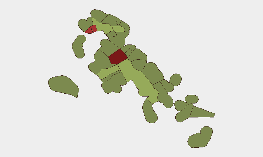
The Bahamas faces a persistent baseline of violent crime concentrated in Nassau and Freeport, with the U.S. State Department maintaining a Level 2 travel advisory as of 28 July 2026. Recent incidents—including a homicide with suspected arson in Nassau, a fatal stabbing in Abaco, and multiple shooting investigations—underscore ongoing gang and interpersonal violence in high-density urban centers. Critical infrastructure vulnerabilities were exposed on 29 July when lightning at the Blue Hills Power Station caused outages affecting the airport and hospital. The overall composite threat score (7, globally #null) reflects endemic crime rather than acute destabilization, but seasonal migration pressure and weather-related disruptions warrant close operational attention.
Key Developments
- Northern Exuma / Norman's Cay–Wax Cay (27 Jul): RBDF and OPBAT interdicted a sailing vessel carrying 54 Haitian migrants and suspected drugs, reflecting continued maritime smuggling activity and irregular migration pressure.
- Blue Hills Power Station, New Providence (29 Jul): Lightning strike triggered an explosion at BPL's primary power facility, causing widespread outages affecting Nassau airport, Princess Margaret Hospital, and commercial sectors; restoration timeline unclear.
- Nassau Village, New Providence (≈29 Jul): Perry Cox found dead with apparent stab wounds inside a burning duplex; death being investigated as suspected homicide with arson component.
- Dundas Town, Abaco (≈29 Jul): A 32-year-old man fatally ambushed near a nightclub; incident renews local calls for venue closure and reflects localized gang violence.
- Chippingham, Nassau (26 Jul): Fatal shooting on Providence Avenue; victim (37-year-old male) died following hospital admission.
- U.S. Travel Advisory Update (28 Jul): State Department elevated Bahamas to Level 2 "exercise increased caution," emphasizing armed robbery, burglary, and sexual assault risks in Nassau and Freeport.
Highest-Risk Areas
New Providence (risk 92) and the City of Freeport (78) account for the majority of tracked violent incidents and represent the geographic concentration of duty-of-care exposure for corporate operations. Central Abaco (52) and Central Andros (48) show elevated risk driven by transient gang activity, maritime crime, and limited law enforcement presence. The remaining islands—Exuma, Grand Bahama, and the southern Family Islands—present moderate to low risk but warrant monitoring for maritime smuggling corridors and seasonal migration surges. Risk correlates with population density, tourism infrastructure, and distance from Nassau-based law enforcement.
How GeoBit Would Assist
Intel Sweep and OSINT fusion enable real-time tracking of violent-crime patterns, gang movements, and maritime interdictions across the archipelago, with temporal and sentiment analysis to detect escalation signals. AOI Monitoring & Early Warning with persistent watch on New Providence, Freeport, and key maritime routes (Exuma, Abaco) can alert security teams to emerging hotspots before they reach incident scale. Routing & Network Analysis supports alternative transit planning for personnel and supply chains away from high-risk zones and identifies safe-passage corridors during disruptions (e.g., airport closures from power outages). Maritime & Aviation tracking integrated with RBDF/OPBAT feeds flags irregular vessel activity and inbound migration pressure in near-real time.
7-Day Outlook
Violent crime levels are expected to remain within baseline ranges absent a major gang conflict or political trigger. The Blue Hills Power Station outage may persist through early August, affecting airport operations and hospitality; secondary incidents (fuel shortages, supply delays) are possible. Maritime smuggling and migration interdictions will likely continue as seasonal patterns persist, requiring sustained border-security monitoring.
Highest-Risk Areas — Ranked
| # | State / Region | Risk |
|---|---|---|
| 1 | New Providence | 92 |
| 2 | City of Freeport | 78 |
| 3 | Central Abaco | 52 |
| 4 | Central Andros | 48 |
| 5 | Exuma | 45 |
| 6 | East Grand Bahama | 42 |
| 7 | South Andros | 38 |
| 8 | North Abaco | 35 |
| 9 | North Eleuthera | 33 |
| 10 | South Abaco | 32 |
| 11 | Cat Island | 30 |
| 12 | Mangrove Cay | 28 |
Sources
Previous Daily Briefs
A new Bahamas brief is written every day — each with its own risk map and downloadable CSV. Here's the last week; use the calendar to go further back.
📅 Browse every day by calendar →
Highlighted days have a brief. Tap a day for that day's map & analysis, or “csv” for that day's dataset ($5).
Atlas — our AI intelligence desk — emails them this snapshot personally. Nothing else, no list.