Situation Summary
Bahrain faces an acute, active security escalation following Iranian ballistic missile and drone strikes targeting U.S.-linked military facilities on 18–19 July 2026. Air-defense interceptions have reportedly limited damage, but repeated siren activations, shelter-in-place orders, and confirmed targeting of radar, early-warning, and logistics infrastructure in and around Manama indicate a sustained high-threat environment. The incident is part of a broader regional escalation involving strikes across multiple Gulf states (Qatar, Kuwait, Oman, Syria, Jordan), elevating Bahrain's composite threat ranking and operational risk for corporate and diplomatic personnel.
Key Developments
- Manama and nationwide, 18–19 July – Bahrain's Interior Ministry activated emergency sirens and issued shelter-in-place alerts across multiple areas after Iranian Armed Forces and IRGC announced ballistic missile and drone operations against "strategic U.S. military centers" in Bahrain.
- U.S. military facilities (Bahrain), 18–19 July – Iranian statements claimed strikes on Patriot radar systems, C‑RAM air-defense infrastructure, early-warning facilities, fuel storage, and arms depots associated with the U.S. 5th Fleet and HMS Jufair. Bahrain and U.S. officials confirmed interception of multiple aerial attacks but did not disclose extent of damage.
- Intelligence and defense sites (unspecified locations), 18–19 July – OSINT monitoring identified an intelligence site and radar/air-defense systems in Bahrain among named Iranian targets, alongside concurrent strikes in Kuwait, Jordan, Qatar, and other Gulf locations.
- Regional coordination, 18–19 July – Bahrain, Qatar, and Kuwait activated coordinated emergency security measures and public safety messaging in response to Iranian military claims and sustained aerial threats across the Gulf.
- Manama (capital), 18–19 July – Multiple reports documented repeated explosions heard in and around the capital following Iranian aerial activity; residents were instructed to seek shelter in designated safe areas.
- Bahrain (infrastructure security), 18–19 July – Elevated security protocols activated at critical infrastructure and military-adjacent civilian sites; travel within and around Manama assessed as materially elevated risk despite successful air-defense interceptions.
Highest-Risk Areas
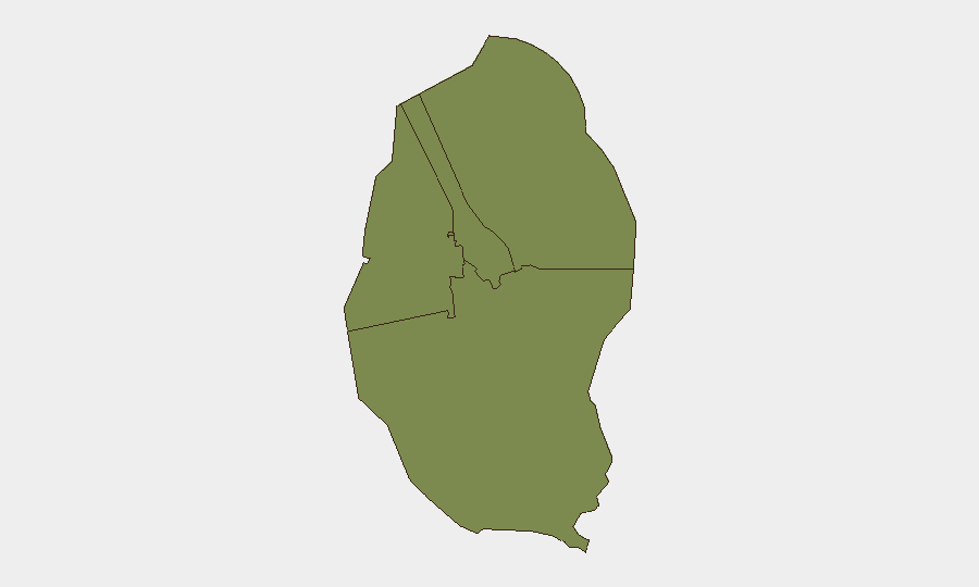
All four governorates—Northern, Capital, Southern, and Muharraq—carry equal composite risk scores (1.8), reflecting the island nation's small geographic footprint and the nationwide scope of air-defense alerts and targeting claims. The Capital Governorate (Manama and surrounding areas) presents the most immediate operational risk due to its concentration of U.S. military facilities, intelligence infrastructure, and civilian population centers that have been explicitly named in Iranian strike claims and experienced direct siren activations. Northern and Muharraq governorates, home to port and logistics facilities linked to the 5th Fleet, also face elevated targeting risk based on OSINT reporting.
How GeoBit Would Assist
Security and duty-of-care teams should deploy AOI Monitoring & Early Warning to track Manama, military zones, and port facilities for real-time siren and emergency-alert signals; Intel Sweep and X/Telegram OSINT to monitor Iranian military and IRGC claims, Bahraini emergency alerts, and casualty reports; and Conflict & Military battle mapping and force-structure tracking to assess air-defense posture and intercept success rates. Routing & Network Analysis can identify alternative travel corridors and safe zones within and out of Manama for personnel relocation or evacuation planning.
7-Day Outlook
Sustained elevated alert posture is expected through the immediate 7-day window as regional tensions remain acute and Iranian retaliation cycles have shown multi-day intervals. A de-escalation trajectory is not yet evident; further Iranian strikes or U.S./allied responses would likely trigger renewed sirens and temporary shelter-in-place orders. Commercial and business operations should anticipate intermittent disruptions to transportation, port operations, and workforce mobility in and around Manama.
Highest-Risk Areas — Ranked
| # | State / Region | Risk |
|---|---|---|
| 1 | Northern Governorate | 1.8 |
| 2 | Capital Governorate | 1.8 |
| 3 | Southern Governorate | 1.8 |
| 4 | Muharraq Governorate | 1.8 |
Sources
Previous Daily Briefs
A new Bahrain brief is written every day — each with its own risk map and downloadable CSV. Here's the last week; use the calendar to go further back.
📅 Browse every day by calendar →
Highlighted days have a brief. Tap a day for that day's map & analysis, or “csv” for that day's dataset ($5).
Atlas — our AI intelligence desk — emails them this snapshot personally. Nothing else, no list.