Situation Summary
Botswana presents a low acute security profile as of 30 July 2026, with no verified violent incidents, civil unrest, or infrastructure emergencies reported in the last 24–48 hours. The national threat composite score remains at 4 (globally unranked), and open-source reporting across major domestic news outlets and regional security feeds confirms a quiet operational picture. Baseline travel risk remains moderate (U.S. State Department Level 2 advisory from 19 July), with no incident-driven change in the past two days. Strategic attention is focused on policy-level security mechanisms and livestock disease management rather than acute internal conflict or crime spikes.
Key Developments
No verified discrete security incidents dated 24–48 hours prior to this brief were identified in credible Botswana-specific news, government communications, or security monitoring feeds. Major outlets (Mmegi, Botswana Guardian, Daily News, Sunday Standard, The Patriot) report no fresh violent crime clusters, protests, riots, or terror activity within this window. No active GDACS disaster alerts or infrastructure failures are currently flagged for the country. Travel-risk aggregation tools note the absence of any new advisory change or incident-driven escalation in the past 1–2 days.
Background context (outside 24–48h window, included for situational awareness):
- Wildfire activity (recent, timing unclear): Multiple wildfire events (IDs 1029681, 1029754, 1029683, 1029528, 1029620, 1029596) are flagged in event feeds; specific dates and impact extent require clarification via satellite or regional monitoring.
- Livestock disease controls (pre-dating 48h window): Ministry of Lands and Agriculture issued guidance on foot-and-mouth disease movement restrictions; operational status and scope not clearly time-stamped within the last two days.
- Digital infrastructure concern (pre-dating 48h window): A P423 million Public Key Infrastructure project transferred to the Directorate of Intelligence and Security reportedly encountered setbacks, raising medium-term cyber-governance risk; timing unclear and not confirmed as active crisis.
- African Union diplomatic engagement (24 July): Government held security-policy discussions with the African Union on conflict prevention and regional mechanisms; reflects policy focus rather than domestic emergency.
Highest-Risk Areas
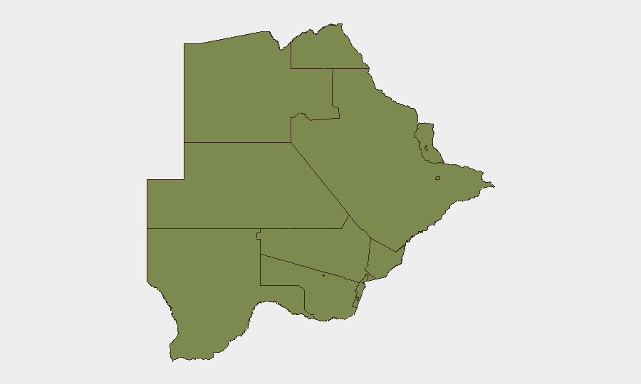
South-East District dominates the sub-national risk ranking at 31.3, a 24-fold elevation above all other tracked regions (which cluster at 1.3). The underlying drivers of this concentration—whether organized crime, border-control challenges, or data-reporting anomalies—require field-level investigation and targeted OSINT to clarify. All remaining regions (Chobe, North-West, Central, North-East, Kgalagadi, Kweneng, Southern, and urban nodes including Francistown and Selebi Phikwe) register near-identical baseline scores, suggesting either genuine low-risk stability or potential reporting gaps. Corporate assets and personnel in South-East District warrant enhanced situational awareness.
How GeoBit Would Assist
Security teams monitoring Botswana should employ AOI Monitoring & Early Warning on South-East District and border zones to detect emerging incidents before they scale. OSINT fusion and multi-language search across Botswana news, social media (X, Telegram), and government sources will sustain real-time incident detection and fill gaps in English-language reporting. GIS and spatial analysis, combined with satellite imagery, can clarify wildfire extent and progression, informing evacuation and supply-chain decisions for affected operations.
7-Day Outlook
Botswana's security trajectory remains stable through early August absent any verified new trigger. Wildfire activity and livestock disease restrictions warrant monitoring for spillover effects on supply chains and movement. Diplomatic and policy work with the African Union suggests a medium-term regional security posture; no acute escalation is signaled for the near term.
Highest-Risk Areas — Ranked
| # | State / Region | Risk |
|---|---|---|
| 1 | South-East District | 31.3 |
| 2 | Chobe District | 1.3 |
| 3 | North-West District | 1.3 |
| 4 | Sowa Town | 1.3 |
| 5 | Central District | 1.3 |
| 6 | North-East District | 1.3 |
| 7 | Francistown | 1.3 |
| 8 | Ghanzi District | 1.3 |
| 9 | Selebi Phikwe | 1.3 |
| 10 | Kgalagadi District | 1.3 |
| 11 | Kweneng District | 1.3 |
| 12 | Southern District | 1.3 |
Sources
Previous Daily Briefs
A new Botswana brief is written every day — each with its own risk map and downloadable CSV. Here's the last week; use the calendar to go further back.
📅 Browse every day by calendar →
Highlighted days have a brief. Tap a day for that day's map & analysis, or “csv” for that day's dataset ($5).
Atlas — our AI intelligence desk — emails them this snapshot personally. Nothing else, no list.