Situation Summary
Chile remains at composite threat level 32 globally, with security conditions broadly stable outside an ongoing national weather emergency. Since 19 July, a preventive state of emergency has been in force across multiple regions due to heavy rain, flooding, landslides, and power interruptions, creating infrastructure and mobility disruptions rather than security incidents. No major new outbreaks of civil unrest, violent crime, or political instability have been confirmed in the past 24–48 hours; the primary risk to corporate operations and personnel is weather-related service disruption, particularly in transport corridors and energy supply.
Key Developments
- Santiago Metropolitan Region, Atacama–Los Ríos belt (ongoing through 21 July): State of emergency remains in effect; heavy rain, strong winds, landslides, and river overflows continue to trigger road closures, detours, and localized power outages affecting mobility and business continuity in affected corridors.
- Central and southern Chile transport routes (19–21 July): Civil protection authorities report intermittent closures on rural highways and secondary roads due to flooding and landslide hazards; intercity and self-drive travel facing contingency delays and route status uncertainty.
- Energy infrastructure across affected regions (19–21 July): Electricity supply interruptions documented in pockets of urban periphery and rural areas linked to storm-system damage; accommodations and facilities outside major cities reporting reduced service availability.
- Santiago Metropolitan Region and major urban centers (20–21 July): Travel advisories reiterate baseline caution for downtown and peripheral neighborhoods due to persistent violent-crime risk; however, no new mass protests, riots, or escalated unrest incidents confirmed in this 24–48h window.
- Recent event signal cluster (19 July): Government, Ministry of Security, and law-enforcement public statements and investigative actions recorded; signals relate to internal security matters rather than external threat events, with no public confirmation of imminent operational risk to foreign personnel or assets.
Highest-Risk Areas
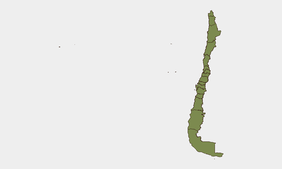
Santiago Metropolitan Region dominates the national risk composite (31.3), reflecting both baseline violent-crime and organized-crime exposure in urban peripheries and the current weather emergency affecting the capital and surrounding zone. Coquimbo Region (13.9) and Tarapacá Region (7.9) rank second and third, driven primarily by accumulated weather-impact signals and transport disruption; no new acute security incidents have elevated these rankings in the past 24–48 hours. Remaining regions (Magallanes through Nuble) show minimal composite scores (1.3–3), indicating localized hazards but no sustained security drivers. Personnel and asset-protection priorities should remain focused on weather-route planning in the Atacama–Los Ríos corridor and baseline crime awareness in Santiago's high-risk neighborhoods, rather than on new political or conflict escalation.
How GeoBit Would Assist
Clients with operations in Chile should deploy AOI (Area-of-Interest) Monitoring & Early Warning on Santiago and key transport corridors to detect any resumption of civil unrest or security incidents once weather conditions stabilize. Routing & Network Analysis and multi-language web/social-media OSINT (Intel Sweep, X/Twitter, YouTube monitoring) will track real-time road status, power-grid updates, and emerging protests or criminal activity with minimal latency. Risk & Threat Assessment and sentiment analysis on government and security statements will provide early signal of policy changes or escalation in the background event cluster noted on 19 July.
7-Day Outlook
Weather impacts are forecast to persist through at least 22–23 July, with transport and energy disruption remaining the primary operational constraint. Security conditions are expected to remain stable; no political or conflict escalation signals suggest imminent change to the current baseline threat environment in the near term. Once weather clears, routine crime and civil-unrest risk in Santiago will return to endemic levels, requiring standard duty-of-care protocols but no elevated alert posture.
Highest-Risk Areas — Ranked
| # | State / Region | Risk |
|---|---|---|
| 1 | Santiago Metropolitan Region | 31.3 |
| 2 | Coquimbo Region | 13.9 |
| 3 | Tarapacа Region | 7.9 |
| 4 | Magallanes and Chilean Antarctica Region | 3 |
| 5 | Valparaiso Region | 1.3 |
| 6 | Antofagasta Region | 1.3 |
| 7 | Atacama Region | 1.3 |
| 8 | Aysen del General Carlos Ibanez del Campo Region | 1.3 |
| 9 | Los Lagos Region | 1.3 |
| 10 | O'Higgins Region | 1.3 |
| 11 | Maule Region | 1.3 |
| 12 | Nuble Region | 1.3 |
Sources
Previous Daily Briefs
A new Chile brief is written every day — each with its own risk map and downloadable CSV. Here's the last week; use the calendar to go further back.
📅 Browse every day by calendar →
Highlighted days have a brief. Tap a day for that day's map & analysis, or “csv” for that day's dataset ($5).
Atlas — our AI intelligence desk — emails them this snapshot personally. Nothing else, no list.