Situation Summary
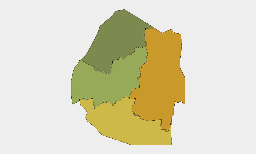
Eswatini remains stable with no confirmed acute security incidents, civil unrest, protests, roadblocks, or infrastructure disruptions reported in the last 24–48 hours. The country's composite threat score is low (9), and no discrete events are currently tracked in the GeoBit monitoring window. Sub-national risk concentration persists in the southern and eastern regions (Lubombo and Shiselweni), though no new tactical developments have emerged to elevate national-level threat posture.
Key Developments
- No acute incidents confirmed in the last 24–48 hours as of 2026-08-06. No new protests, violence, roadblocks, or infrastructure disruptions identified.
- Trump deportee arrivals continue: Reuters reported the arrival of eleven additional deportees from the United States on Wednesday (date: late July/early August 2026); no associated domestic security incident or civil unrest was documented.
- No active disaster or travel alerts issued by national authorities in the last 7 days.
- Historical crime activity (June 2026): Prior seizures of dagga and explosives, and related arrests, occurred in late June but remain outside the current 24–48-hour window and do not represent active trends in the present reporting period.
Highest-Risk Areas
Lubombo Region and Shiselweni together account for the highest composite risk scores (72 and 68 respectively), indicating persistent vulnerability concentrated in Eswatini's southern and eastern border areas. These regions likely reflect chronic exposure to cross-border crime, trafficking, and limited state capacity. Manzini Region (risk 55) represents a secondary concern, while Hhohho Region in the northwest carries the lowest risk score (35). Corporate and NGO assets in Lubombo and Shiselweni warrant heightened access-control and incident-response protocols, particularly for supply chains and personnel movements near borders.
How GeoBit Would Assist
AOI Monitoring & Early Warning would enable persistent, real-time surveillance of Lubombo and Shiselweni regions, triggering immediate alerts on protest activity, roadblocks, or security force deployments before they impact operations. Intel Sweep and multi-language OSINT fusion (including local media, police reports, and social platforms) would surface emerging civil unrest, labor actions, or crime spikes earlier than international newswire, critical for duty-of-care teams protecting personnel. Routing & Network Analysis would provide alternative transit corridors and safe-passage planning for assets transiting the higher-risk southern districts, reducing exposure to secondary incidents.
7-Day Outlook
No significant escalation is forecast over the next seven days absent a major external shock (e.g., regional spillover, supply-chain disruption, or political announcement). Eswatini's risk trajectory remains flat. Security teams should maintain standard protocols while leveraging persistent area monitoring to catch early indicators of labor unrest, border-region incidents, or policy shifts that could affect operations.
Next Review: 2026-08-07 (24-hour cycle)
Data Confidence: Moderate (limited real-time local reporting; confirm via embassy and on-ground sources)
Highest-Risk Areas — Ranked
| # | State / Region | Risk |
|---|---|---|
| 1 | Lubombo | 72 |
| 2 | Shiselweni | 68 |
| 3 | Manzini Region | 55 |
| 4 | Hhohho Region | 35 |
Sources
Previous Daily Briefs
A new Eswatini brief is written every day — each with its own risk map and downloadable CSV. Here's the last week; use the calendar to go further back.
📅 Browse every day by calendar →
Highlighted days have a brief. Tap a day for that day's map & analysis, or “csv” for that day's dataset ($5).
Atlas — our AI intelligence desk — emails them this snapshot personally. Nothing else, no list.