Situation Summary
Guatemala faces elevated criminal violence concentrated in the western and southern regions, with a composite threat score of 35 and 9 tracked events in the current monitoring cycle. Armed attacks, extortion networks, and gang activity continue across Guatemala City and secondary urban centers, with police operations ongoing against organized criminal groups. The security environment remains volatile but localized; national institutions are responding to incidents, though capacity constraints persist in remote departments.
Key Developments
- Zone 3, Quetzaltenango — 17 Jul — Police disrupted a suspected planned attack on public transport; three alleged Mara 18 members arrested and one 15-year-old detained following extortion alerts and citizen reports of assault threats against microbuses.
- San Miguel Dueñas, Sacatepéquez — 18 Jul — Armed attack at municipal entrance resulted in two fatalities and one serious injury; victims were occupants of a pickup truck. Fire/rescue and police processed the scene.
- Zone 18, Guatemala City (Colonia Alameda 3) — 18 Jul — Armed attack on main boulevard killed one male; traffic closure implemented during police and prosecutor scene documentation.
- Zone 4, Guatemala City (Olympic Bridge area) — 15 Jul — Male found deceased in white vehicle following armed attack; police secured perimeter and announced possible road closures during investigation.
- Criminal activity signals — Multiple event indicators spanning 21–22 Jul include threats, arrests/detentions, civilian-police force engagement, and assassination reports, reflecting ongoing gang and criminal enforcement activity across the capital and adjacent municipalities.
Highest-Risk Areas
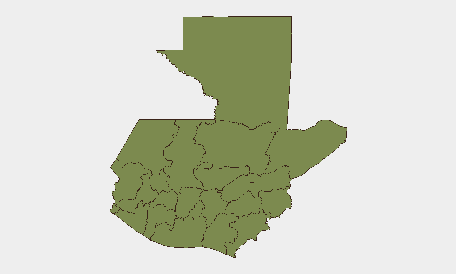
Suchitepéquez department dominates the sub-national risk ranking at 31.3, approximately three times higher than the second-ranked Santa Rosa (11.0), indicating concentrated criminal activity in Guatemala's southwestern coastal and agricultural zones. Santa Rosa follows at significant distance, suggesting either localized gang territorial disputes or trafficking-corridor violence. Remaining departments (Huehuetenango, San Marcos, and others) register substantially lower composite scores, with the capital and its immediately adjacent zones (reflected in Zone 18 and Zone 4 incidents) experiencing episodic armed crime rather than structural territorial instability. The risk gradient suggests that corporate and personnel security focus should prioritize Suchitepéquez transit and operations, with secondary vigilance for Guatemala City's gang-controlled zones.
How GeoBit Would Assist
Security teams should employ AOI Monitoring & Early Warning on Suchitepéquez, Santa Rosa, and Guatemala City's high-risk zones (18, 4, 3) to receive real-time alerts on criminal incidents and police responses before they impact supply chains or personnel. OSINT fusion & corroboration across X/Twitter, Telegram, and local media sources would validate emerging threats (gang demands, territorial shifts, extortion targets) and distinguish genuine operational risk from noise. Routing & Network Analysis can identify alternative transport corridors and safe passage timing for personnel and assets transiting Suchitepéquez and the capital, reducing exposure to known ambush or checkpoint zones.
7-Day Outlook
Gang enforcement activity and armed robbery are likely to persist at current tempo in Suchitepéquez and Guatemala City through the next 7 days; police operations may increase suppression efforts, creating secondary displacement of criminal activity into secondary cities. Rainfall and flood conditions (recent GeoBit signal: 22 Jul flood alert) may degrade road security and create additional logistical delays. No indication of imminent structural escalation, but episodic armed incidents should be anticipated in monitored zones.
Highest-Risk Areas — Ranked
| # | State / Region | Risk |
|---|---|---|
| 1 | Suchitepéquez | 31.3 |
| 2 | Santa Rosa | 11 |
| 3 | Huehuetenango | 2.1 |
| 4 | San Marcos | 2.1 |
| 5 | Petén | 1.3 |
| 6 | Quetzaltenango | 1.3 |
| 7 | Retalhuleu | 1.3 |
| 8 | Quiché | 1.3 |
| 9 | Alta Verapaz | 1.3 |
| 10 | Totonicapán | 1.3 |
| 11 | Sololá | 1.3 |
| 12 | Chimaltenango | 1.3 |
Sources
Previous Daily Briefs
A new Guatemala brief is written every day — each with its own risk map and downloadable CSV. Here's the last week; use the calendar to go further back.
📅 Browse every day by calendar →
Highlighted days have a brief. Tap a day for that day's map & analysis, or “csv” for that day's dataset ($5).
Atlas — our AI intelligence desk — emails them this snapshot personally. Nothing else, no list.