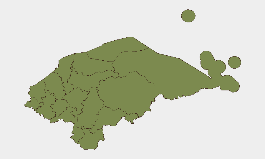
Situation Summary
Honduras faces a composite threat score of 28 with 6 tracked security events in the past 48 hours, spanning organized crime, civil unrest, infrastructure disruption, and weather-driven mobility risks. Security Ministry investigations into recent massacres in Colón and Yoro remain active, while road accidents claimed 22 lives over the weekend and heavy rains have cut off communities in the eastern departments. The country's threat environment remains fragmented geographically, with acute risks concentrated in Francisco Morazán and Olancho, but no nationwide destabilization indicators are currently present.
Key Developments
- Tocoa, Colón – July 20, 2026: Campesino organizations staged road-blocking protests demanding repeal of agricultural laws, causing traffic disruption on key northern routes.
- National routes – July 19–20, 2026: 114 separate traffic incidents resulted in 22 fatalities and 38 injuries; authorities announced expanded traffic-control brigades in response.
- Gracias a Dios & Olancho (Patuca, Wampusirpi) – July 19–20, 2026: COPECO maintained Yellow Alert in Gracias a Dios due to persistent heavy rains; flooding cut off approximately 80% of communities in Patuca and forced evacuation of 60+ families in Wampusirpi.
- Balfate, Colón – July 19–20, 2026: An 11-year-old was murdered; police detained a suspect, with motive under investigation, indicating localized violent-crime risk in Colón.
- Tegucigalpa (Security Ministry) – July 20, 2026: Ongoing investigations into massacres in Rigores (Colón) and Yoro remain active, with continued police operations in both areas.
- Multiple locations, Honduras – July 20, 2026: Police detained three individuals linked to gang activity (alleged Barrio 18 member "El Rango") and drug trafficking, transferred to DPI Colonia Kennedy, reflecting sustained anti-gang operations.
- Gracias a Dios & five Olancho municipalities – July 20, 2026: High-altitude trough forecast to bring continued rains, raising flood, landslide, and road-closure risks for travelers and supply chains.
- National electricity sector – July 20, 2026: Political tensions over electricity law reforms have intensified ahead of congressional session; opposition rejection signals potential short-term policy friction affecting investor and infrastructure confidence.
Highest-Risk Areas
Francisco Morazán (risk 31.3) and Olancho (risk 31.3) jointly drive the country's highest threat composite scores, followed by Cortés (29). Francisco Morazán's risk reflects Tegucigalpa's concentration of organized-crime investigations and gang detention operations, while Olancho combines active massacre investigations, flooding-driven infrastructure collapse, and community isolation. Colón, though ranking fourth (8.3), has seen recent homicides and road-blocking protests that warrant tactical attention. The remaining eight departments register minimal risk signals (1.3), indicating risk concentration in three northern/central regions.
How GeoBit Would Assist
Security teams should employ AOI Monitoring & Early Warning on Francisco Morazán and Olancho to track emerging gang operations, massacre investigations, and protest activity in real time. Routing & Network Analysis would provide alternative journey planning around Tocoa and flood-affected areas in Patuca and Wampusirpi, enabling duty-of-care compliance for personnel movement. Intel Sweep and OSINT fusion across local police reports, COPECO alerts, and regional sources would offer continuous corroboration of emerging risks—particularly gang detentions and weather-driven mobility forecasts—allowing security teams to anticipate disruptions 48–72 hours ahead.
7-Day Outlook
Persistent rainfall in Gracias a Dios and Olancho will likely sustain road closures and community isolation through mid-week; mobility impacts may extend supply-chain delays. Campesino protests in Colón may broaden or persist if agricultural policy discussions stall in congress. Gang-related detentions and massacre investigations will remain operationally active but are not forecast to trigger wider violence escalation or territorial conflict in the near term.
Highest-Risk Areas — Ranked
| # | State / Region | Risk |
|---|---|---|
| 1 | Francisco Morazán | 31.3 |
| 2 | Olancho | 31.3 |
| 3 | Cortés | 29 |
| 4 | Colón | 8.3 |
| 5 | El Paraíso | 1.3 |
| 6 | Copán | 1.3 |
| 7 | Ocotepeque | 1.3 |
| 8 | Yoro | 1.3 |
| 9 | Santa Bárbara | 1.3 |
| 10 | Lempira | 1.3 |
| 11 | Intibucá | 1.3 |
| 12 | Comayagua | 1.3 |
Sources
Previous Daily Briefs
A new Honduras brief is written every day — each with its own risk map and downloadable CSV. Here's the last week; use the calendar to go further back.
📅 Browse every day by calendar →
Highlighted days have a brief. Tap a day for that day's map & analysis, or “csv” for that day's dataset ($5).
Atlas — our AI intelligence desk — emails them this snapshot personally. Nothing else, no list.