Situation Summary
Indonesia remains a composite threat rank #42 globally with a moderate overall risk profile (37/100), though sub-national variation is significant. The past 24–48 hours have been operationally quiet on conflict, civil unrest, and political-instability fronts; verified incidents are routine (ship fire, forest fires, traffic enforcement, labor resolution). Regional diplomatic tension with Malaysia, Vietnam, and the Philippines has surfaced in recent official statements, but no acute security escalation or on-ground unrest is independently confirmed.
Key Developments
- Jakarta – Muara Baru Shipyard, 22 July ~19:30 local. State-owned SAR vessel *Ramawijaya* caught fire while berthed; Jakarta Regional Metropolitan Police investigating cause. No reports of broader unrest or targeted action.
- West Kalimantan – Ketapang, 22–23 July. Forest and land fires threatening YIARI Orangutan Rehabilitation Center; National Disaster Management Agency (BNPB) conducting active water-bombing operations. Environmental/infrastructure threat under official management.
- Jakarta – INP Headquarters, 23 July. Indonesian National Police Chief General Listyo Sigit Prabowo and FBI Director Kash Patel met to discuss transnational-crime cooperation. Strategic development; no acute incident.
- Jakarta – Central Jakarta, 22–23 July. Jakarta Regional Metropolitan Police Traffic Directorate issued summons in connection with viral social-media video involving traffic violations and alleged fake license plates. Routine law-enforcement response.
- National – Industrial relations, 22–23 July. INP Manpower Desk and Ministry of Manpower facilitated formal resolution of dispute between PT Amos Indah Indonesia and 134 former workers. No ongoing labor unrest reported.
- National – Diplomatic statements, 23 July. Multiple bilateral "disapprove" statements exchanged between Indonesia and Malaysia, Vietnam, and the Philippines. No military mobilization or escalation indicators currently confirmed.
Highest-Risk Areas
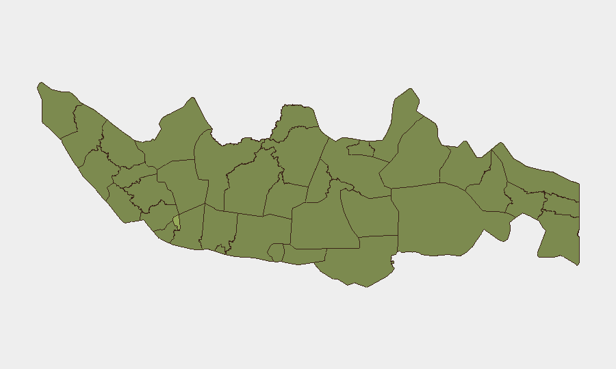
Jakarta dominates the risk profile (55.6/100), driven by population density, economic criticality, and historical protest activity. East Java (38.6) presents the second-highest concern; Riau, Central Java, and West Java cluster in the 28–29 range. Risk concentration in Java reflects urban density, labor organizing, and political activity; East Java and Jakarta are priority monitoring zones for labor disputes, transport disruption, and crowd events. Riau and West Kalimantan carry environmental and transnational-crime overlays (forest fires, maritime smuggling, resource conflicts) that can trigger secondary instability.
How GeoBit Would Assist
Corporate security teams should employ AOI Monitoring & Early Warning on Jakarta and East Java to detect labor unrest, road closures, and crowd movements before operational impact. Multi-language OSINT fusion (X, Telegram, local news, police bulletins) combined with sentiment & temporal analysis will flag emerging protest narratives or diplomatic escalation faster than mainstream headlines. GIS & Spatial Analysis and satellite imagery are operationally critical for supply-chain routing, facility vulnerability (fire, flooding), and political gathering forecasting in high-density areas.
7-Day Outlook
Near-term trajectory remains stable barring unexpected diplomatic or labor escalation. Forest-fire season continues in Sumatra and Kalimantan, with air-quality and transport-disruption risk through August. Diplomatic friction with neighbors warrants passive monitoring but poses low immediate on-ground security risk. Close watch on labor organizing in East Java and Jakarta (Q3 union activity typically peaks) and any secondary unrest tied to environmental or resource issues in western provinces.
Highest-Risk Areas — Ranked
| # | State / Region | Risk |
|---|---|---|
| 1 | Special capital Region of Jakarta | 55.6 |
| 2 | East Java | 38.6 |
| 3 | Riau | 29.3 |
| 4 | Central Java | 29.1 |
| 5 | West Java | 28.9 |
| 6 | North Sumatra | 26.9 |
| 7 | Southeast Sulawesi | 26.9 |
| 8 | Banten | 26.9 |
| 9 | East Nusa Tenggara | 26.5 |
| 10 | North Sulawesi | 26.3 |
| 11 | Central Kalimantan | 26.3 |
| 12 | Riau Islands | 26.3 |
Previous Daily Briefs
A new Indonesia brief is written every day — each with its own risk map and downloadable CSV. Here's the last week; use the calendar to go further back.
📅 Browse every day by calendar →
Highlighted days have a brief. Tap a day for that day's map & analysis, or “csv” for that day's dataset ($5).
Atlas — our AI intelligence desk — emails them this snapshot personally. Nothing else, no list.