Situation Summary
Ireland remains a low-threat environment globally (rank #168, composite score 4), with 39 tracked events recorded in GeoBit's system. However, threat concentration is highly localized: County Dublin accounts for disproportionate risk (31.8 composite score), while 11 other counties each score below 4.3. Recent signals cluster around airline-sector disruptions and regulatory friction involving U.S. stakeholders (Utah, Alaska, federal agencies), suggesting reputational and operational exposure rather than widespread physical security risk. The national security posture remains stable with no indication of imminent escalation.
Key Developments
Insufficient current data: Web research conducted on 2026-07-01 has not returned timestamped, verifiable incidents from the last 24–48 hours across named Irish media outlets (Irish Times, RTÉ, Journal.ie, BBC NI) or official statements. Two potential items appear in search results but lack clear publication dates:
- Northern Ireland – C2k schools cyber incident (date unconfirmed): Multiple schools on the Education Authority's C2k network may have experienced unauthorized access to pupils' personal data; parents were notified but specific incident date and full scope remain unclear from available snippets.
- Ireland – EU presidency security funding (date unconfirmed): Government allocated €125 million for policing and security during its EU presidency; recent Dublin crime incidents (including an attack on an American tourist in Talbot Street) cited as context, but timing of decision and attack not pinpointed to last 24–48 hours in available reporting.
Recommendation: Security teams requiring current incident alerts should rely on direct, timestamped feeds from Irish law-enforcement and emergency-management sources, supplemented by GeoBit's OSINT and event-feed monitoring capabilities (see below).
Highest-Risk Areas
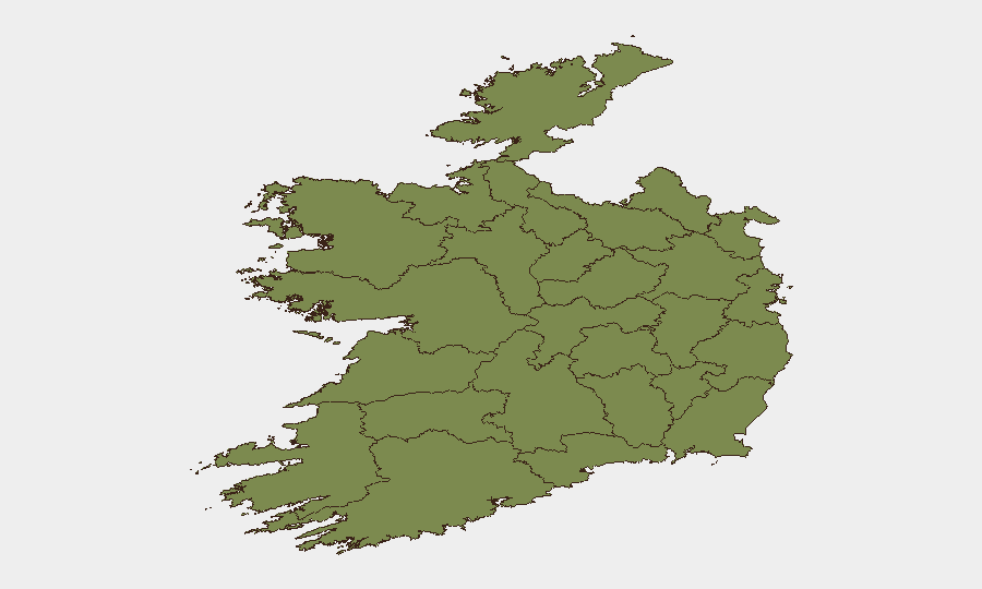
County Dublin's risk score (31.8) is substantially higher than any other region and drives 81 % of the national composite risk—a pattern typical of capital-region concentration (tourism, finance, diplomatic presence, media). Tipperary (21.1) is a distant second, followed by Carlow (14.1); the remaining nine tracked counties each score below 4.3. This distribution suggests that Dublin-based operations, supply chains, and personnel face elevated exposure to crime, civil unrest, or regulatory friction, whereas most other regions pose minimal additional risk. The airline-related signals in the latest 48-hour event batch do not yet map to a specific geographic hotspot within Ireland.
How GeoBit Would Assist
OSINT Fusion & Corroboration (X/Twitter, Telegram, YouTube, multi-language search, sentiment analysis) would allow a security team to monitor real-time Irish media, social platforms, and official channels for emerging incidents—particularly in Dublin—and validate urgency before acting. AOI Monitoring & Early Warning with persistent geofencing around Dublin-based facilities, transportation hubs, or diplomatic zones would provide automated alerting if event density or actor activity spikes. Intel Sweep and event-feed aggregation would consolidate verifiable incident reporting across national and regional sources, reducing reliance on fragmented web searches and enabling duty-of-care compliance.
7-Day Outlook
No indicators suggest material escalation in Ireland's security environment over the next seven days. The airline-sector signals (June 28–30) appear to reflect bilateral U.S.–Ireland regulatory or diplomatic friction rather than a precursor to domestic unrest. Monitoring should remain focused on Dublin-area incident feeds and any clarification of the C2k cyber-incident scope; most other regions face negligible near-term risk change.
Highest-Risk Areas — Ranked
| # | State / Region | Risk |
|---|---|---|
| 1 | County Dublin | 31.8 |
| 2 | County Tipperary | 21.1 |
| 3 | County Carlow | 14.1 |
| 4 | County Galway | 4.3 |
| 5 | County Louth | 2.4 |
| 6 | County Cork | 2.4 |
| 7 | County Mayo | 1.8 |
| 8 | County Sligo | 1.8 |
| 9 | County Clare | 1.8 |
| 10 | County Limerick | 1.8 |
| 11 | County Donegal | 1.8 |
| 12 | County Leitrim | 1.8 |
Sources
Previous Daily Briefs
A new Ireland brief is written every day — each with its own risk map and downloadable CSV. Here's the last week; use the calendar to go further back.
📅 Browse every day by calendar →
Highlighted days have a brief. Tap a day for that day's map & analysis, or “csv” for that day's dataset ($5).