Situation Summary
Jordan remains exposed to secondary effects of the broader U.S.–Iran conflict, with no new security incidents confirmed in the last 24–48 hours. However, the cumulative impact of Iranian missile and drone activity (July 17–23), U.S. Embassy travel warnings tied to Aqaba infrastructure, and ongoing airspace restrictions continue to elevate risk across the country—particularly in southern and eastern regions. The security posture is one of active defense and heightened vigilance rather than acute escalation on July 25.
Key Developments
- No new distinct incidents documented in Jordan in the last 24–48 hours (July 23–25, 2026). Open-source reporting and official channels have not issued new event timestamps; existing commentary repeats or analyzes the July 17–23 incident sequence without adding new dated security events.
- Aqaba infrastructure threat alert remains in effect. The U.S. Embassy's July 19 security alert regarding "specific and credible threat" to King Hussein International Airport and Aqaba seaport persists in travel advisories and corporate security guidance, despite Jordanian government denial of evacuation orders. The facility remains a focal point for duty-of-care decisions.
- Commercial aviation routing disruptions ongoing. Airlines continue to avoid or alter flight paths over Jordan and Iraq in response to the missile corridors identified during July 17–23 Iranian operations, affecting connections to Amman and Aqaba and creating secondary travel delays and cost impacts.
- Jordanian air defenses remain elevated. The July 23 official military statement (four missiles, six drones intercepted with no casualties) indicates sustained operational posture and readiness, reflecting expectation of continued hostile activity in the airspace.
- U.S. military footprint and medical response ongoing. Casualties from the July 17 Muwaffaq Al‑Salti Air Base strike continue to influence U.S. command decisions and Jordanian military coordination; no further attacks on U.S. facilities have been reported, but the underlying strategic tension persists.
Highest-Risk Areas
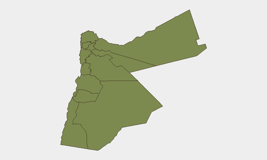
Aqaba dominates the sub-national ranking (risk score 31.3), driven by the U.S. Embassy's July 19 alert, regional missile trajectory history, and port/airport criticality. Zarqa (8.8) reflects proximity to military infrastructure and historic vulnerability to spillover conflict. Amman (1.9) and smaller governorates carry baseline risk from nationwide airspace activity and siren alerts, but remain significantly lower-risk than the south and east. The concentration of threat in Aqaba and Zarqa reflects both the geographic reality of Iranian missile corridors and the sensitivity of dual-use infrastructure (airports, ports, military bases) in those zones.
How GeoBit Would Assist
Persistent AOI Monitoring & Early Warning on Aqaba airport, seaport, and military installations would provide immediate alerting to teams if new threats or evacuation orders materialize. Conflict & Military tracking (force posture, air-defense activity, missile intercept patterns) and Maritime & Aviation tracking offer real-time visibility into operational changes and flight-routing adjustments. GIS & Spatial Analysis combined with Satellite & Imagery analysis can confirm facility status, detect preparations for attack, and map safe corridors for personnel movement or supply chains.
7-Day Outlook
Absent new Iranian strikes or U.S. escalation, the immediate risk trajectory is downward but not normalized. The Aqaba alert, airspace restrictions, and U.S.–Jordanian military coordination will likely remain in place through the weekend. Teams should assume elevated response times and operational friction (travel delays, facility access delays) persist for the next 7 days, with potential for sharp reversal if regional tensions spike.
Highest-Risk Areas — Ranked
| # | State / Region | Risk |
|---|---|---|
| 1 | Aqaba | 31.3 |
| 2 | Zarqa | 8.8 |
| 3 | Amman | 1.9 |
| 4 | Irbid | 1.3 |
| 5 | Ajlun | 1.3 |
| 6 | Balqa | 1.3 |
| 7 | Jarash | 1.3 |
| 8 | Mafraq | 1.3 |
| 9 | Madaba | 1.3 |
| 10 | Karak | 1.3 |
| 11 | Tafilah | 1.3 |
| 12 | Maan | 1.3 |
Sources
Previous Daily Briefs
A new Jordan brief is written every day — each with its own risk map and downloadable CSV. Here's the last week; use the calendar to go further back.
📅 Browse every day by calendar →
Highlighted days have a brief. Tap a day for that day's map & analysis, or “csv” for that day's dataset ($5).
Atlas — our AI intelligence desk — emails them this snapshot personally. Nothing else, no list.