Situation Summary
Malawi is experiencing elevated localized security incidents across multiple categories—including serious violent crime, civil unrest, illegal firearms circulation, and maritime safety operations—without evidence of nationwide instability or systemic breakdown. The Central Region, particularly urban centers (Lilongwe, Blantyre), accounts for the majority of reported activity and drives the country's composite threat score. Overall risk remains moderate and geographically concentrated; Northern and Southern regions show significantly lower incident density.
Key Developments
- Ntcheu District, Blantyre–Lilongwe road (29 July 2026): Vice-President Jane Ansah's motorcade experienced a tyre blowout; no attack or civil disorder reported, vehicle secured by security personnel, VP confirmed unharmed.
- Lake Malawi, Luwiru vicinity (26–27 July 2026): Tanzanian speedboat carrying four Dutch nationals and three crew reported missing en route to Nkhata Bay; bilateral search-and-rescue operation by Malawian and Tanzanian Defence Forces located vessel near Luwiru; rescue ongoing.
- Blantyre (within last 24 hours): Police arrested a suspect in connection with the killing of a Blantyre doctor; investigation ongoing, classified as serious violent crime.
- Lilongwe, Malawi Electoral Commission headquarters (recent Friday): Fiscal Police conducted unannounced interrogation of MEC Director of Administration and HR on alleged financial mismanagement; operation caused temporary staff disruption and fear, raising institutional-governance concerns.
- Nkhotakota District (this week, specific date unclear): Police arrested 11 individuals following violent civil unrest and clashes; security forces restored order.
- Machinga District, Msosa Trading Centre (recent): Two individuals arrested after brandishing unlicensed pistol to intimidate traders; illegal firearm seized, investigation into weapons circulation underway.
- Chitipa District (recent court ruling): Magistrate's Court convicted individual of possessing 85 kg of cannabis; sentence underscores narcotics trafficking enforcement activity along northern Tanzania border corridor.
Highest-Risk Areas
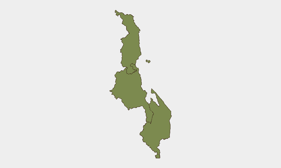
The Central Region dominates risk, with a composite score of 31.3—driven by concentration of serious violent crime (homicide investigation in Blantyre), institutional friction (electoral commission raid in Lilongwe), and armed civil disorder (Nkhotakota arrests). The Southern Region (risk 7.3) shows secondary concern, primarily linked to transnational narcotics enforcement and localized crime. The Northern Region (risk 1.3) remains the lowest-risk zone, though the Chitipa border area warrants monitoring for cross-border trafficking activity. Risk is urban and localized rather than rural or diffuse.
How GeoBit Would Assist
AOI Monitoring & Early Warning on Lilongwe and Blantyre would detect clustering of crime, civil-unrest, or institutional incidents in real time; OSINT Fusion & Corroboration (X/Twitter, Telegram, local news) would surface emerging flashpoints and official responses faster than traditional reporting cycles. Network & Actor Analysis would map relationships among police, electoral authorities, and political figures to contextualize institutional tensions and predict secondary friction. Routing & Network Analysis would identify alternative routes for personnel and asset movement around high-incident corridors (e.g., Ntcheu road, Lake Malawi).
7-Day Outlook
Near-term trajectory shows no evidence of escalation to nationwide or armed-group violence; incidents remain localized, reactive, and subject to rapid law-enforcement response. Institutional friction (MEC raid, financial-misconduct allegations) may persist and merit diplomatic or governance-risk attention, but do not suggest imminent regime instability. Continued vigilance on Southern Region narcotics trafficking and Northern border activity is warranted given regional trafficking patterns.
Highest-Risk Areas — Ranked
| # | State / Region | Risk |
|---|---|---|
| 1 | Central Region, Malawi | 31.3 |
| 2 | Southern Region, Malawi | 7.3 |
| 3 | Northern Region, Malawi | 1.3 |
Sources
Previous Daily Briefs
A new Malawi brief is written every day — each with its own risk map and downloadable CSV. Here's the last week; use the calendar to go further back.
📅 Browse every day by calendar →
Highlighted days have a brief. Tap a day for that day's map & analysis, or “csv” for that day's dataset ($5).
Atlas — our AI intelligence desk — emails them this snapshot personally. Nothing else, no list.