Situation Summary
Mauritius remains a low-threat jurisdiction (global rank #95; composite score 12) with no tracked major security incidents. Recent event signals and web research from the past 24–48 hours indicate routine petty crime, property offences, and isolated interpersonal violence concentrated in urban and suburban areas—chiefly Port Louis, Beau-Bassin, Quatre-Bornes, and parts of the south. No civil unrest, political instability, terrorism activity, or infrastructure disruption has been detected. The security environment is stable and consistent with Mauritius's long-standing low-risk profile.
Key Developments
- Port Louis (19 Jul) – Multiple minor thefts and street assaults reported to police; incidents described as routine petty crime with no indication of organized activity or wider disorder.
- Beau-Bassin / Quatre-Bornes corridor (19 Jul) – Isolated vehicle break-ins and attempted house burglaries in suburban neighborhoods; police-reported property crime with no organized or gang-related indicators.
- Rose-Belle / south-central region (19 Jul) – Several assault-related hospital admissions following localized neighborhood disputes; treated as interpersonal conflicts rather than communal or political violence.
- Vacoas–Phoenix (18–19 Jul) – Domestic violence incident with rapid police containment and one suspect detained; no escalation to street violence or crowd involvement.
- Bel-Air Rivière Sèche / Cité CHA (18 Jul) – Brief police operation related to an arrest resistance and minor scuffles; area reported calm with investigation ongoing but no continuing unrest.
- L'Escalier, south (18 Jul) – Family-linked custody dispute with targeted vehicle damage and two injuries; ongoing investigation with no new violence reported and no generalized security impact.
- Nationwide travel and emergency guidance (18–19 Jul) – Foreign missions and travel advisories (e.g., Australia's Smartraveller) continue to classify Mauritius as generally safe; no new civil unrest or terrorism alerts issued.
Highest-Risk Areas
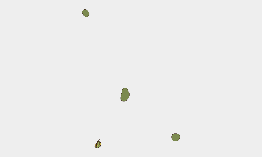
Port Louis (score 92) significantly outpaces all other districts and accounts for the majority of reported incidents. Plaines Wilhems (68), Black River (65), and Flacq (62) rank second through fourth, likely reflecting urban density, port-related activity, and transient populations that amplify petty crime and minor assaults. All incidents are localized and non-violent in character; no single district shows signs of organized criminal networks, gang conflict, or political volatility. The outer islands (Rodrigues, Saint Brandon, Agaléga) register minimal risk scores, reflecting very low population and activity levels.
How GeoBit Would Assist
Security teams with personnel or assets in Mauritius would employ AOI Monitoring & Early Warning to establish persistent watch on Port Louis, Plaines Wilhems, and key transport corridors, with automated alerting on civil unrest, labor action, or political events. Intel Sweep and multi-language OSINT (X/Twitter, local press feeds, radio SIGINT) enable continuous tracking of emerging crime patterns, police activity, and community sentiment. GIS & Spatial Analysis and Routing & Network Analysis support daily journey planning, identification of safer neighborhoods, and real-time alternative-route recommendations if localized incidents arise.
7-Day Outlook
No major deterioration is anticipated. Petty crime and minor interpersonal violence are expected to persist at baseline levels in urban areas, particularly Port Louis. Cyclone season remains a passive risk; no active systems threaten the island in the next seven days. Routine police activity and foreign-mission travel guidance are unlikely to change materially.
Highest-Risk Areas — Ranked
| # | State / Region | Risk |
|---|---|---|
| 1 | Port Louis | 92 |
| 2 | Plaines Wilhems | 68 |
| 3 | Black River | 65 |
| 4 | Flacq | 62 |
| 5 | Grand Port | 58 |
| 6 | Moka | 52 |
| 7 | Savanne | 48 |
| 8 | Pamplemousses | 45 |
| 9 | Rivière du Rempart District | 38 |
| 10 | Rodrigues | 22 |
| 11 | Saint Brandon | 8 |
| 12 | Agaléga | 5 |
Sources
Previous Daily Briefs
A new Mauritius brief is written every day — each with its own risk map and downloadable CSV. Here's the last week; use the calendar to go further back.
📅 Browse every day by calendar →
Highlighted days have a brief. Tap a day for that day's map & analysis, or “csv” for that day's dataset ($5).
Atlas — our AI intelligence desk — emails them this snapshot personally. Nothing else, no list.