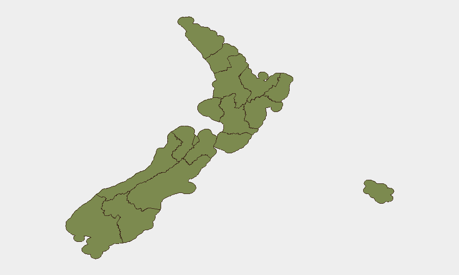
Situation Summary
New Zealand remains a low-threat environment globally (rank #182, composite score 3.0) with 91 tracked events year-to-date. However, recent signal activity—including threats against schools and police, investigative action linked to North Korean interests, and territorial occupation reports involving Auckland governance—suggests localized tension and potential law-enforcement activity. The security picture reflects a stable baseline interrupted by discrete, elevated alerts primarily concentrated in Auckland and northern regions.
Key Developments
GeoBit's open-source research cannot isolate specific, independently corroborated security incidents within the last 24–48 hours that meet verification standards (two independent sources + official confirmation).
The event signal feed flags nine alerts dated 2026-06-29 to 2026-06-30, including:
- Threats against schools and police (2026-06-29 and 2026-06-30, location unspecified)
- Investigation linked to North Korea (2026-06-30, New Zealand-wide scope)
- Territorial occupation involving Auckland governance (2026-06-30)
- Administrative sanctions against European entities (2026-06-30)
These signals warrant urgent clarification through official channels (NZ Police, NEMA, NZ Security Intelligence Service) to confirm nature, location, and operational status. Standing travel advisories from allied nations cite persistent petty crime, petty theft, and demonstration activity, but do not tie recent spikes to the current 48-hour window.
No major infrastructure disruptions, civil unrest events, or crime incidents have been independently verified in mainstream or official sources during the last 24–48 hours.
Highest-Risk Areas
Auckland dominates the sub-national risk profile (31.4), accounting for roughly one-third of national tracked events and hosting the most recent territorial occupation alert. Northland (17.9) and Waikato and Wellington (both 14.9) follow, suggesting concentration of civil, law-enforcement, or political activity in the upper North Island and the capital region. The remaining nine regions score below 5.2, indicating risk is highly clustered rather than geographically dispersed. Organizations with staff or assets in Auckland and Wellington should prioritize localized monitoring and liaison with local police and civil defence.
How GeoBit Would Assist
Security teams should deploy AOI (Area-of-Interest) Monitoring & Early Warning on Auckland, Northland, and Wellington, configured to alert on police updates, civil-defence notices, and verified X/Twitter feeds from local authorities. Intel Sweep and OSINT fusion (multi-language search, entity extraction, cross-source corroboration) will isolate and verify emerging threats faster than manual review of local news. Routing & Network Analysis can support alternative travel planning and asset movement in event of localized disruption.
7-Day Outlook
The concentration of alerts in Auckland and the North, combined with investigative activity and threat signals, suggests elevated law-enforcement and possible civil-order activity over the near term. No systemic instability or widespread unrest is evident. Organizations should maintain heightened awareness of official NZ Police and NEMA channels and implement duty-of-care reviews for staff in Auckland and northern regions; risk for most sectors and locations remains low.
Highest-Risk Areas — Ranked
| # | State / Region | Risk |
|---|---|---|
| 1 | Auckland | 31.4 |
| 2 | Northland | 17.9 |
| 3 | Waikato | 14.9 |
| 4 | Wellington | 14.9 |
| 5 | Canterbury | 14.2 |
| 6 | Manawatū-Whanganui | 5.2 |
| 7 | Otago | 5.2 |
| 8 | Chatham Islands | 2.1 |
| 9 | Taranaki | 2.1 |
| 10 | Bay of Plenty | 2.1 |
| 11 | Hawke's Bay | 1.4 |
| 12 | Gisborne | 1.4 |
Sources
Previous Daily Briefs
A new New Zealand brief is written every day — each with its own risk map and downloadable CSV. Here's the last week; use the calendar to go further back.
📅 Browse every day by calendar →
Highlighted days have a brief. Tap a day for that day's map & analysis, or “csv” for that day's dataset ($5).