Situation Summary
Oman remains domestically stable with no active civil unrest, terrorist activity, or major infrastructure disruption reported within Omani cities or populated areas. However, the security picture has deteriorated significantly in adjacent maritime zones over the past 48 hours, with multiple commercial tanker strikes in the Strait of Hormuz and Gulf of Oman attributed to Iranian forces. Low-level governance tension signals—including administrative sanctions and reported incidents against journalists—suggest a tightening domestic environment, but pose secondary risk to corporate operations compared to the acute maritime and shipping corridor exposure.
Key Developments
- Strait of Hormuz, Limah area (Musandam Governorate), night of 6 July 2026: A southbound oil tanker was struck by an unknown projectile and caught fire; UK Maritime Trade Operations confirmed the impact, emergency response, and no casualties or spill.
- Strait of Hormuz / Gulf of Oman corridor, 6–7 July 2026: U.S. officials attributed multiple commercial vessel attacks—including damage to a Qatari LNG tanker (Al-Rekayyat) and Saudi crude tanker (Wedyan)—to Iranian Revolutionary Guard missile strikes on vessels near or in Omani waters.
- Gulf of Oman shipping lanes, 6–7 July 2026: Three separate tanker incidents reported in a 24-hour window near the Strait of Hormuz along a route proximate to Oman's coast, consistent with multi-vessel targeting by Iranian forces against commercial shipping.
- Strait of Hormuz, 5 July 2026: U.S. Central Command reported disabling an oil tanker for alleged blockade violations in the Gulf of Oman/Strait of Hormuz area, increasing near-term risk for vessels transiting corridors serving Omani ports.
- Shipping lane abandonment, 5 July 2026: Multiple Japanese-linked commercial vessels departed the Strait of Hormuz corridor in response to escalated Iran-related tensions, indicating immediate commercial risk aversion affecting supply chains dependent on Omani port access.
- Oman (national), 4–5 July 2026: Event signals indicate recent administrative sanctions, violent repression in prisons, and assaults on journalists and activists; while localized, these suggest a deteriorating governance environment.
Highest-Risk Areas
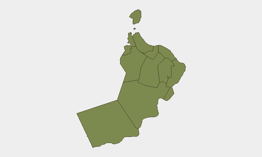
Al Wusta Governorate (risk score 31.4) and Musandam Governorate (9.5) drive the current risk ranking and are substantially ahead of all other regions. Musandam's elevation is almost entirely attributable to geographic proximity to Strait of Hormuz chokepoints and recent maritime attack incidents; Al Wusta's higher score reflects its remoteness, limited governance presence, and historical smuggling/trafficking vulnerabilities. The remaining nine governorates cluster at 1.4, indicating minimal internal threat. Risk is overwhelmingly *external*—maritime and energy-sector exposure—rather than domestic instability.
How GeoBit Would Assist
Security teams should deploy Maritime & Aviation Tracking combined with AOI Monitoring & Early Warning to maintain real-time visibility of vessel movements and incident patterns in the Strait of Hormuz and Gulf of Oman corridors serving Oman. Routing & Network Analysis capabilities enable alternative journey planning for supply chains and personnel movements dependent on Omani ports. Intel Sweep and multi-language OSINT (social, broadcast, maritime alerts) provide early signal of vessel targeting, port facility disruptions, or governance enforcement actions affecting corporate operations.
7-Day Outlook
Maritime tensions are likely to persist or escalate if Iran continues targeting commercial shipping in the Strait of Hormuz, with potential knock-on effects on port operations, shipping insurance, and supply-chain routing through Oman. Domestic governance signals warrant monitoring but pose lower acute risk. Any widening of maritime conflict involving U.S. or allied naval assets could rapidly elevate risk across all sub-national zones.
Highest-Risk Areas — Ranked
| # | State / Region | Risk |
|---|---|---|
| 1 | Al Wusta Governorate | 31.4 |
| 2 | Musandam Governorate | 9.5 |
| 3 | Muscat Governorate | 1.4 |
| 4 | Al Buraymi Governorate | 1.4 |
| 5 | Ad Dhahirah Governorate | 1.4 |
| 6 | Al Batinah North Governorate | 1.4 |
| 7 | Al Batinah South Governorate | 1.4 |
| 8 | Ad Dakhiliyah Governorate | 1.4 |
| 9 | Ash Sharqiyah North Governorate | 1.4 |
| 10 | Ash Sharqiyah South Governorate | 1.4 |
| 11 | Dhofar Governorate | 1.4 |
Previous Daily Briefs
A new Oman brief is written every day — each with its own risk map and downloadable CSV. Here's the last week; use the calendar to go further back.
📅 Browse every day by calendar →
Highlighted days have a brief. Tap a day for that day's map & analysis, or “csv” for that day's dataset ($5).
Atlas — our AI intelligence desk — emails them this snapshot personally. Nothing else, no list.