Situation Summary
Palau remains in a stable, low-threat environment with no verified security incidents, civil unrest, crime spikes, infrastructure failures, or transport disruptions reported in the last 24–48 hours. The country-wide composite threat score of 3 reflects a benign operational picture for corporate personnel and assets. Sub-national risk concentrations—primarily in Peleliu and Angaur—reflect structural/legacy vulnerability factors rather than active incidents or emerging events.
Key Developments
- Country-wide, Palau (20–21 July 2026): No credible reports of protests, politically-motivated violence, crime events, or civil unrest in the last 24–48 hours. Regional Pacific news wires and security feeds confirm absence of reportable incidents.
- Koror, Palau (20–21 July 2026): No new security, infrastructure, or transport disruptions detected. The capital and primary commercial hub remains operationally stable.
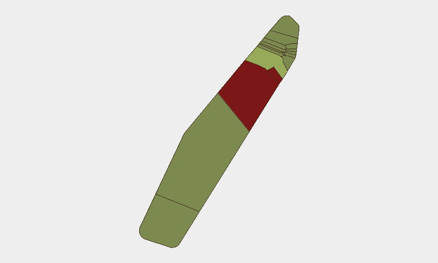
- Peleliu & Angaur, Palau (20–21 July 2026): Elevated structural risk scores (92 and 88, respectively) remain unlinked to active incidents or new developments within the current 24–48 hour window; these reflect pre-existing vulnerabilities rather than acute threats.
- Maritime & Aviation (20–21 July 2026): No disruptions to port operations, inter-island transport, or regional aviation reported. Standard commercial and inter-regional movement continues.
*Note: A mid-July press item (dated 16 July) referencing a drug-trafficking case from April 2026 is outside the current 24–48 hour reporting window and does not represent a new development.*
Highest-Risk Areas
Peleliu (92) and Angaur (88) drive the sub-national risk ranking and warrant ongoing monitoring due to structural factors—including isolation, limited administrative infrastructure, and historical resource constraints—that elevate vulnerability to supply-chain disruption, maritime incidents, or slow emergency-response capacity. Koror (45), as the commercial and demographic hub, carries moderate risk tied to population density and transient labor dynamics but remains stable operationally. The remaining states (Melekeok through Ngchesar) present minimal acute risk and are suitable for routine business continuity protocols.
How GeoBit Would Assist
AOI Monitoring & Early Warning can establish persistent watch over Koror's commercial districts and inter-island transport nodes to flag emerging incidents, crime patterns, or infrastructure stress before they impact operations. Intel Sweep, regional event feeds, and multi-language OSINT enable continuous scanning of Palau-specific news, social media, and maritime/aviation channels to detect early signals of civil unrest, supply disruption, or security incidents. Routing & Network Analysis supports contingency planning for personnel and asset movement, particularly between Koror and outer states, in the event of transport or infrastructure disruption.
7-Day Outlook
Palau's security environment is forecast to remain stable over the next 7 days, with no indicators of imminent civil unrest, natural hazard emergency, or infrastructure failure. Routine corporate security and duty-of-care protocols are appropriate. Continued low-level monitoring of Peleliu and Angaur for weather, maritime, or supply-chain issues is recommended as a standard precaution given their geographic isolation and infrastructure constraints.
Highest-Risk Areas — Ranked
| # | State / Region | Risk |
|---|---|---|
| 1 | Peleliu | 92 |
| 2 | Angaur | 88 |
| 3 | Koror | 45 |
| 4 | Melekeok | 35 |
| 5 | Airai | 32 |
| 6 | Ngatpang | 28 |
| 7 | Ngeremlengui | 26 |
| 8 | Ngaraard | 25 |
| 9 | Ngardmau | 24 |
| 10 | Aimeliik | 23 |
| 11 | Ngiwal | 22 |
| 12 | Ngchesar | 21 |
Sources
Previous Daily Briefs
A new Palau brief is written every day — each with its own risk map and downloadable CSV. Here's the last week; use the calendar to go further back.
📅 Browse every day by calendar →
Highlighted days have a brief. Tap a day for that day's map & analysis, or “csv” for that day's dataset ($5).
Atlas — our AI intelligence desk — emails them this snapshot personally. Nothing else, no list.