Situation Summary
Papua New Guinea remains a fragmented security environment with composite threat score of 16 (rank #72 globally) and 87 tracked events. The security picture is dominated by localized criminal and communal violence, with Morobe Province presenting significantly elevated risk (31.4 composite score) compared to all other regions. No major political instability, organized terrorism, or state-level conflict has been reported in the last 24–48 hours; however, environmental hazards and routine military activity are underway.
Key Developments
- Western Highlands Province – 7 July 2026 – Provincial authorities issued a severe dry-season warning requiring immediate resident preparation; this creates significant livelihood and health-related travel risk across agricultural and remote communities during the coming weeks.
- Lae, Morobe Province – 7 July 2026 – U.S. and Papua New Guinea defense forces conducted a groundbreaking ceremony for Tamiok Strike 26 at Igam Barracks, a scheduled bilateral military exercise with no indication of unrest or operational incident.
- National Level – 7 July 2026 – Multiple public statements from Prime Minister, advocacy groups, and Australian government officials were issued; web research has not corroborated specific security incidents associated with these statements in the last 24–48 hours.
- Health Sector – Circulating vaccine-derived poliovirus type 2 (cVDPV2) remains active; this is an ongoing public-health risk requiring duty-of-care attention for personnel in rural and under-vaccinated regions, particularly in provinces with limited medical infrastructure.
- No Active Civil Unrest Reported – As of 7–8 July 2026, no verified reports of riots, major violent crime outbreaks, or political instability have been corroborated in the last 24–48 hours across monitored sources.
Highest-Risk Areas
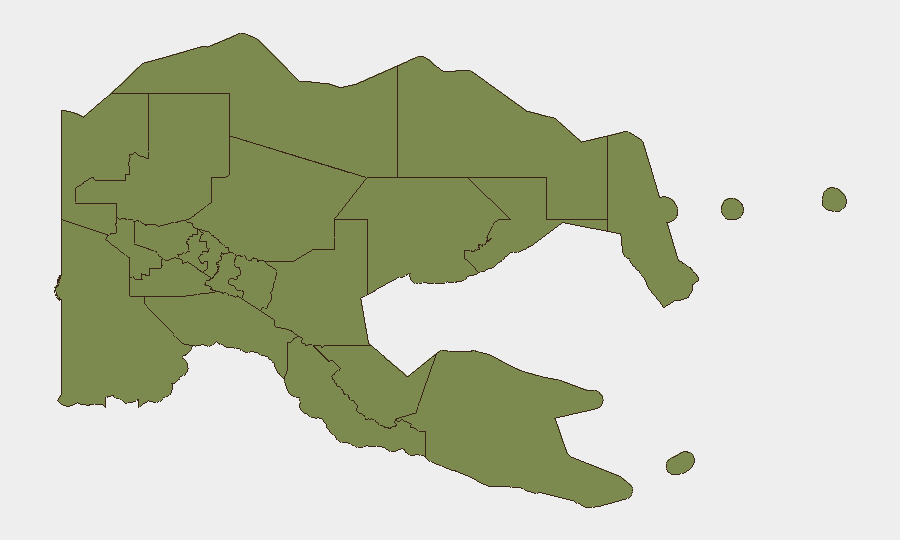
Morobe Province is the clear outlier, with a composite risk score of 31.4—approximately 22 times higher than all other tracked regions. This elevation is driven by historically high rates of criminal violence, gang activity, and communal conflict, particularly in and around Lae (the provincial capital and PNG's second-largest city). All other 11 provinces and the National Capital District cluster at a composite score of 1.4, suggesting either lower baseline threat intensity or lower reporting density. Security teams with personnel or assets in Morobe should maintain elevated vigilance; those in other provinces face standard Papua New Guinea-baseline risks (communal disputes, petty crime, health hazards).
How GeoBit Would Assist
Teams responsible for Papua New Guinea duty-of-care should deploy Area-of-Interest (AOI) Monitoring & Early Warning on Morobe Province and key nodes (Lae, surrounding districts), with alerting thresholds set for violent crime, communal conflict, and civil unrest. OSINT & multi-language event feeds combined with sentiment and temporal analysis provide real-time detection of emerging incidents and public statements that may signal escalation. GIS & spatial analysis tools enable risk-aware routing and alternative journey planning for personnel movement, particularly during the current dry-season window.
7-Day Outlook
Morobe Province will likely remain the primary security concern, with dry-season conditions potentially increasing resource competition and communal tensions in Western Highlands and other agricultural regions. No imminent political instability or state-level crisis is forecast; however, localized criminal and intercommunal violence should be monitored continuously given historical volatility.
Highest-Risk Areas — Ranked
| # | State / Region | Risk |
|---|---|---|
| 1 | Morobe | 31.4 |
| 2 | Eastern Highlands | 1.4 |
| 3 | Gulf | 1.4 |
| 4 | Madang | 1.4 |
| 5 | Manus | 1.4 |
| 6 | West New Britain | 1.4 |
| 7 | New Ireland | 1.4 |
| 8 | East New Britain | 1.4 |
| 9 | National Capital District | 1.4 |
| 10 | Central | 1.4 |
| 11 | Oro | 1.4 |
| 12 | Milne Bay | 1.4 |
Sources
Previous Daily Briefs
A new Papua New Guinea brief is written every day — each with its own risk map and downloadable CSV. Here's the last week; use the calendar to go further back.
📅 Browse every day by calendar →
Highlighted days have a brief. Tap a day for that day's map & analysis, or “csv” for that day's dataset ($5).
Atlas — our AI intelligence desk — emails them this snapshot personally. Nothing else, no list.