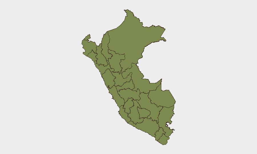
Situation Summary
Peru remains a composite mid-tier risk environment (global rank #64, threat score 18) with regional concentration of threats in central and southern departments. Security incidents recorded in the past 48 hours span minor seismic activity, ongoing infrastructure strain from El Niño emergency measures, and scattered administrative/law-enforcement actions, with no indicators of sudden escalation in organized crime, terrorism, or political instability. The incoming Fujimori administration (28 July 2026) has not yet altered the near-term threat profile, though policy shifts on security and mining regulation remain uncertain variables for mid-term risk.
Key Developments
- Huánuco region – 8 July 2026, 05:00 UTC – Moderate earthquake (M4.6). Shallow-depth seismic event reported by Volcano Discovery and regional feeds; felt across central Peru with no immediate reports of major damage or casualties, though aftershock risk and secondary effects (landslides in already-unstable terrain) warrant monitoring given Huánuco's status as Peru's highest-risk department.
- Peru (national) – 8 July 2026 – El Niño emergency state ongoing. Approximately 800 municipalities remain under emergency decree; travel disruption and infrastructure vulnerability (road closures, flood/landslide risk) persisting. No new escalation reported, but baseline operational friction for commercial and personnel movement remains elevated.
- Lima/Banking sector – 9 July 2026 – Disapproval incident at financial institution. Event signal logged but specifics not detailed in available wire reporting; categorized as administrative/regulatory concern rather than security incident. Standard duty-of-care monitoring recommended for Lima operations.
- Healthcare system – 8–9 July 2026 – Hospital threat notification and doctor-facility dispute. Threat signal against hospital (9 July) and arrest/detention incident involving doctor and hospital administration (8 July) documented; no citywide or systemic impact evident, but reflects operational friction in Lima healthcare infrastructure.
- Law enforcement – 7 July 2026 – Hitman arrest and cross-border detention incident. Organized crime-linked arrest in Lima and separate detention involving Ohio jurisdiction; no indication of organized retaliation or cartel escalation, but confirms ongoing presence of transnational organized crime networks in Lima.
Highest-Risk Areas
Huánuco (risk 31.5) and Lima (risk 26.5) account for more than two-thirds of Peru's tracked threat events. Huánuco's elevated composite score reflects drug-trafficking corridor activity, illegal mining, and organized crime presence in remote terrain; the 8 July earthquake adds natural hazard compounding to existing fragility. Lima's risk stems from concentration of financial crime, transnational organized crime networks, and administrative/healthcare sector friction. Tacna (17.5) and Piura (17.2) represent secondary southern and northern corridors of concern, primarily linked to trafficking and smuggling networks. Southern Andean departments (Apurímac, Ayacucho) show declining but non-zero threat signals, possibly reflecting prior political violence legacies and ongoing coca-cultivation zones.
How GeoBit Would Assist
Teams with personnel or assets in Huánuco and Lima should employ AOI Monitoring & Early Warning to track seismic aftershock risk, El Niño-related infrastructure failures, and organized crime activity signals in real-time. Intel Sweep and entity extraction on trafficking networks, mining disputes, and healthcare/financial sector friction in Lima support targeted duty-of-care briefing and mitigation planning. Routing & Network Analysis capabilities enable alternative journey planning during El Niño emergency periods and post-seismic road closure events.
7-Day Outlook
No major security escalation is anticipated in the immediate term. Earthquake aftershock risk in central Peru will decline over 5–7 days; El Niño emergency conditions are expected to persist through at least late July. Administrative transitions ahead of 28 July presidential handover merit standard monitoring for policy signaling but do not currently indicate imminent instability.
Highest-Risk Areas — Ranked
| # | State / Region | Risk |
|---|---|---|
| 1 | Huánuco | 31.5 |
| 2 | Lima | 26.5 |
| 3 | Tacna | 17.5 |
| 4 | Piura | 17.2 |
| 5 | Apurímac | 9.7 |
| 6 | Ayacucho | 2.2 |
| 7 | Loreto | 1.5 |
| 8 | Tumbes | 1.5 |
| 9 | Lambayeque | 1.5 |
| 10 | Amazonas | 1.5 |
| 11 | Cajamarca | 1.5 |
| 12 | La Libertad | 1.5 |
Sources
Previous Daily Briefs
A new Peru brief is written every day — each with its own risk map and downloadable CSV. Here's the last week; use the calendar to go further back.
📅 Browse every day by calendar →
Highlighted days have a brief. Tap a day for that day's map & analysis, or “csv” for that day's dataset ($5).
Atlas — our AI intelligence desk — emails them this snapshot personally. Nothing else, no list.