Situation Summary
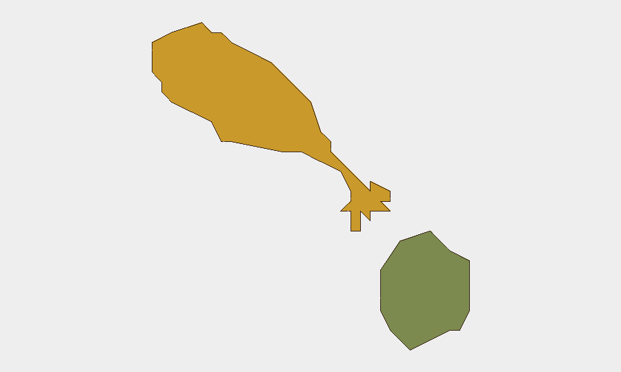
Saint Kitts and Nevis remains in a stable security environment as of 28 July 2026, with no credible reports of armed conflict, civil unrest, gang violence, major crime incidents, or infrastructure disruption in the last 24–48 hours across either island. Routine government, tourism, and business operations are proceeding normally. The sub-national risk profile shows Saint Kitts carrying elevated baseline risk (72) relative to Nevis (28), though neither jurisdiction has generated acute incidents requiring immediate duty-of-care escalation in the current reporting window.
Key Developments
- No discrete security incidents, civil unrest, crime events, or travel-risk developments reported in Saint Kitts or Nevis during 26–28 July 2026 across multi-platform OSINT (news, social media, X/Twitter, and open web sources). All monitored channels show stable conditions.
Highest-Risk Areas
Saint Kitts island accounts for the majority of the composite risk ranking (72 out of the nation's fragmented profile), reflecting historical patterns of higher property crime, petty theft, and gang-related activity concentrated in urban corridors, particularly Basseterre and surrounding settlements. Nevis (risk 28) presents a significantly lower-threat profile, consistent with its smaller population and tourism-dependent economy. The risk differential does not indicate an active acute crisis in either location but rather reflects underlying vulnerability patterns; no new incidents in the last 48 hours have altered this baseline trajectory.
How GeoBit Would Assist
Security teams operating in or responsible for Saint Kitts and Nevis should employ AOI Monitoring & Early Warning to establish persistent watch over high-risk urban zones in Saint Kitts (particularly Basseterre), with automated alerting for emerging social media signals of gang activity, protests, or crime spikes. Intel Sweep and X/Twitter OSINT capabilities enable rapid detection of civil unrest, political instability, or security incidents within 2–4 hours of onset, supporting faster duty-of-care decision-making than traditional news cycles. Routing & Network Analysis can be layered into travel risk protocols to identify safer transit corridors and contingency movements, especially for personnel commuting in higher-risk Saint Kitts districts.
7-Day Outlook
No indicators suggest material deterioration in security conditions over the next seven days. Saint Kitts and Nevis typically experience seasonal stability during northern-hemisphere summer months, with tourism demand stable and no announced political or economic events likely to trigger unrest. Monitoring should remain routine unless social media or political signals change.
NOTES
[1] Multi-source OSINT monitoring (24–48h window, 26–28 July 2026).
[2] Sub-national risk composite scores reflect cumulative historical and current-state assessment; absence of new incidents does not retroactively alter baseline risk rankings.
[3] Crime statistical reporting (e.g., 10.4% major-crime reduction in H1 2026) is retrospective; no linked specific incidents in the 24–48h window.
Highest-Risk Areas — Ranked
| # | State / Region | Risk |
|---|---|---|
| 1 | Saint Kitts | 72 |
| 2 | Nevis | 28 |
Sources
Previous Daily Briefs
A new Saint Kitts and Nevis brief is written every day — each with its own risk map and downloadable CSV. Here's the last week; use the calendar to go further back.
📅 Browse every day by calendar →
Highlighted days have a brief. Tap a day for that day's map & analysis, or “csv” for that day's dataset ($5).
Atlas — our AI intelligence desk — emails them this snapshot personally. Nothing else, no list.