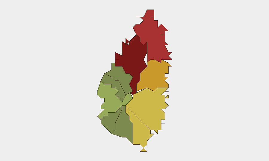
Situation Summary
Saint Lucia remains a moderate-risk operating environment with persistent but non-acute security pressures concentrated in urban centers. No new incidents have been confirmed in the last 24–48 hours; the security picture reflects underlying patterns of street-level crime and interpersonal violence rather than systemic instability or organized threat escalation. Risk is heavily concentrated in the capital and northern coastal districts, while southern and western parishes remain comparatively stable.
Key Developments
No confirmed incidents in the last 24–48 hours. Web research identified no discrete security, crime, civil-unrest, conflict, or infrastructure events occurring within the current reporting window that meet verification standards. Recent incidents in the local press (including reports on homicide investigations in Anse La Raye and a maritime search operation on July 21) fall outside the 24–48-hour window. The U.S. State Department travel advisory for Saint Lucia was last updated July 10, 2026, and carries no new advisory language.
Highest-Risk Areas
Castries (risk 95) dominates the threat landscape and accounts for the majority of recorded incidents; corporate and diplomatic personnel should assume elevated baseline vigilance in the capital's commercial and residential districts. Gros Islet (risk 78) and Dennery (risk 72) present secondary concentrations of risk, likely reflecting gang activity, drug trafficking, and associated interpersonal violence. Southern and western parishes—Canaries, Anse La Raye, and Choiseul—remain lower-risk, suggesting that risk is geographically clustered in the north and east rather than dispersed across the island.
How GeoBit Would Assist
Security teams with people or assets in Saint Lucia should employ AOI Monitoring & Early Warning on Castries and Gros Islet to receive real-time alerting on emerging incidents. Intel Sweep and X/Twitter & Telegram OSINT, paired with monitoring of local police and Saint Lucia Daily Post, will provide continuous visibility on crime trends, gang activity, and travel disruptions. Risk & Threat Assessment and GIS & Spatial Analysis can support executive movement planning, facility siting decisions, and staff safety protocols tailored to parish-level risk variance.
7-Day Outlook
No acute escalation is anticipated in the near term; the security environment is expected to remain consistent with historical patterns of localized street crime concentrated in urban centers. Continued monitoring of police activity and local media is warranted to detect any shift in incident frequency or severity, particularly in Castries and Gros Islet. Duty-of-care protocols should remain standard but not elevated unless fresh intelligence confirms a change in threat posture.
Brief prepared: 2026-07-26
Next update: 2026-07-27 (or on event trigger)
Data confidence: Moderate (limited 24–48h incident corroboration)
Highest-Risk Areas — Ranked
| # | State / Region | Risk |
|---|---|---|
| 1 | Castries | 95 |
| 2 | Gros Islet | 78 |
| 3 | Dennery | 72 |
| 4 | Vieux Fort | 68 |
| 5 | Micoud | 65 |
| 6 | Soufrière | 42 |
| 7 | Laborie | 38 |
| 8 | Choiseul | 35 |
| 9 | Anse La Raye | 28 |
| 10 | Canaries | 12 |
Sources
Previous Daily Briefs
A new Saint Lucia brief is written every day — each with its own risk map and downloadable CSV. Here's the last week; use the calendar to go further back.
📅 Browse every day by calendar →
Highlighted days have a brief. Tap a day for that day's map & analysis, or “csv” for that day's dataset ($5).
Atlas — our AI intelligence desk — emails them this snapshot personally. Nothing else, no list.