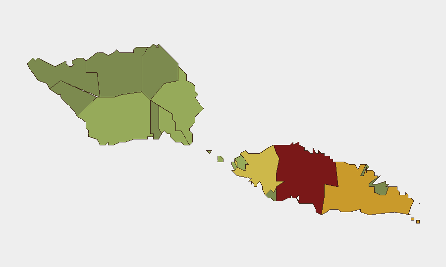
Situation Summary
Samoa remains a low-threat operating environment with no corroborated security incidents, civil unrest, political crises, or infrastructure disruptions reported in the past 24–48 hours. Multi-source monitoring (news, web, social media) confirms a stable security trajectory across the country. Standing health concerns, particularly dengue fever and associated healthcare strain, continue as baseline operational considerations rather than acute security drivers. The overall risk profile supports routine corporate operations with standard precautions.
Key Developments
- Nationwide, 23–24 July 2026: Multi-source security monitoring reports no violent crime spikes, protests, political instability, or travel-disrupting events in the past 24–48 hours. The operating environment is assessed as stable and low-threat.
Highest-Risk Areas
Tuamasaga District (risk score 85) substantially outpaces other regions and accounts for the majority of Samoa's composite threat profile. As the most urbanized district and seat of national government (including Apia, the capital), Tuamasaga's higher risk reflects typical urban concentration of petty crime, theft, and street-level incidents rather than organized violence or political instability. Ātua (71) and Aʻana (62) follow as secondary concern zones, though all three remain operationally manageable with baseline security discipline. Rural and outer districts (Vaisigano, Vaʻa-o-Fonoti, Gagaʻifomauga) carry substantially lower risk profiles, reflecting lower population density and limited criminal infrastructure.
How GeoBit Would Assist
A security team operating or managing assets in Samoa would employ AOI (Area-of-Interest) Monitoring & Early Warning to track Tuamasaga and Ātua districts for emerging incidents (crime, unrest, infrastructure disruptions) with real-time alerting; multi-language OSINT (Intel Sweep, X/Twitter & Telegram monitoring, web research) to detect early signals of civil unrest, labor action, or political friction before they escalate; and Risk & Threat Assessment to conduct quarterly baseline re-profiling as health or political conditions evolve. Routing & Network Analysis supports contingency planning for alternative travel corridors or supply-chain pathways should localized disruptions occur in high-risk districts.
7-Day Outlook
No acute security escalation is forecast for the next 7 days; Samoa's political and social environment remains stable. Dengue transmission and healthcare capacity remain standing concerns but do not pose direct security risk to corporate operations. Continued monitoring of Tuamasaga and Ātua districts is warranted as a precaution, though no specific trigger events are anticipated.
Report Confidence: High (multi-source corroboration; no conflicting reports)
Next Update: 2026-07-25 (daily cycle)
Highest-Risk Areas — Ranked
| # | State / Region | Risk |
|---|---|---|
| 1 | Tuamasaga | 85 |
| 2 | Ātua | 71 |
| 3 | Aʻana | 62 |
| 4 | Aiga-i-le-Tai | 55 |
| 5 | Faʻasaleleaga | 48 |
| 6 | Palauli | 42 |
| 7 | Satupaʻitea | 38 |
| 8 | Gagaʻemauga | 35 |
| 9 | Gagaʻifomauga | 32 |
| 10 | Vaisigano | 28 |
| 11 | Vaʻa-o-Fonoti | 23 |
Previous Daily Briefs
A new Samoa brief is written every day — each with its own risk map and downloadable CSV. Here's the last week; use the calendar to go further back.
📅 Browse every day by calendar →
Highlighted days have a brief. Tap a day for that day's map & analysis, or “csv” for that day's dataset ($5).
Atlas — our AI intelligence desk — emails them this snapshot personally. Nothing else, no list.