Situation Summary
Tonga remains in a low-threat security environment with no active civil unrest, armed conflict, or major infrastructure disruption as of 31 July 2026. A nationwide manhunt concluded successfully in late July with the arrest of the final escapee from the Central Police Station operation, and associated police checkpoints around Nuku'alofa are easing. Moderate seismic activity (M 4.3–5.1) in offshore waters poses minimal immediate risk to transport and infrastructure. The political transition following the Court of Appeal's upholding of a parliamentary election cancellation proceeded without incident, underscoring institutional stability.
Key Developments
- Nuku'alofa, Tongatapu – 29 July 2026: Minister for Tourism and Infrastructure Semisi Sika attended his final Cabinet meeting following the Court of Appeal's confirmation that his Tongatapu 2 parliamentary election victory was cancelled; a by-election for the constituency is required, marking an orderly constitutional transition.
- Hala'ovave, Tongatapu – late July 2026 (within last 48 hours): Tonga Police arrested the final escapee from the Central Police Station "TRACE" operation at a residence, formally concluding the nationwide manhunt. No additional charges have been disclosed.
- Nuku'alofa and surrounding areas, Tongatapu – last 48 hours: Police checkpoints and heightened enforcement activity around Nuku'alofa and Mataki'eua are easing following the closure of the manhunt, with no new related security incidents reported.
- Offshore waters (Pangai, Houma vicinity) – confirmed within last 24–48 hours: Four moderate earthquakes (M 4.3–5.1) were recorded in archipelago waters; no tsunami warnings were issued, no damage was reported, and no transport disruptions occurred.
- Nationwide – 29 July 2026: Tonga received a drought-preparedness insurance payout from the Pacific Catastrophe Risk Insurance Company (PCRIC) in response to a forecast rainfall deficit and elevated tropical-cyclone outlook for the coming season. This reflects longer-term climate-related risk management rather than an immediate threat.
- Nationwide (Tonga) – 26–31 July 2026: Recent security assessments confirm no civil unrest, protests, armed conflict, or major infrastructure failures; routine crime remains within normal parameters and travel conditions are stable.
Highest-Risk Areas
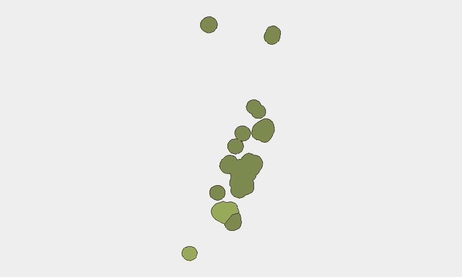
Tongatapu (risk 45) dominates the composite risk ranking and concentrates the majority of Tonga's security exposure due to its status as the capital island, largest population center, and seat of government. Vavaʻu (risk 28) and Haʻapai (risk 22) carry secondary risk profiles typical of lower-population outer islands with limited emergency-response infrastructure and periodic isolation during adverse weather. The clustering of risk in Tongatapu reflects political, administrative, and economic centrality rather than acute instability; ʻEua and Ongo Niua pose minimal comparative risk.
How GeoBit Would Assist
Security teams monitoring Tonga would deploy AOI Monitoring & Early Warning capabilities on Tongatapu and Vavaʻu to track political developments, law-enforcement activity, and public-order incidents in real time, coupled with Intel Sweep and OSINT fusion across local and regional news, social media, and official sources to detect early signals of unrest or disruption. Maritime & Aviation tracking and Environmental & Health monitoring (focused on seismic and tropical-cyclone activity) would provide advance notice of transport delays or infrastructure risk affecting personnel or supply chains. Risk & Threat Assessment would maintain duty-of-care situational awareness for corporate staff, expats, and operations across the islands.
7-Day Outlook
No significant escalation of security risks is forecast over the next seven days. Seismic activity in offshore waters is likely to continue at background levels without material consequence. Political transition processes and law-enforcement operations are proceeding without incident, suggesting institutional resilience and a stable near-term trajectory for Tonga.
Highest-Risk Areas — Ranked
| # | State / Region | Risk |
|---|---|---|
| 1 | Tongatapu | 45 |
| 2 | Vavaʻu | 28 |
| 3 | Haʻapai | 22 |
| 4 | ʻEua | 18 |
| 5 | Ongo Niua | 12 |
Sources
Previous Daily Briefs
A new Tonga brief is written every day — each with its own risk map and downloadable CSV. Here's the last week; use the calendar to go further back.
📅 Browse every day by calendar →
Highlighted days have a brief. Tap a day for that day's map & analysis, or “csv” for that day's dataset ($5).
Atlas — our AI intelligence desk — emails them this snapshot personally. Nothing else, no list.