Situation Summary
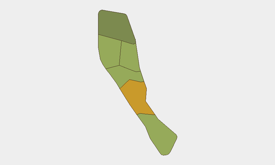
Vanuatu remains a low-threat environment globally (composite threat score 7; rank #146 worldwide) with no discrete security events tracked in the current monitoring window. No credible reports of new security incidents, civil unrest, crime spikes, political instability, infrastructure disruption, or travel risks have been identified in the last 24–48 hours. The archipelago's risk profile is geographically concentrated, with Shefa Province substantially elevated relative to the national baseline.
Key Developments
No security, conflict, civil unrest, crime, infrastructure, or travel-risk incidents meeting verification criteria (multiple independent sources, precise date/location, last 24–48 hours) have been identified for Vanuatu as of 28 August 2026.
*Note: The absence of reportable incidents reflects the low baseline threat environment and limitations of real-time open-source coverage for a small Pacific island state, not confirmed stability. Minor criminal or civil events may occur without immediate international media or social-media visibility.*
Highest-Risk Areas
Shefa Province (risk 72) is the dominant driver of national risk, nearly 25 points above the second-ranked province and more than double the risk of the two lowest-ranked regions. Penama (58) and Sanma (52) form a secondary tier of elevated concern. Risk concentration in these three provinces suggests that corporate security priorities—particularly for Port Vila (capital, Shefa) and Luganville (Penama)—should focus monitoring and contingency planning on Shefa and Penama. The gradient from Shefa (72) through Torba (35) indicates material variance in regional threat environment; operations in Torba and Tafea carry substantially lower assessed risk.
How GeoBit Would Assist
AOI (Area-of-Interest) Monitoring & Early Warning deployed on Port Vila, Luganville, and Shefa's key corporate/logistics hubs would provide persistent, automated alerting for civil unrest, infrastructure incidents, or security developments before they reach international headlines. Multi-language OSINT fusion (news, X/Twitter, Telegram, radio SIGINT) specific to Vanuatu's Bislama, French, and English media ecosystem would close gaps in English-only open-source reporting and surface early warning signals. Risk & Threat Assessment refreshed weekly would establish if sub-national risk drivers (crime, political tension, natural hazard exposure) are stable or shifting, enabling duty-of-care teams to validate evacuation triggers and insurance thresholds.
7-Day Outlook
No significant deterioration in Vanuatu's security posture is indicated for the next seven days. The stability of the Shefa/Penama risk concentration suggests regional factors (crime, governance, economic stress) are chronic rather than acute; absent a major political or infrastructure shock, no spike in reported incidents is expected. Cyclone season risk (typically November–April) remains low in late August; maritime and aviation incident exposure should remain within historical norms.
Highest-Risk Areas — Ranked
| # | State / Region | Risk |
|---|---|---|
| 1 | Shefa Province | 72 |
| 2 | Penama | 58 |
| 3 | Sanma | 52 |
| 4 | Malampa | 48 |
| 5 | Tafea | 45 |
| 6 | Torba | 35 |
Sources
Previous Daily Briefs
A new Vanuatu brief is written every day — each with its own risk map and downloadable CSV. Here's the last week; use the calendar to go further back.
- August 26, 2026
- August 24, 2026
- August 22, 2026
- August 20, 2026
- August 18, 2026
- August 16, 2026
- August 14, 2026
📅 Browse every day by calendar →
Highlighted days have a brief. Tap a day for that day's map & analysis, or “csv” for that day's dataset ($5).
Atlas — our AI intelligence desk — emails them this snapshot personally. Nothing else, no list.