Situation Summary
Saint Kitts and Nevis remains a lower-tier global security concern (rank #123) with crime and gang activity as the primary threat driver. The past week saw routine infrastructure maintenance, a high-profile armed robbery in Basseterre, and the Prime Minister's return to full duties following medical leave. No significant escalation in underlying security conditions has been recorded, though persistent localized crime and utility vulnerabilities warrant continued monitoring.
Key Developments
- 14 October — Basseterre (national): Prime Minister Terrance Drew announced completion of rehabilitation and medical clearance to resume full executive duties; he departed for a U.S.–Caribbean dialogue in Washington on 15 October. Regional political stability improved marginally with leadership continuity restored.
- 14–15 October — Camps, Bay View, Saint Peters (Saint Kitts): Planned water-service interruptions occurred across multiple zones for pipeline and fire-hydrant replacement. Service was restored by the morning of 15 October. Critical infrastructure vulnerability to supply-chain disruption remains evident.
- 15 October — Basseterre (national): Government convened a regional cybersecurity-resilience seminar to strengthen national cyber-awareness. This reflects growing official recognition of cyber risk as a secondary threat vector.
- 17 October — Port Zante, Basseterre: Two masked assailants carried out an armed robbery at Royal Gems Jewellery Store (approximately 4:30–5:00 p.m.), using a hammer, knife, and firearm to breach display cases and steal jewelry before fleeing on a red-and-black scooter. No injuries reported. Police confirmed investigation on 19 October. This incident underscores persistent street-level violent crime in the capital's commercial district.
Highest-Risk Areas
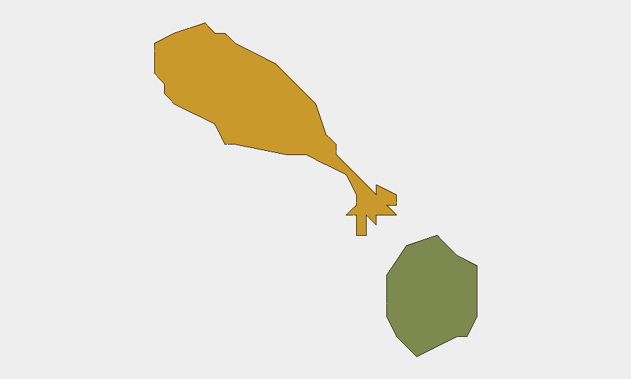
Saint Kitts (composite risk score 72) accounts for the overwhelming majority of documented threat activity and remains the primary concern. Basseterre, the capital, concentrates both commercial and residential assets; recent armed robbery activity in the Port Zante retail zone indicates vulnerability of high-value targets in daytime operating hours. Nevis (risk score 28) remains significantly lower-risk and serves as a secondary operational base for organizations with personnel across both islands. The disparity reflects Saint Kitts' larger population, higher commercial density, and documented gang-related activity.
How GeoBit Would Assist
Security teams operating in Saint Kitts and Nevis can deploy AOI Monitoring & Early Warning to track Basseterre's commercial districts and key infrastructure sites (power plant, port facilities, retail centers) for emerging threat activity. Intelligence & OSINT capabilities—particularly X/Twitter monitoring, regional news feeds, and multi-language search—enable real-time detection of crime incidents, utility disruptions, and political developments. Risk & Threat Assessment integrated with Network & Actor Analysis can map local crime networks and identify patterns in targeting (e.g., jewelry retailers, tourist-facing businesses) to inform security posture and incident response protocols.
7-Day Outlook
No significant escalation in the security environment is forecast for the near term. Routine infrastructure maintenance will likely continue, with potential for unannounced utility outages; duty-of-care teams should maintain redundant communication and supply chains. Street-level crime in Basseterre—particularly armed robbery of commercial establishments—remains the dominant operational risk and will likely persist at current levels absent major law-enforcement intervention.
Highest-Risk Areas — Ranked
| # | State / Region | Risk |
|---|---|---|
| 1 | Saint Kitts | 72 |
| 2 | Nevis | 28 |
Sources
Previous Weekly Briefs
A new Saint Kitts and Nevis brief is written every Monday, covering the week — each with its own risk map and downloadable CSV. Use the calendar to go further back.
- October 13, 2026
- October 6, 2026
- September 29, 2026
- September 22, 2026
- September 15, 2026
- September 8, 2026
- September 1, 2026
📅 Browse past briefs by calendar →
Highlighted days have a brief. Tap a day for that day's map & analysis, or “csv” for that day's dataset ($5).
Atlas — our AI intelligence desk — emails them this snapshot personally. Nothing else, no list.