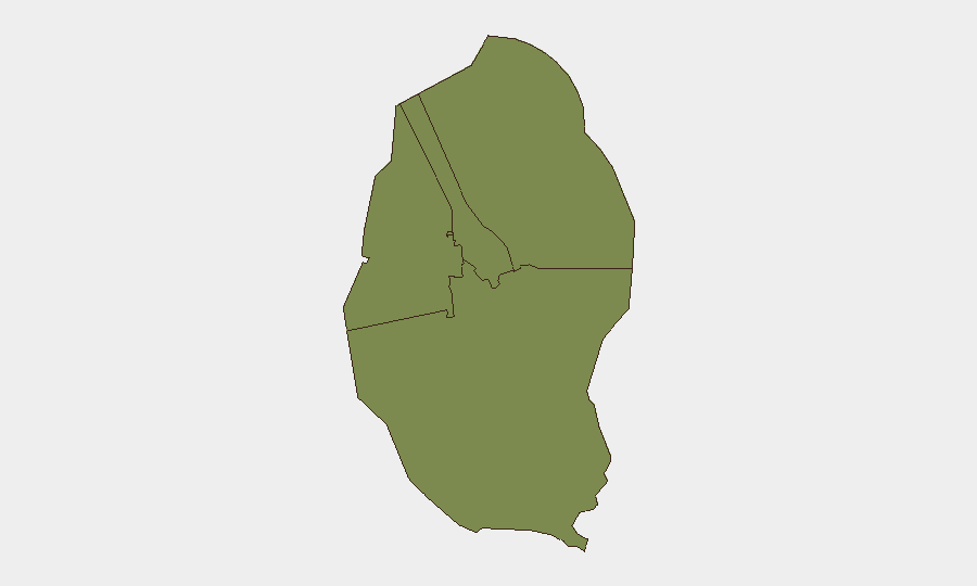
Situation Summary
Bahrain is experiencing acute escalation risk following Iranian aerial attacks on the kingdom in the early hours of 21 July, with Bahraini air defences reported to have intercepted multiple incoming missiles and drones. The US Embassy has issued a security alert warning of potential Iranian targeting of central Manama, and European governments have upgraded travel warnings citing active airstrikes on Bahraini territory and heightened terrorism risk. Civil unrest in majority-Shiite areas is ongoing alongside military mobilization, creating a compound threat environment across all four governorates.
Key Developments
- Bahrain airspace (nationwide) – 21 July, 0400–0600 hrs: Bahrain's military reported interception and destruction of multiple incoming Iranian aerial attacks (missiles/drones) targeting the kingdom; regional media confirmed strikes directed at Bahraini territory.
- Manama (nationwide) – 21 July, dawn: Interior Ministry sounded air-raid sirens across Bahrain and issued shelter-in-place advisories to civilians and residents; French authorities note "frappes iraniennes ayant visé le territoire bahreïnien" and advise French nationals to seek shelter during alerts.
- Central Manama – 21 July: US Embassy issued a security alert warning that Iran may seek to target unspecified locations in central Manama, advising heightened vigilance and avoidance of potential targets.
- Coastal waters around Bahrain – in force 21 July: Bahrain's Interior Ministry imposed a night-time restricted zone (18:00–04:00) for private and commercial vessels, directly linked to risk of further regional strikes.
- Majority-Shiite areas (mid-to-late July, ongoing): Pro-Iranian protest gatherings and isolated clashes with security forces reported in Shiite-majority districts, particularly after Friday prayers, with localized security deployments and traffic disruption.
- Iranian military statements – 20–21 July: IRGC-linked outlets claimed drone and missile attacks on US military assets and infrastructure in Bahrain, framed as retaliation for US strikes on Iranian targets.
- European travel advisories – 21 July: France and Germany issued updated warnings strongly discouraging travel to Bahrain, explicitly referencing July 2026 airstrikes and advising avoidance of US-linked facilities and security installations.
Highest-Risk Areas
All four governorates (Northern, Capital, Southern, and Muharraq) carry equivalent composite risk scores of 1.3, reflecting nationwide exposure to aerial and missile threats. The Capital Governorate (Manama) faces the highest concentration of targeting risk, given the US Embassy alert for central Manama and the density of government, security, and US-linked infrastructure. Northern Governorate remains a flashpoint for pro-Iranian activity and Shiite-majority unrest, creating dual risk from aerial attacks and civil disturbance. Muharraq's proximity to US military facilities elevates vulnerability to indirect effects.
How GeoBit Would Assist
Security teams should activate AOI Monitoring & Early Warning on Manama central district, coastal approach zones, and Shiite-majority neighborhoods to detect protest escalation or military movement in near real-time. Conflict & Military intelligence (force structure, weapons-capability tracking) and Maritime & Aviation tracking would provide asset-level situational awareness of Bahraini air-defence posture and vessel movements under the curfew. Routing & Network Analysis would support alternative journey planning and safe-zone identification for personnel during alert periods.
7-Day Outlook
Iranian threat messaging and retaliation claims suggest sustained targeting posture over the next 7 days, with high probability of additional aerial activity or alerts. Bahraini military mobilization and civil unrest in Shiite areas are likely to persist in parallel, complicating movement and increasing localized security incidents. European travel warnings are expected to remain in effect through at least mid-week pending de-escalation signals.
Highest-Risk Areas — Ranked
| # | State / Region | Risk |
|---|---|---|
| 1 | Northern Governorate | 1.3 |
| 2 | Capital Governorate | 1.3 |
| 3 | Southern Governorate | 1.3 |
| 4 | Muharraq Governorate | 1.3 |
Sources
Previous Daily Briefs
A new Bahrain brief is written every day — each with its own risk map and downloadable CSV. Here's the last week; use the calendar to go further back.
📅 Browse every day by calendar →
Highlighted days have a brief. Tap a day for that day's map & analysis, or “csv” for that day's dataset ($5).
Atlas — our AI intelligence desk — emails them this snapshot personally. Nothing else, no list.