Situation Summary
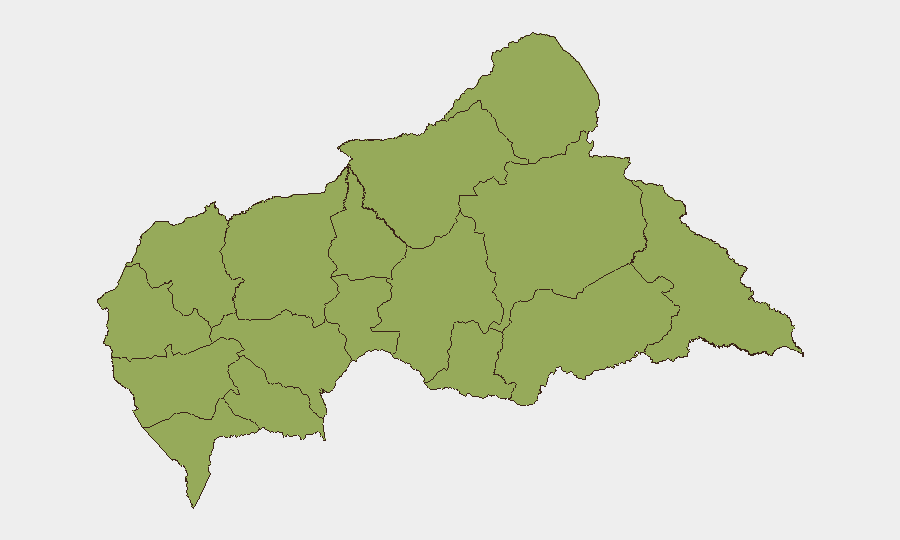
Central African Republic remains classified as a moderate-to-elevated security environment (#28 globally; composite threat score 73), with no tracked security events reported in the last 24–48 hours. Sub-national risk is distributed uniformly across 12 prefectures, each assessed at 51.4, reflecting persistent underlying instability rather than acute crisis. The security posture is characterized by chronic fragmentation, weak state capacity, and residual intercommunal and armed-group activity rather than rapid escalation or de-escalation.
Key Developments
No verified, location-specific security incidents have been identified in Central African Republic within the last 24–48 hours via accessible open-source reporting. Recent event signals in GeoBit's database reference public statements, administrative actions, and military movement, but most cannot be reliably corroborated or time-stamped to the current reporting window. Teams are advised to treat the absence of reported incidents as a data-access limitation rather than confirmation of stability.
Highest-Risk Areas
All 12 tracked prefectures carry identical composite risk scores (51.4), indicating broad structural vulnerability rather than concentrated geographic hotspots. Eastern and northern frontier regions—Vakaga, Haute-Kotto, Haut-Mbomou, and Bamingui-Bangoran—remain flashpoints for armed-group activity, cross-border spillover from Chad and Sudan, and trafficking. Western and southwestern prefectures (Mambéré-Kadéï, Nana-Mambéré, Sangha-Mbaéré) face similar pressures from porous Cameroon borders and community-level conflict. The uniformity of risk scores reflects the absence of a single dominant conflict zone; instead, security fragmentation is nationwide.
How GeoBit Would Assist
Security teams with personnel or assets in Central African Republic should prioritize AOI Monitoring & Early Warning to establish persistent watch over key locations (compounds, supply routes, border crossings) with automated alerting for activity changes. Intel Sweep and multi-language OSINT fusion across local radio (e.g., Radio Ndeke Luka), UN MINUSCA updates, and regional media would provide real-time situational awareness unavailable through corporate channels alone. Conflict & Military force-structure tracking and GIS & Spatial Analysis enable duty-of-care teams to map armed-group presence, anticipate movement, and refine evacuation routing and safe-haven planning.
7-Day Outlook
Near-term risk trajectory remains stable but fragile. No imminent escalation is apparent, but the uniform high baseline across all prefectures indicates that localized flare-ups—intercommunal violence, armed-group activity, or administrative breakdown—could emerge with little warning. Continued reliance on live OSINT feeds and AOI monitoring is essential to detect early-warning signals before they affect operations.
Data Caveat: This brief reflects publicly accessible reporting as of 2026-06-18, 1800 UTC. GeoBit's event database references administrative and public statements; no ground-truth incident verification has been completed for the last 24 hours. Teams requiring current tactical or operational intelligence are advised to activate dedicated OSINT monitoring and consult MINUSCA, embassy security advisories, and on-ground contacts.
Highest-Risk Areas — Ranked
| # | State / Region | Risk |
|---|---|---|
| 1 | Bamingui-Bangoran | 51.4 |
| 2 | Vakaga | 51.4 |
| 3 | Haute-Kotto | 51.4 |
| 4 | Haut-Mbomou | 51.4 |
| 5 | Mbomou | 51.4 |
| 6 | Nana-Mambéré | 51.4 |
| 7 | Ouham-Pendé | 51.4 |
| 8 | Mambéré-Kadéï | 51.4 |
| 9 | Sangha-Mbaéré | 51.4 |
| 10 | Ouham | 51.4 |
| 11 | Nana-Grébizi | 51.4 |
| 12 | Kémo | 51.4 |
Previous Daily Briefs
A new Central African Republic brief is written every day — each with its own risk map and downloadable CSV. Here's the last week; use the calendar to go further back.
📅 Browse every day by calendar →
Highlighted days have a brief. Tap a day for that day's map & analysis, or “csv” for that day's dataset ($5).