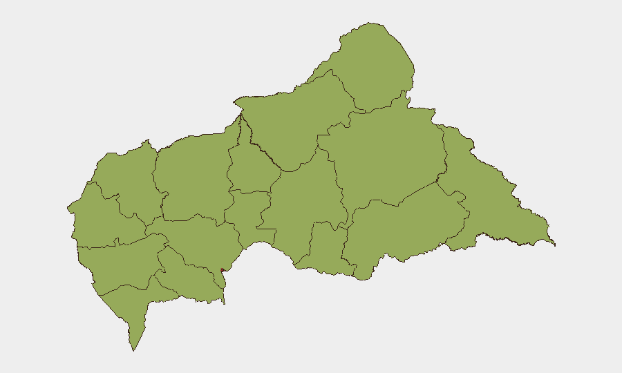
Situation Summary
Central African Republic remains a fragile security environment ranked #32 globally with a composite threat score of 67, driven primarily by persistent armed-group activity, limited state capacity, and sporadic communal violence across multiple prefectures. Bangui continues to present the highest localized risk (76.8), reflecting capital-city concentration of political and criminal actors. No major escalation or de-escalation has been confirmed in the last 24–48 hours; the current trajectory reflects chronic instability rather than acute deterioration.
Key Developments
No reliably confirmed, CAR-specific security or conflict incidents have been identified in open sources within the last 24–48 hours. Recent event signals flagged by GEOBIT's feed include references to Central Bank statements and regional activity (Congo, Uganda), but these do not constitute verified incidents on CAR soil during this window. Open-source reporting over the past two days does not reflect fresh violence, displacement, checkpoint activity, or travel disruptions specific to Central African Republic. Corporate security teams should continue to rely on real-time feeds from MINUSCA, OCHA, and mission-specific travel-security providers (Crisis24, International SOS, GardaWorld) for any incidents emerging between brief publication and operational decision-making.
Highest-Risk Areas
Bangui (76.8) dominates the risk profile and warrants the closest monitoring given its concentration of government, banking, diplomatic, and commercial activity. The twelve remaining prefectures cluster at 46.8–54.3, reflecting distributed but lower-intensity armed-group presence, inter-communal tension, and limited governance; Ouaka (54.3) stands slightly elevated within that tier. Risk in these outlying regions is driven by periodic FACA (armed forces) operations, non-state armed group (NSAG) movements, and banditry affecting road corridors and supply chains rather than by acute conflict events. Organizations with staff or assets in provincial capitals or resource-extraction sites should assume baseline heightened precaution.
How GeoBit Would Assist
Intel Sweep & OSINT Fusion provides multi-language monitoring of social media, radio SIGINT, and public statements across actors in Bangui and provincial nodes, enabling early detection of political shifts, armed-group repositioning, or criminal activity before mainstream reporting emerges. AOI Monitoring & Early Warning with persistent geospatial watch on high-value sites (airports, border crossings, resource zones, government buildings) and Network & Actor Analysis tracking state and non-state force structure, leadership changes, and inter-faction dynamics supply corporate teams with forward indicators of risk escalation. Routing & Network Analysis supports real-time alternative-route planning for personnel and logistics, essential in an environment where main corridors may become contested or insecure.
7-Day Outlook
No imminent escalation is signaled; however, CAR's structural fragility—armed groups, limited FACA capacity, political uncertainty, and humanitarian stress—means that localized violence, banditry, or administrative disruption can emerge with minimal warning. Organizations should expect baseline operations to continue but remain positioned to activate contingency protocols rapidly should Central Bank tensions, regional spillover from Congo, or internal political friction generate new incidents.
Highest-Risk Areas — Ranked
| # | State / Region | Risk |
|---|---|---|
| 1 | Bangui | 76.8 |
| 2 | Ouaka | 54.3 |
| 3 | Bamingui-Bangoran | 46.8 |
| 4 | Vakaga | 46.8 |
| 5 | Haute-Kotto | 46.8 |
| 6 | Haut-Mbomou | 46.8 |
| 7 | Mbomou | 46.8 |
| 8 | Nana-Mambéré | 46.8 |
| 9 | Ouham-Pendé | 46.8 |
| 10 | Mambéré-Kadéï | 46.8 |
| 11 | Sangha-Mbaéré | 46.8 |
| 12 | Ouham | 46.8 |
Sources
Previous Daily Briefs
A new Central African Republic brief is written every day — each with its own risk map and downloadable CSV. Here's the last week; use the calendar to go further back.
📅 Browse every day by calendar →
Highlighted days have a brief. Tap a day for that day's map & analysis, or “csv” for that day's dataset ($5).