Situation Summary
Chile faces an acute national weather emergency (declared 19 July, ongoing) characterized by severe flooding, landslides, and infrastructure disruption across multiple regions, with confirmed fatalities and thousands displaced. No major civil unrest, organized political violence, or terrorism incidents have been reported in the last 24–48 hours; current threat is overwhelmingly environmental and logistical rather than security-based. The composite national threat score remains low (15/100), but sub-national concentrations—particularly Santiago Metropolitan (31.3) and Tarapacá (25.3)—reflect underlying socioeconomic and crime pressures independent of the weather event. The trajectory is stabilization of weather impacts by mid-to-late week, with gradual restoration of transport and power infrastructure.
Key Developments
- Coquimbo & Atacama Regions – 21 July 2026
At least 10 deaths, 17 injured, and four missing confirmed following days of extreme rainfall; over 1,100 homes destroyed or severely damaged. Rivers blocking roads have isolated communities; power cuts disrupting water supplies. President's emergency declaration enables military deployment and movement restrictions.
- Nationwide Transport & Energy Corridors – 21–22 July 2026
Ongoing disruption in supply chains and passenger movement reported across multiple states due to road closures, flooding, and landslides. No new large-scale civil unrest or organized crime activity verified in this window.
- Santiago Metropolitan Region – 21–22 July 2026
Security monitoring confirms stable overall crime and protest conditions with no fresh large-scale riots, protests, or political-instability spikes in the last 24–48 hours. Risk profile unchanged from earlier July.
- National Travel Advisory Updates – 20–21 July 2026
Foreign ministries have updated guidance to highlight severe-weather impacts (flooding, landslides, power interruptions) and advise caution on road travel and in river/landslide zones. No new terrorism or major unrest threats specific to Chile confirmed.
Highest-Risk Areas
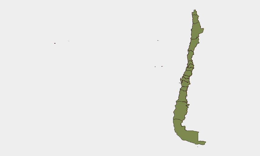
Santiago Metropolitan Region (31.3) and Tarapacá (25.3) dominate the sub-national ranking, driven primarily by persistent organized crime, gang activity, and socioeconomic pressures rather than the current weather emergency. Coquimbo (21.3) ranks third, where immediate risk is now compounded by weather-induced isolation, power loss, and resource scarcity, creating secondary safety and supply-chain vulnerabilities. Valparaíso, Maule, and Araucania follow at 3.3 each; remaining regions carry minimal independent baseline risk (1.3), though weather impacts are geographically widespread.
How GeoBit Would Assist
Intel Sweep & OSINT Fusion provide continuous monitoring of X/Twitter, Telegram, and multi-language Chilean sources to detect any emergence of protest activity, organized-crime escalation, or civil unrest that might exploit weather-induced displacement and service gaps. AOI Monitoring & Early Warning on high-risk regions (Santiago, Tarapacá, Coquimbo) with persistent area-of-interest watch and alerting would flag unauthorized gatherings, roadblock activity, or supply-chain blockades in near-real time. GIS & Spatial Analysis combined with Satellite & Imagery analysis would track road/bridge damage, power-grid restoration, and isolated communities to assess secondary security risks (looting, displacement crises) and inform duty-of-care routing.
7-Day Outlook
Heavy rainfall is expected to ease by 23–24 July; power and water restoration will proceed incrementally over 5–7 days. Transport corridors will reopen sequentially, with major routes (Santiago–Valparaíso, Norte Grande) restored by late week. Organized-crime and civil-unrest risk remains at baseline; no political crisis or security escalation is anticipated, barring slower-than-expected disaster relief response, which could spark localized protests in affected areas.
Highest-Risk Areas — Ranked
| # | State / Region | Risk |
|---|---|---|
| 1 | Santiago Metropolitan Region | 31.3 |
| 2 | Tarapacа Region | 25.3 |
| 3 | Coquimbo Region | 21.3 |
| 4 | Valparaiso Region | 3.3 |
| 5 | Maule Region | 3.3 |
| 6 | Araucania Region | 3.3 |
| 7 | Antofagasta Region | 1.3 |
| 8 | Atacama Region | 1.3 |
| 9 | Aysen del General Carlos Ibanez del Campo Region | 1.3 |
| 10 | Los Lagos Region | 1.3 |
| 11 | Magallanes and Chilean Antarctica Region | 1.3 |
| 12 | O'Higgins Region | 1.3 |
Sources
Previous Daily Briefs
A new Chile brief is written every day — each with its own risk map and downloadable CSV. Here's the last week; use the calendar to go further back.
📅 Browse every day by calendar →
Highlighted days have a brief. Tap a day for that day's map & analysis, or “csv” for that day's dataset ($5).
Atlas — our AI intelligence desk — emails them this snapshot personally. Nothing else, no list.