Situation Summary
Cuba remains at composite threat rank #108 globally (score 10/184 tracked events), with infrastructure collapse—not acute political violence—as the primary driver of operational risk. Nationwide blackouts lasting up to 20 hours daily, severe fuel scarcity, and water shortages affecting ~3 million people are creating cascading pressure on hospitals, transport, and municipal services. While diplomatic tensions with the U.S. (June 30) and scattered arrests/detention signals (July 2) indicate political stress, no independently verified large-scale protests, clashes, or discrete security incidents have been corroborated in the past 24–48 hours; risk is currently chronic rather than acute.
Key Developments
- Nationwide (multiple provinces), ongoing into early July 2026 – Prolonged blackouts averaging 15–20 hours daily persist across residential and commercial areas. At least one neighborhood reported continuous outages exceeding 48 hours as of early July, directly impairing water supply, fuel distribution, and emergency services[6][7][10].
- National transport system, ongoing – Flight cancellations linked to fuel shortages are documented as part of current disruption pattern; specific route/date details remain limited in open sources[7].
- Havana and multiple hospitals, ongoing – Healthcare infrastructure under growing operational pressure due to energy and supply constraints; no acute medical crisis is reported, but systemic degradation is accelerating[7].
- Havana, June 30, 2026 – Cuba's Foreign Minister publicly stated that U.S.–Cuba talks had stalled and accused Washington of applying coercive measures in UN embargo debates, framing sanctions as contributing to shortages of food, fuel, medicine, and electricity. This is the most recent dated political indicator but falls slightly outside the 24–48-hour window as of July 4[4].
- Multiple locations, July 2, 2026 – Event signals indicate arrests/detentions of Cuban nationals, threats involving military and police, and demonstration/rally activity directed at government; however, no corroborated reports of scale, location specificity, or outcome have been independently verified in open sources.
- Water supply, nationwide – Approximately 3 million people are experiencing water shortages as a downstream effect of the energy crisis, representing sustained humanitarian and operational pressure across the island[6].
Highest-Risk Areas
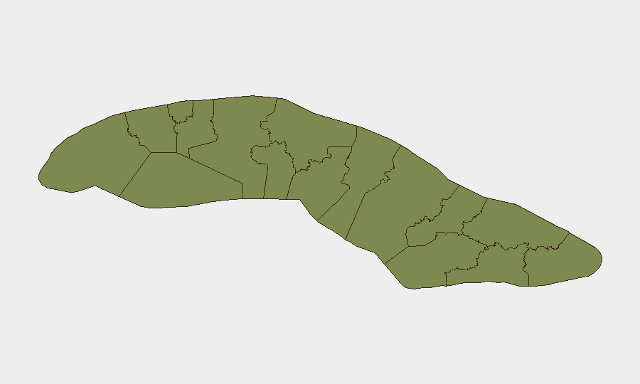
Sancti Spiritus (34.4) and Havana (32.8) significantly outrank all other provinces, together accounting for ~67% of the tracked national risk score. Sancti Spiritus' elevated risk likely reflects infrastructure and governance challenges in a less-urbanized region; Havana's score reflects both capital-city political sensitivity and concentration of diplomatic, financial, and media activity. Secondary risk zones (Matanzas, Villa Clara, Las Tunas) score substantially lower (5–9 range), suggesting risk is concentrated in the two leading provinces rather than distributed nationwide. The gap between top two and remainder of the country indicates that duty-of-care planning should prioritize Havana and Sancti Spiritus for monitoring and contingency routing.
How GeoBit Would Assist
Security teams should deploy AOI Monitoring & Early Warning on Havana and Sancti Spiritus to detect any threshold-crossing escalations in protest activity, checkpoints, or infrastructure failure. Intel Sweep and multi-language OSINT (X, Telegram, local media) provide real-time corroboration of protest reports and infrastructure incidents that open-source news often lags by hours. Routing & Network Analysis can identify alternate land and sea routes around fuel-disrupted zones and airports with canceled flights, essential for personnel movement and supply chains.
7-Day Outlook
Infrastructure stress (power, fuel, water) will likely remain the dominant risk driver through early July, with no clear indication of imminent recovery. Diplomatic tension with the U.S. may sustain low-level political activity and detention signals, but lack of corroborated mass mobilization suggests escalation to street-level violence remains unlikely in the next week absent external shock.
Highest-Risk Areas — Ranked
| # | State / Region | Risk |
|---|---|---|
| 1 | Sancti Spiritus | 34.4 |
| 2 | Havana | 32.8 |
| 3 | Matanzas | 8.6 |
| 4 | Villa Clara | 7.2 |
| 5 | Las Tunas | 6 |
| 6 | Santiago de Cuba | 5.2 |
| 7 | Guantánamo | 5.2 |
| 8 | Artemisa | 4.8 |
| 9 | Cienfuegos | 4.8 |
| 10 | Holguín | 4.8 |
| 11 | Pinar del Rio | 4.4 |
| 12 | Mayabeque | 4.4 |
Sources
Previous Daily Briefs
A new Cuba brief is written every day — each with its own risk map and downloadable CSV. Here's the last week; use the calendar to go further back.
📅 Browse every day by calendar →
Highlighted days have a brief. Tap a day for that day's map & analysis, or “csv” for that day's dataset ($5).
Atlas — our AI intelligence desk — emails them this snapshot personally. Nothing else, no list.