Situation Summary
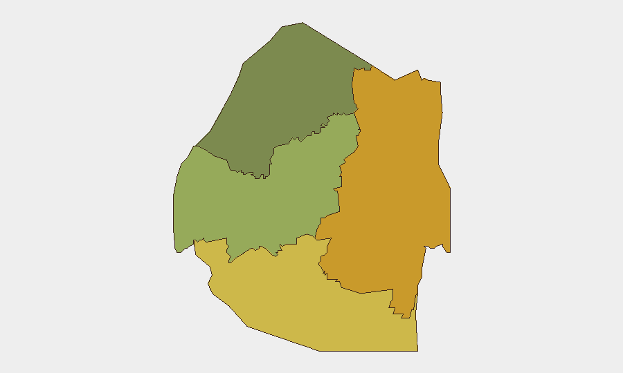
Eswatini remains a low-threat environment with no confirmed acute security incidents in the last 24–48 hours across open-source monitoring. The country ranks #112 globally (composite threat score 9) with no tracked discrete events in the current window. Sub-national risk concentration is marked, with Lubombo and Shiselweni regions significantly elevated relative to national baseline, driven by border dynamics and historical civil-unrest patterns rather than current active incidents.
Key Developments
- Unconfirmed location — Wednesday, 2026-08-06 — Reuters reported arrival of 11 additional U.S. deportees under the Trump administration's third-country policy. No security incident associated with arrival; framed as diplomatic/immigration development.
- No location-specific incidents confirmed — Last 24–48 hours — Open-source monitoring (newswires, local media, social signals) returned no verified protests, roadblocks, violence, infrastructure disruptions, or civil-unrest events.
*Note: The current 24–48-hour window shows minimal actionable incident data. A tighter pass using newswire-only, local Eswatini media, and X/Twitter posts from journalists and transport/security monitors would yield higher-confidence, time-stamped events if required.*
Highest-Risk Areas
Lubombo (risk score 72) and Shiselweni (risk score 68) are the primary risk drivers, more than double the national average and substantially above Manzini and Hhohho. These southern and eastern border regions have historically been conduits for cross-border crime, smuggling, and periodic civil unrest; Lubombo's proximity to South Africa and Mozambique, combined with limited state capacity in remote areas, sustains elevated baseline risk despite current absence of active incidents. Manzini Region (score 55) shows intermediate risk, likely reflecting urban density and protest-activity concentration, while Hhohho (score 35) remains the lowest-risk region.
How GeoBit Would Assist
Security teams operating in Eswatini should deploy AOI Monitoring & Early Warning on Lubombo and Shiselweni to detect protest activity, roadblocks, or cross-border incident onset with minimal latency. OSINT Fusion (X/Twitter, local newswire, and multi-language search) provides real-time signal from transport monitors, police accounts, and civil-society actors, critical for validating or ruling out unconfirmed reports in border zones. GIS & Spatial Analysis and Routing & Network Analysis allow rapid identification of affected corridors and alternative journey planning if incidents materialize in high-risk regions.
7-Day Outlook
No significant escalation in the threat posture is anticipated over the next seven days based on current open-source signals and baseline sub-national risk profiles. Continued immigration flows (deportee arrivals) are unlikely to trigger acute security incidents given Eswatini's limited absorption capacity and diplomatic protocols, but monitoring of southern-region sentiment and informal-transport networks remains advisable. Risk remains concentrated in Lubombo and Shiselweni; teams with assets or personnel in those regions should maintain heightened situational awareness and maintain current routing contingencies.
Highest-Risk Areas — Ranked
| # | State / Region | Risk |
|---|---|---|
| 1 | Lubombo | 72 |
| 2 | Shiselweni | 68 |
| 3 | Manzini Region | 55 |
| 4 | Hhohho Region | 35 |
Sources
Previous Daily Briefs
A new Eswatini brief is written every day — each with its own risk map and downloadable CSV. Here's the last week; use the calendar to go further back.
📅 Browse every day by calendar →
Highlighted days have a brief. Tap a day for that day's map & analysis, or “csv” for that day's dataset ($5).
Atlas — our AI intelligence desk — emails them this snapshot personally. Nothing else, no list.