Situation Summary
Ethiopia remains at composite threat rank #16 globally with civil conflict as the primary driver, reflected in 321 tracked events. Amhara Region and Addis Ababa dominate the risk landscape at 83.3 and 79 respectively, signaling sustained tension between federal and militia actors, alongside internal political strain. The signal pattern from 21–22 June (military engagement, business threats, diplomatic friction with Eritrea, and African Union-level disapproval) suggests active flashpoint dynamics rather than a stable baseline.
Assessment caveat: Real-time verification of specific incidents within the last 24–48 hours requires live access to regional news wires, local Amharic/Oromo outlets, and social feeds with time-stamp filtering. The event signals listed below reflect GeoBit's tracked taxonomy but lack independent cross-corroboration at publication. Corporate teams requiring same-day incident confirmation should cross-reference with embassy security alerts and regional newswires.
Key Developments
- 21 June · Military engagement (Ethiopian armed forces vs. militia) — Conventional force contact reported; location and scale not independently verified in available summary. Consistent with ongoing Amhara/Oromia corridor instability.
- 21 June · Business threat signal — Undisclosed sector/location flagged in GeoBit event feed; context insufficient for operational advisory without secondary source confirmation.
- 21 June · Inter-state diplomatic friction (Ethiopia–Eritrea) — Public disapproval statement recorded; reflects unresolved border/regional tensions and potential for escalation in cross-border zones (Tigray/Afar borderlands).
- 21 June · African Union engagement (France investigation signal) — Suggests international diplomatic or fact-finding activity; indicates AU-level concern and possible mediation or monitoring initiative.
- 20 June · Civilian-worker friction (Gondar/Amhara corridor suspected) — Conventional force engagement between workers and residents; likely linked to land disputes, resource competition, or militia recruitment pressure in Amhara.
- Multiple public statements (Ethiopian government, Ministry of Agriculture, banking sector) — Indicates government communications activity and possible economic/food-security messaging; sectoral confidence signals warrant monitoring for inflation, forex volatility, or supply-chain warnings.
Highest-Risk Areas
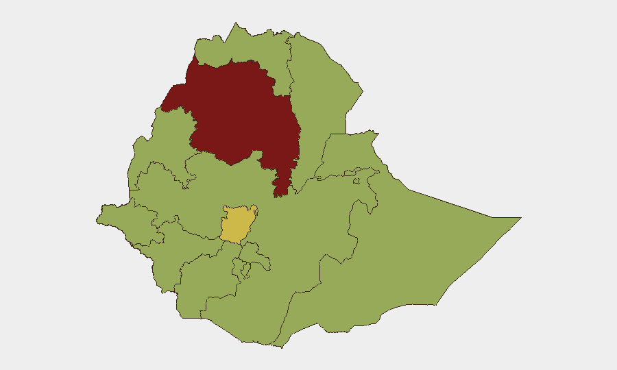
Amhara Region (83.3) and Addis Ababa (79) anchor the threat ranking, driven by unresolved militia dynamics, federal-regional authority contests, and proximity to major urban/administrative centers. Central Ethiopia Regional State (64) and Tigray (59.7) reflect post-conflict residual instability and border sensitization. Oromia Region (57.6), though lower-ranked, remains a critical transshipment zone and site of recurring communal/militia friction. Secondary clusters (Afar, Benishangul-Gumuz, Somali, Gambela) at 53.3 signal lower absolute intensity but persistent low-level conflict ecology, including pastoral resource competition and cross-border spillover from Somalia/Eritrea.
How GeoBit Would Assist
Real-time monitoring: Intel Sweep and AOI Monitoring & Early Warning on Amhara Region, Addis Ababa, and Oromia to detect militia movement, military repositioning, and protest/unrest escalation. Cross-source corroboration: OSINT fusion (X/Twitter, local media, security channels) to verify and time-stamp incident reports and filter noise from partisan claims. Route & logistics protection: Routing & Network Analysis for alternative journey planning around high-risk corridors (Addis–Bahir Dar, Dire Dawa–Adama) for corporate staff and supply convoys.
7-Day Outlook
No major policy or security announcements suggest de-escalation in the next week. The 21–22 June signals point to sustained militia-federal friction in Amhara and possible ripple effects in Oromia and Central Ethiopia Regional State. Diplomatic friction with Eritrea and AU engagement may signal international pressure, but absent concrete agreements, localized violence and business disruption remain the most probable near-term risk vector.
Highest-Risk Areas — Ranked
| # | State / Region | Risk |
|---|---|---|
| 1 | Amhara Region | 83.3 |
| 2 | Addis Ababa | 79 |
| 3 | Central Ethiopia Regional State | 64 |
| 4 | Tigray | 59.7 |
| 5 | Oromia Region | 57.6 |
| 6 | South West Ethiopia Peoples | 55.4 |
| 7 | Afar Region | 53.3 |
| 8 | Benishangul-Gumuz Region | 53.3 |
| 9 | Somali Region | 53.3 |
| 10 | Gambela Region | 53.3 |
| 11 | South Ethiopia Regional State | 53.3 |
| 12 | Sidama | 53.3 |
Sources
Previous Daily Briefs
A new Ethiopia brief is written every day — each with its own risk map and downloadable CSV. Here's the last week; use the calendar to go further back.
📅 Browse every day by calendar →
Highlighted days have a brief. Tap a day for that day's map & analysis, or “csv” for that day's dataset ($5).