Situation Summary
Ghana remains a relatively stable operating environment in West Africa (global rank #90, composite threat score 13) with no major security incidents confirmed in the last 24–48 hours. However, structural vulnerabilities—including curfew enforcement in Oti Region (since June 26), ongoing flood-related infrastructure disruption in Accra, and political-legal tensions at the national level—warrant monitoring. Risk is heavily concentrated in Greater Accra Region (score 34.1), which accounts for the majority of tracked threat signals; secondary concern exists in Bono East and Eastern regions. The near-term trajectory remains stable provided political and institutional tensions do not escalate.
Key Developments
No discrete security incidents meeting verification criteria (verifiable sources, Ghana-domestic location, last 24–48 hours) are currently available from open sources. The following standing conditions warrant awareness:
- Accra (Greater Accra Region) – Infrastructure Disruption
Flood-related evacuation alerts were reported in short-form media in late June/early July, with unclear time stamps. If active, this poses travel delays and displacement risk in the capital; confirmation of current status recommended.
- Nkwatan South Municipality (Oti Region) – Curfew in Effect
A curfew imposed June 26, 2026, remains in place. Movement restrictions apply 24/7 in this municipality; travelers and operations should verify current hours with local authorities.
- National Political Tension – Institutional Friction
Multiple GEOBIT signals (July 2–4) indicate tension between executive, judicial, and other state organs. These are political-process events (public statements, court filings, demands) rather than street-level security incidents, but they carry latent risk if escalation occurs.
- Ghanaian Nationals in South Africa – Heightened Vulnerability
A killing of a Ghanaian national in Cape Town (reported late June) and subsequent xenophobic unrest has prompted Ghana's Foreign Ministry to relocate and prepare evacuation of ~900–1,200 citizens. This is a *regional* travel advisory, not a Ghana-domestic risk, but affects citizen security outside Ghana.
- National Drug-Threat Messaging
Ghana's Chief of Staff (June 26) publicly flagged illicit drugs as a national security concern; this reflects strategic positioning but does not indicate a new crime spike in the last 48 hours.
Highest-Risk Areas
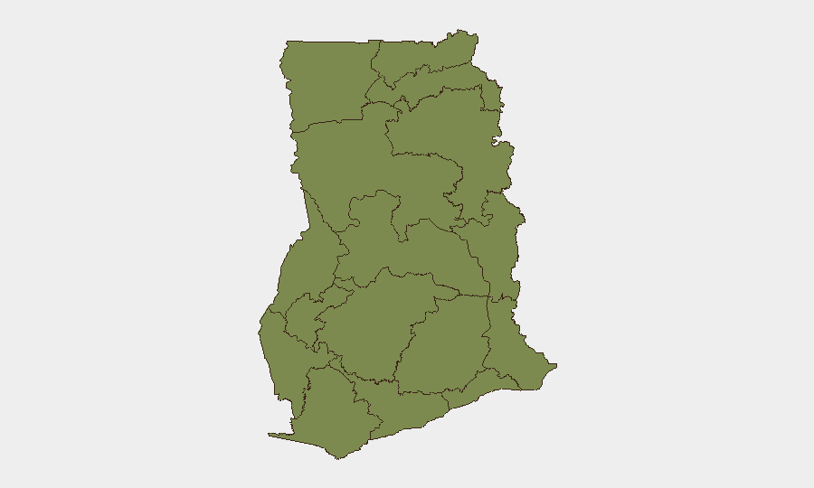
Greater Accra Region dominates the national threat profile (risk score 34.1), driven by its concentration of political, economic, and population density—making it the focal point for institutional tension, protest, and organized crime. Bono East (16.7) and Eastern (14.8) regions show secondary risk, likely reflecting mining-related labor disputes, transnational smuggling, or resource-competition tensions. The remaining nine regions cluster at or below 4.5, indicating fragmented, low-volume threat activity. Risk management should prioritize Accra for institutional/political monitoring and Bono East/Eastern for commodity-crime and unrest watch.
How GeoBit Would Assist
Security teams should deploy AOI Monitoring & Early Warning against Accra and Bono East to detect escalation in political rhetoric, protest assembly, or crime signals in near-real time. OSINT fusion (X/Telegram + news feeds + sentiment analysis) would track the ongoing institutional tensions and flag any coordinated action by state or non-state actors. Routing & Network Analysis can identify alternative transport corridors around flood-affected zones in Accra and curfew areas in Oti, protecting supply chains and personnel movement.
7-Day Outlook
No imminent security escalation is signaled by current data; institutional tensions remain in the political domain and have not spilled into mass unrest. Weather-related infrastructure risk (flooding) may persist through the rainy season; curfew zones should be treated as standing restrictions. Continued monitoring of political rhetoric and any protest mobilization is warranted to detect early warning of instability.
Highest-Risk Areas — Ranked
| # | State / Region | Risk |
|---|---|---|
| 1 | Greater Accra Region | 34.1 |
| 2 | Bono East Region | 16.7 |
| 3 | Eastern Region | 14.8 |
| 4 | Upper East Region | 4.9 |
| 5 | Ashanti Region | 4.5 |
| 6 | Upper West Region | 4.1 |
| 7 | Savannah Region | 4.1 |
| 8 | North East Region | 4.1 |
| 9 | Northern Region | 4.1 |
| 10 | Oti Region | 4.1 |
| 11 | Volta Region | 4.1 |
| 12 | Bono Region | 4.1 |
Sources
Previous Daily Briefs
A new Ghana brief is written every day — each with its own risk map and downloadable CSV. Here's the last week; use the calendar to go further back.
📅 Browse every day by calendar →
Highlighted days have a brief. Tap a day for that day's map & analysis, or “csv” for that day's dataset ($5).