Situation Summary
Guatemala faces a stable but fragmented security environment marked by localized violence, transport disruption, and natural hazards rather than nationwide instability. Composite threat signals remain moderate (score 19), with 680 monitored events over the past 7 days showing no significant country-wide escalation; however, discrete incidents—armed attacks in periurban areas, planned transport protests in the capital, and tropical storm risk—create pockets of elevated risk requiring targeted situational awareness. The capital remains under a "estado de prevención" (prevention state) with increased security force presence, while Pacific and western highland regions face concurrent flood and landslide hazards from Tropical Storm Cristina.
Key Developments
- Guatemala City transport protests (24–25 July): Urban bus drivers, mototaxi operators, and taxi associations announced planned road blockades and pacific demonstrations on six major arterial routes (Calzada Roosevelt, Raúl Aguilar Batres, Avenida Bolívar, Calzada San Juan, Avenida Petapa, Calle Martí) to protest fuel price increases; municipal traffic police warned of massive disruption and authorities reinforced security posture.
- Chinautla armed attack (22 July): A shooting near the central park of San Antonio Las Flores, Chinautla municipality, killed a 17-year-old and wounded seven others; National Civil Police arrested four suspected attackers (two adults, two minors) and seized two pistols and mobile phones, with investigation ongoing into possible local criminal network involvement.
- Sacatepéquez armed ambush (23 July, night): At the main entrance to San Miguel Dueñas, Sacatepéquez, a coordinated attack by two armed vehicles targeted a pickup truck (plates 814-LDZ), killing two occupants and wounding one who was evacuated to Hospital Nacional Pedro de Bethancourt in Antigua Guatemala; victims remained unidentified at reporting time.
- Tropical Storm Cristina threat (active through late July): Guatemala's disaster agency CONRED issued flood and landslide warnings for Pacific coast, Bocacosta, Occidente, Altiplano Central, and Valles de Oriente regions; heavy rainfall and infrastructure disruption, including potential road closures, affect travel and service continuity particularly in western highland and coastal departments.
- Guatemala City urban crime persistence: Commercial and transit zones (Zones 10, 13, 14) remain subject to frequent robberies and assaults on pedestrians and public transport during all daylight hours, representing chronic risk for resident and visitor movement.
Highest-Risk Areas
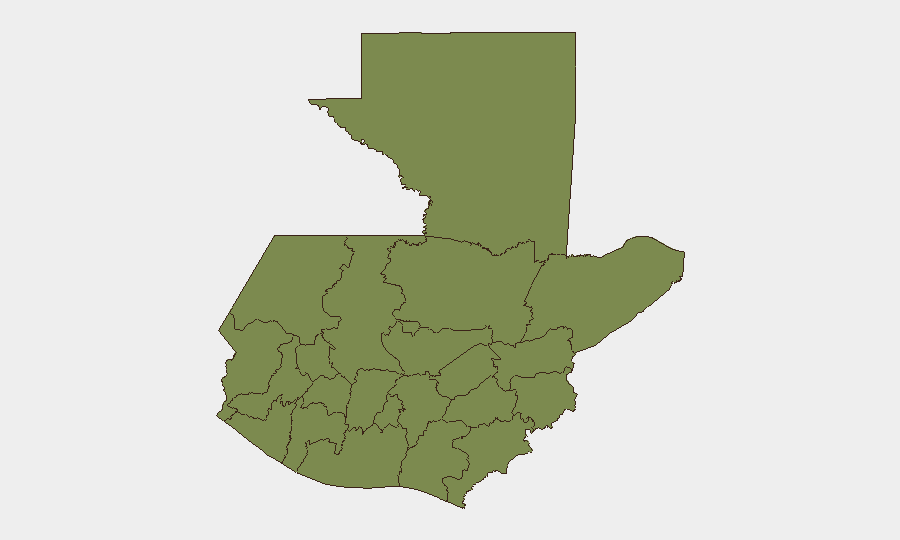
Quetzaltenango department ranks substantially above all others with a composite risk score of 31.3, driven by a combination of criminal activity and gang presence in the region's transport and commercial corridors. Petén, Huehuetenango, San Marcos, and the western highland chain (Quiché, Alta Verapaz, Totonicapán, Sololá, Chimaltenango) all carry elevated baseline risk (1.3–1.5 composite scores) due to persistent organized crime networks, migration-transit zones, and limited state security presence; concurrently, Tropical Storm Cristina amplifies physical hazard risk in Pacific-facing departments (Retalhuleu, Suchitepéquez). Guatemala City, while not ranked highest sub-nationally, remains the operational and security nerve center with ongoing gang presence and protest risk.
How GeoBit Would Assist
Security teams operating in Guatemala should employ AOI Monitoring & Early Warning to track real-time incident clusters (e.g., Chinautla, Sacatepéquez violence zones, protest assembly points) with automated alerting; Intel Sweep and multi-language OSINT to detect emerging transport strikes, roadblock announcements, and crime-network activity on local X/Telegram channels; and GIS & Spatial Analysis with Routing & Network Analysis to maintain alternative journey corridors around planned blockades and flood-risk zones. Environmental & Health monitoring feeds will track Tropical Storm Cristina progression and CONRED advisories to anticipate infrastructure closures.
7-Day Outlook
Transport disruptions in Guatemala City are likely to persist through late July and potentially intensify if fuel-price negotiations stall; localized armed violence in periurban Sacatepéquez and Chinautla neighborhoods remains elevated. Tropical Storm Cristina will dominate Pacific and western highland risk through the weekend, with rainfall and landslide hazards potentially forcing road closures and service disruptions; no nationwide political or security escalation is forecast, but discrete criminal incidents and protest activity will require continued localized vigilance.
Highest-Risk Areas — Ranked
| # | State / Region | Risk |
|---|---|---|
| 1 | Quetzaltenango | 31.3 |
| 2 | Petén | 1.3 |
| 3 | Huehuetenango | 1.3 |
| 4 | San Marcos | 1.3 |
| 5 | Retalhuleu | 1.3 |
| 6 | Quiché | 1.3 |
| 7 | Alta Verapaz | 1.3 |
| 8 | Totonicapán | 1.3 |
| 9 | Sololá | 1.3 |
| 10 | Chimaltenango | 1.3 |
| 11 | Suchitepéquez | 1.3 |
| 12 | Sacatepéquez | 1.3 |
Sources
Previous Daily Briefs
A new Guatemala brief is written every day — each with its own risk map and downloadable CSV. Here's the last week; use the calendar to go further back.
📅 Browse every day by calendar →
Highlighted days have a brief. Tap a day for that day's map & analysis, or “csv” for that day's dataset ($5).
Atlas — our AI intelligence desk — emails them this snapshot personally. Nothing else, no list.