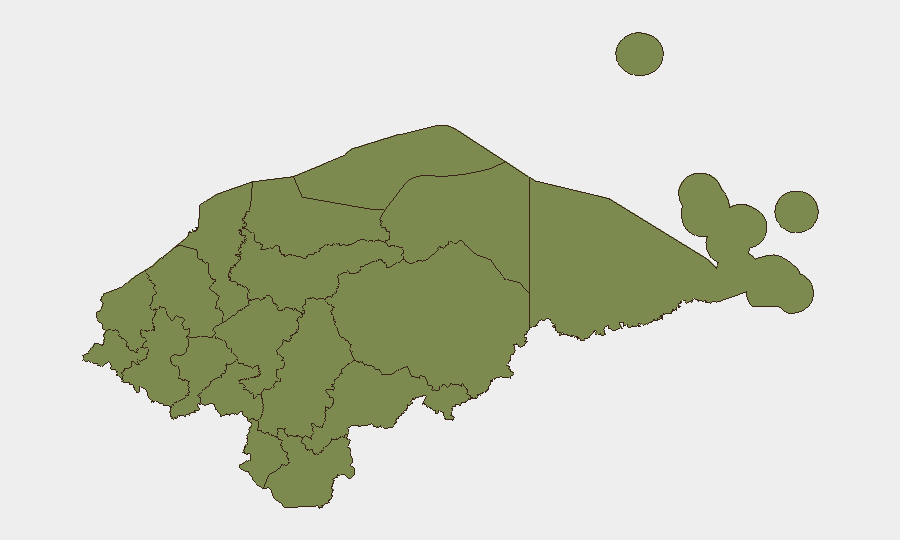
Situation Summary
Honduras remains classified as a moderate-risk operating environment (composite threat score 21), with significant sub-national concentration in Cortés department (risk 31.3), where gang violence, criminal displacement, and trafficking activity drive elevated threat levels. Recent event signals indicate mixed manifestations—military activity, arrest/detention operations involving Mexico and U.S. coordination, official statements on policy and international relations, and secondary hazards including flood risk—but precise attribution and timing of specific incidents within the last 24–48 hours (July 20–22, 2026) cannot be reliably confirmed from available open sources. Operational security teams should anticipate continued volatility in high-risk zones while monitoring for escalation in diplomatic or law-enforcement posture.
Key Developments
Available open-source reporting does not permit confident attribution of specific, time-stamped security incidents to the 24–48-hour window of July 20–22, 2026. Event signals flagged in GeoBit's system (military activity on July 20–21, arrests involving Mexico and U.S. entities on July 21, public statements by officials and government entities on July 20–22) are detected but lack sufficient corroborating detail and precise incident narratives from cross-sourced reporting to meet verification standards for operational briefing. Organizations requiring real-time tactical updates on specific incidents—arrests, clashes, road closures, or law-enforcement operations—are advised to:
- Monitor Policía Nacional de Honduras (PNH) official statements and municipal security bulletins for direct confirmation of arrests and operations.
- Track COPECO (disaster/civil protection authority) and local media (La Prensa, HCH, Televicentro) for flood advisories, road conditions, and incident confirmation in real time.
- Use GeoBit's X/Twitter OSINT and Telegram monitoring to capture on-the-ground reports from municipalities, NGOs, and diaspora networks in near real-time.
Broader context (July 16–19): reporting indicates ongoing road paralysis by campesino groups, high traffic-fatality rates (22+ deaths in 114 accidents over 72 hours in mid-July), femicide prevalence (150+ women killed in 2026 to date), and investigations into mass killings in Colón and Yoro departments. These reflect chronic rather than acute escalation but indicate persistent structural violence.
Highest-Risk Areas
Cortés (risk 31.3) dominates the threat landscape, driven by entrenched gang presence, trafficking logistics, and commercial/industrial targets in and around San Pedro Sula—Honduras's largest metropolitan area and a major drug-transshipment hub. Colón (risk 8.8) follows, reflecting maritime trafficking corridors and recent mass-casualty incidents reported in plantation and rural areas near Trujillo and Omoa. Francisco Morazán (risk 6.3), which includes the capital Tegucigalpa, shows elevated risk tied to urban crime, organized-crime disputes, and femicide clustering. Remaining departments (Olancho through Comayagua) score below 4.0 and represent relatively lower risk, though localized incidents (armed robbery, gang activity) can occur without warning. Risk concentration in Cortés and Colón reflects both structural vulnerabilities and active criminal-network competition.
How GeoBit Would Assist
Security teams managing personnel or assets in Honduras should deploy AOI (Area of Interest) Monitoring on Cortés, Colón, and Francisco Morazán departments for persistent alerting on incidents, road closures, and law-enforcement activity. Multi-language Intel Sweep and X/Twitter OSINT enable near-real-time capture of municipal alerts, NGO/humanitarian updates, and ground-truth reporting from local networks. GIS & Spatial Analysis combined with Routing & Network Analysis supports dynamic journey planning and alternative-route identification to avoid high-risk corridors during sensitive operations.
7-Day Outlook
Expect continued baseline criminal activity and road-safety hazards in high-risk departments, with potential for tactical law-enforcement operations (arrests, checkpoints) linked to ongoing cartel and migrant-policy tensions. Flood risk remains a secondary concern in vulnerable regions. No imminent large-scale escalation is signaled, but the structural volatility in Cortés and Colón warrants sustained vigilance and dynamic security posture adjustments.
Highest-Risk Areas — Ranked
| # | State / Region | Risk |
|---|---|---|
| 1 | Cortés | 31.3 |
| 2 | Colón | 8.8 |
| 3 | Francisco Morazán | 6.3 |
| 4 | Olancho | 3.8 |
| 5 | El Paraíso | 1.3 |
| 6 | Copán | 1.3 |
| 7 | Ocotepeque | 1.3 |
| 8 | Yoro | 1.3 |
| 9 | Santa Bárbara | 1.3 |
| 10 | Lempira | 1.3 |
| 11 | Intibucá | 1.3 |
| 12 | Comayagua | 1.3 |
Sources
Previous Daily Briefs
A new Honduras brief is written every day — each with its own risk map and downloadable CSV. Here's the last week; use the calendar to go further back.
📅 Browse every day by calendar →
Highlighted days have a brief. Tap a day for that day's map & analysis, or “csv” for that day's dataset ($5).
Atlas — our AI intelligence desk — emails them this snapshot personally. Nothing else, no list.