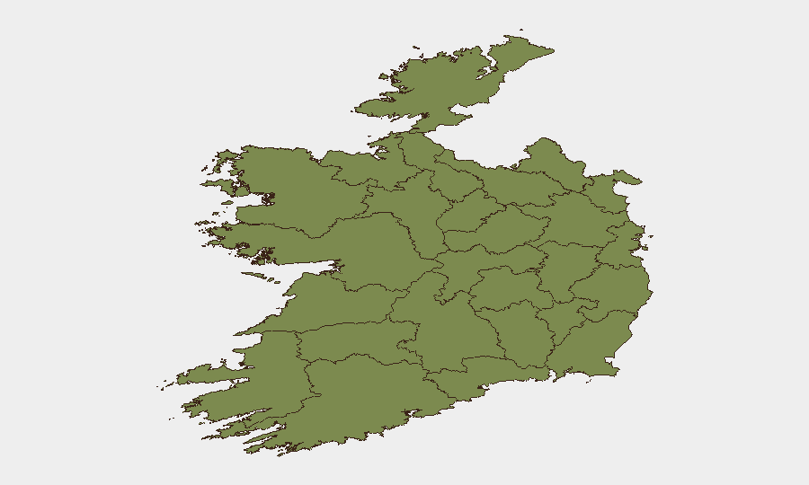
Situation Summary
Ireland remains a low-threat environment globally (rank #139, composite score 6), with concentrated risk in the Dublin metropolitan area. Recent event signals indicate operational disruptions affecting airline services, with secondary impacts on relations and administrative sanctions. The overall security posture has not deteriorated materially, but corporate operations dependent on aviation or cross-border movement warrant situational awareness of emerging airline-sector friction.
Key Developments
The available open-source intelligence does not contain verifiable, time-stamped incident reports specific to Ireland within the last 24–48 hours that meet threshold for inclusion in this brief. GeoBit's event signals through 2 July identify multiple airline-sector developments (public statements, investigation, tribunal demands, territory occupation, and administrative sanctions) occurring between 30 June and 2 July, but underlying causes, locations, and operational impact on Irish security or travel remain unconfirmed in corroborated news sources. Further investigation via GeoBit's Intel Sweep, multi-language search, and conflict-event corroboration is recommended to establish factual basis and specific Irish implications.
Highest-Risk Areas
Dublin accounts for 82 % of Ireland's tracked threat score (31.8 of 38.6), reflecting the capital's role as the primary hub for international business, aviation, diplomatic activity, and urban-crime reporting. County Tipperary's secondary risk elevation (15.4) warrants monitoring but lacks clear attribution in available signals; rural and western counties (Galway, Clare, Offaly, Mayo, Sligo, Limerick, Donegal, and others) remain at baseline risk (1.8–2.4).
Organizations with offices, supply chains, or personnel in Dublin should maintain standard urban-security protocols; those dependent on airline operations (cargo, passenger services, staff mobility) should monitor the ongoing airline-sector friction for schedule disruptions or secondary knock-on effects on ground transport and logistics.
How GeoBit Would Assist
AOI Monitoring & Early Warning on Dublin and Tipperary would provide persistent watch for civil unrest, transport disruption, or security incidents affecting corporate movement and asset safety. Intel Sweep and multi-language search across news, official statements, Telegram, and X would rapidly clarify the airline-sector events and their operational scope in Ireland, enabling timely travel and supply-chain adjustments. Routing & Network Analysis can model alternative ground-transport and logistics corridors if air-sector delays persist, and conflict-event corroboration will separate verified incidents from unconfirmed signals, reducing false-alarm overhead for security teams.
7-Day Outlook
The airline-sector signals suggest operational friction rather than acute security risk; resolution within 7–14 days is typical for such events. No current indicators suggest expansion to civil unrest, infrastructure attack, or border instability. Corporate security teams should maintain passive monitoring of airline announcements and Dublin-area event feeds; escalation to active mitigation (alternate routes, schedule buffering) is not recommended unless corroborated incidents emerge in the next 48 hours.
Report compiled: 2026-07-02 | Next update: 2026-07-03 | GeoBit threat rank (global): #139 | Composite score: 6/100
Highest-Risk Areas — Ranked
| # | State / Region | Risk |
|---|---|---|
| 1 | County Dublin | 31.8 |
| 2 | County Tipperary | 15.4 |
| 3 | County Galway | 2.4 |
| 4 | County Clare | 2.1 |
| 5 | County Offaly | 2 |
| 6 | County Mayo | 1.8 |
| 7 | County Sligo | 1.8 |
| 8 | County Limerick | 1.8 |
| 9 | County Donegal | 1.8 |
| 10 | County Leitrim | 1.8 |
| 11 | County Roscommon | 1.8 |
| 12 | County Cavan | 1.8 |
Sources
Previous Daily Briefs
A new Ireland brief is written every day — each with its own risk map and downloadable CSV. Here's the last week; use the calendar to go further back.
📅 Browse every day by calendar →
Highlighted days have a brief. Tap a day for that day's map & analysis, or “csv” for that day's dataset ($5).