Situation Summary
Liberia remains at composite threat score 8 (mid-tier global rank) with no new security incidents reported in the last 24–48 hours. The threat landscape is characterized by persistent sub-national instability concentrated in Montserrado and Nimba counties, driven by land disputes, political friction, and organized crime, but the current 48-hour window shows no acute violence, unrest, or civil disturbance. The institutional environment remains tense following the University of Liberia shutdown (21 July), but conditions are stable at the national level.
Key Developments
No corroborated new security, conflict, or crime incidents have been documented in Liberia during the 24–48 hours prior to 26 July 2026. Open-source aggregation, news feeds, and social media monitoring have not surfaced reports of armed clashes, protests, communal violence, or major criminal activity in any county during this period.
Note: Recent significant events—including anti-narcotics operations and cocaine seizures near Monrovia (20–21 July), land-dispute enforcement clashes in Monrovia (17–20 July), and the University of Liberia faculty shutdown (21 July)—fall outside the strict 48-hour window and are referenced below as context.
Highest-Risk Areas
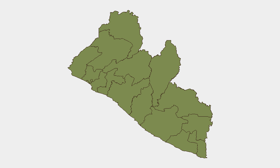
Montserrado County (risk score 31.3), home to Monrovia and the national capital, dominates the threat profile. Recent activity—including drug trafficking operations, land-dispute policing, and political demonstrations (mid-July)—reflects institutional and criminal pressure. Nimba County (risk 20.6) in the northeast shows persistent baseline instability tied to cross-border dynamics and localized resource tension. Together, these two counties account for the majority of tracked events; the remaining ten counties each score 1.3–5.6, indicating contained or routine risks. Grand Cape Mount County (5.6) shows secondary concern.
How GeoBit Would Assist
Security teams with personnel or assets in Montserrado or Nimba should employ AOI Monitoring & Early Warning on Monrovia and county capitals to detect emerging protests, clashes, or infrastructure disruption in real time. OSINT fusion (combining X/Twitter, Telegram, local news, and radio SIGINT) will surface grassroots political sentiment and criminal activity signals before escalation. Routing & Network Analysis can identify safe transit corridors around ongoing land disputes and policing operations, while Conflict & Military intelligence supports understanding of militia or security-force posture. Periodic Intel Sweep updates will maintain current awareness of political statements and institutional actions affecting operations.
7-Day Outlook
Liberia's threat trajectory remains stable absent new triggering events. The University of Liberia shutdown and recent political friction suggest elevated institutional tension, but no indicators point to imminent nationwide unrest or security-force mobilization. Monitoring should focus on land-dispute resolution progress in Monrovia and any political rally or opposition activity signaling renewed street mobilization; mid-August parliamentary or judicial developments could shift the outlook.
Highest-Risk Areas — Ranked
| # | State / Region | Risk |
|---|---|---|
| 1 | Montserrado County | 31.3 |
| 2 | Nimba County | 20.6 |
| 3 | Grand Cape Mount County | 5.6 |
| 4 | Lofa County | 1.3 |
| 5 | Gbarpolu County | 1.3 |
| 6 | Bomi County | 1.3 |
| 7 | Margibi County | 1.3 |
| 8 | Bong County | 1.3 |
| 9 | Grand Bassa County | 1.3 |
| 10 | Rivercess County | 1.3 |
| 11 | Grand Gedeh County | 1.3 |
| 12 | Sinoe County | 1.3 |
Sources
Previous Daily Briefs
A new Liberia brief is written every day — each with its own risk map and downloadable CSV. Here's the last week; use the calendar to go further back.
📅 Browse every day by calendar →
Highlighted days have a brief. Tap a day for that day's map & analysis, or “csv” for that day's dataset ($5).
Atlas — our AI intelligence desk — emails them this snapshot personally. Nothing else, no list.