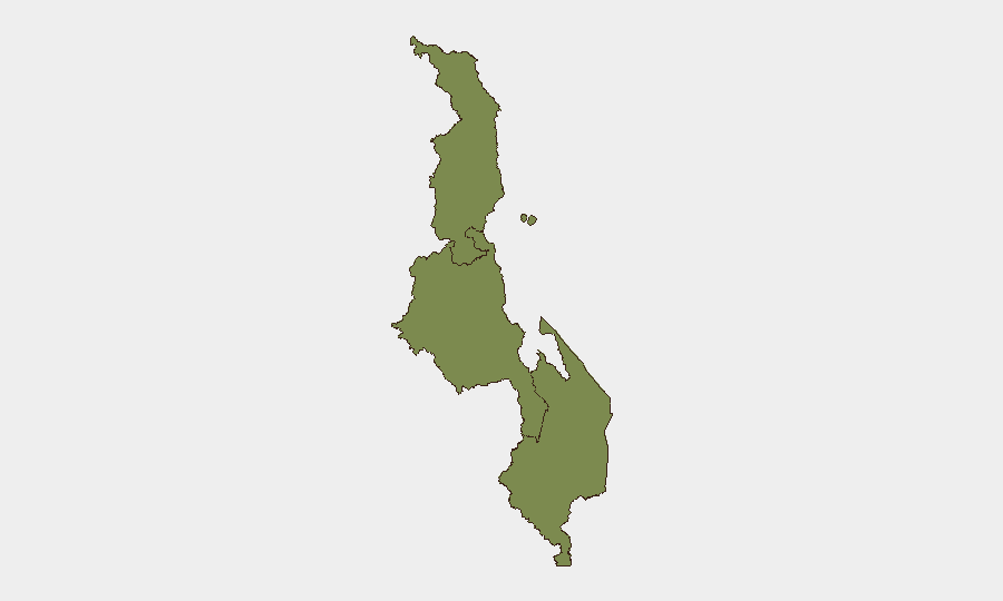
Situation Summary
Malawi's security environment remains fragmented and localized, with no systemic nationwide threat but persistent pockets of law-enforcement activity, petty crime, and isolated civil unrest. The Central Region—encompassing Lilongwe, Ntcheu, and Nkhotakota districts—accounts for the majority of recent incident clustering and elevated composite risk (31.3), driven by police operations against illegal weapons, narcotics trafficking, and localized clashes. A cross-border maritime incident on Lake Malawi and politically sensitive detention of a civil-society figure add complexity to an otherwise low-intensity security picture.
Key Developments
- Lilongwe (Area 30 Police HQ) – 30 July 2026: Human-rights campaigner Sylvester Namiwa summoned to National Police Headquarters for formal questioning by the Head of CID and Inspector General over alleged land-allocation irregularities, signaling potential escalation in civil-society–government tensions and possible reputational/operational risk for advocacy organizations.
- Nkhotakota District – 28 July 2026 (arrests announced late July): Police arrested 11 individuals suspected of involvement in violent clashes and property damage, indicating active localized unrest and potential community-level instability in the Central Region.
- Ntcheu District (Muwalo Village) – late July 2026: Police arrested a 55-year-old man in possession of illegal firearms (homemade shotgun, three rifles, assorted ammunition), underscoring ongoing small-arms proliferation and law-enforcement focus on weapons interdiction.
- Lake Malawi (Mbamba Bay–Nkhata Bay route) – 26–27 July 2026: A Tanzanian speedboat carrying seven people (four Dutch nationals and three crew) went missing; Malawian and Tanzanian authorities launched coordinated search-and-rescue operations; vessel later located at Luwiru, highlighting maritime safety risks and cross-border coordination challenges.
- Machinga District Hospital – night of 26 July 2026: A Burundian national reportedly went on a violent rampage at the hospital following notification of his wife's death, prompting police investigation and facility security review; illustrates potential for sudden violence at civilian infrastructure.
- Blantyre – late July 2026: Police arrested a suspect in connection with the killing of a local doctor; case underscores violent crime in Malawi's commercial capital and active homicide investigations.
- Chitipa District – late July 2026: Magistrate's Court convicted and fined a 45-year-old for possession of 85 kg of cannabis, reinforcing endemic drug-trafficking activity in the northern border zone.
Highest-Risk Areas
The Central Region's elevated risk score (31.3) reflects clustering of law-enforcement operations, weapons seizures, violent clashes, and politically sensitive police actions in and around Lilongwe, Ntcheu, and Nkhotakota. The Northern Region and Southern Region, despite tracking some crime and narcotics activity, remain significantly lower-risk. Central Region risk drivers include small-arms proliferation, local unrest, and civil-society friction with government authorities; corporate and expatriate presence in Lilongwe warrants elevated monitoring.
How GeoBit Would Assist
Security teams operating in Malawi would deploy AOI Monitoring & Early Warning on high-risk districts (Lilongwe, Ntcheu, Nkhotakota, Lake Malawi shipping routes) to capture emerging incidents in real time. OSINT fusion & corroboration (X/Twitter, local media, Telegram channels) and Network & Actor Analysis would track police operations, civil-unrest triggers, and cross-border crime networks. Routing & Network Analysis would provide real-time alternative-route planning for personnel and asset movement, particularly around Lake Malawi and volatile districts.
7-Day Outlook
Near-term risk remains localized and manageable; no systemic instability is evident. Continued low-level law-enforcement operations against weapons and narcotics are likely. Close monitoring of civil-society–government friction and Lake Malawi maritime conditions is warranted to detect escalation or secondary incidents.
Highest-Risk Areas — Ranked
| # | State / Region | Risk |
|---|---|---|
| 1 | Central Region, Malawi | 31.3 |
| 2 | Southern Region, Malawi | 1.3 |
| 3 | Northern Region, Malawi | 1.3 |
Sources
Previous Daily Briefs
A new Malawi brief is written every day — each with its own risk map and downloadable CSV. Here's the last week; use the calendar to go further back.
📅 Browse every day by calendar →
Highlighted days have a brief. Tap a day for that day's map & analysis, or “csv” for that day's dataset ($5).
Atlas — our AI intelligence desk — emails them this snapshot personally. Nothing else, no list.