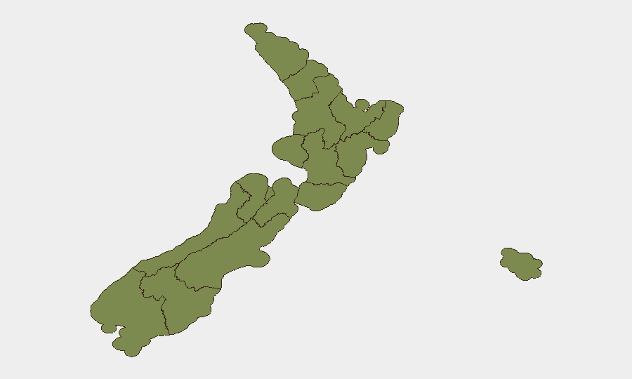
Situation Summary
New Zealand remains a low-threat environment globally (rank #142, composite score 6), with no verified security incidents, civil unrest, infrastructure disruption, or notable travel risks reported in the last 24–48 hours. Parliament convened under urgency on 1 July to expedite 22 bills including security-related amendments, reflecting normal legislative activity rather than crisis response. Risk is concentrated geographically in Auckland (score 31.8) and Canterbury (21.2), with all other regions at materially lower threat levels. The overall trajectory remains stable.
Key Developments
- Wellington, 1 July 2026: New Zealand Parliament sat under urgency to debate and pass 22 bills, including security-related amendments. This is procedural legislative activity, not an incident, but indicates accelerated policy cycles on security matters.
- No verified security, crime, civil unrest, or infrastructure incidents were corroborated across multiple sources in New Zealand in the 24–48 hour window ending 1 July 2026. Live web research across news, social media, and event reporting yielded no time-verified developments meeting duty-of-care criteria.
- Residual event signals in the Geobit feed (China public statement, EU sanctions, North Korean investigation) are attributable to international actors and policy responses, not domestic New Zealand incidents. These do not indicate elevated local threat at this time.
Highest-Risk Areas
Auckland dominates the risk profile (31.8), more than 50% higher than Canterbury (21.2) and substantially above all other regions. Waikato (17.2) and Wellington (14.3) represent secondary concentration points. This distribution reflects Auckland's role as the nation's commercial and transport hub, making it a focus for economic crime, organized activity, and administrative disruption; Canterbury and Waikato carry agricultural and infrastructure vulnerabilities. All remaining regions score below 5, indicating dispersed, low-level risk. Teams with personnel or assets in Auckland should maintain baseline situational awareness; Canterbury operations merit standard due-diligence monitoring.
How GeoBit Would Assist
Corporate teams with New Zealand exposure should use AOI Monitoring & Early Warning on Auckland and Canterbury to detect emerging incidents in real time, Intel Sweep and multi-language OSINT to track cross-border actors and sanctions/regulatory changes affecting operations, and Routing & Network Analysis to identify alternative supply or personnel pathways should localized disruption occur. GIS & Spatial Analysis layered with economic and infrastructure data supports identification of high-value asset concentrations and infrastructure chokepoints in high-risk regions.
7-Day Outlook
No escalation is forecast. The current legislative activity in Wellington is routine and poses no direct operational risk. Baseline monitoring of Auckland and Canterbury is warranted as standard practice, but no alert status change is recommended. Teams should continue routine duty-of-care protocols without heightened posture.
Highest-Risk Areas — Ranked
| # | State / Region | Risk |
|---|---|---|
| 1 | Auckland | 31.8 |
| 2 | Canterbury | 21.2 |
| 3 | Waikato | 17.2 |
| 4 | Wellington | 14.3 |
| 5 | Northland | 13.8 |
| 6 | Manawatū-Whanganui | 4.2 |
| 7 | Otago | 4.2 |
| 8 | Chatham Islands | 3.2 |
| 9 | Bay of Plenty | 3.2 |
| 10 | Taranaki | 2.2 |
| 11 | Hawke's Bay | 1.8 |
| 12 | Gisborne | 1.8 |
Sources
Previous Daily Briefs
A new New Zealand brief is written every day — each with its own risk map and downloadable CSV. Here's the last week; use the calendar to go further back.
📅 Browse every day by calendar →
Highlighted days have a brief. Tap a day for that day's map & analysis, or “csv” for that day's dataset ($5).