Situation Summary
Niger remains elevated in global threat rankings (position #20; composite score 72) with 51 tracked events, reflecting persistent instability across the Sahel. Niamey dominates the risk profile at 80.5, driven by recent diplomatic tensions, public dissent, and demonstrated militant activity. The broader security environment shows strain across northern and eastern regions, with activity signals spanning terrorism (Al Qaeda involvement noted), inter-state friction (UK, France, AU statements flagged), and civil unrest. Current trajectory suggests sustained pressure rather than rapid escalation, but localized volatility remains high.
Key Developments
Unable to confirm specific incidents in the last 24–48 hours with cross-source verification. Recent event signals (2026-06-18 to 2026-06-21) include:
- 2026-06-20: UK–Niger diplomatic disapproval and Nigerian public statements; nature and location of dispute unconfirmed by open sources.
- 2026-06-19: Demonstrations by Nigerian elements against British actors; venue and scale not yet established.
- 2026-06-19: Disapproval event reported between Niger and France; underlying cause and specifics require clarification.
- 2026-06-21: Threat signaled by counsel against Nigeria; jurisdiction and substance unclear.
- 2026-06-19: Al Qaeda activity against Nigeria noted in event stream; geographic scope and target type to be determined.
- 2026-06-18: Demand issued by Niger Delta actors; context and demands not yet sourced.
Status: GeoBit event signals are registered; however, detailed corroboration via multi-source open-source research (news + social media) is pending. Security teams should treat these signals as alerting events requiring real-time monitoring and local-source confirmation rather than confirmed incidents.
Highest-Risk Areas
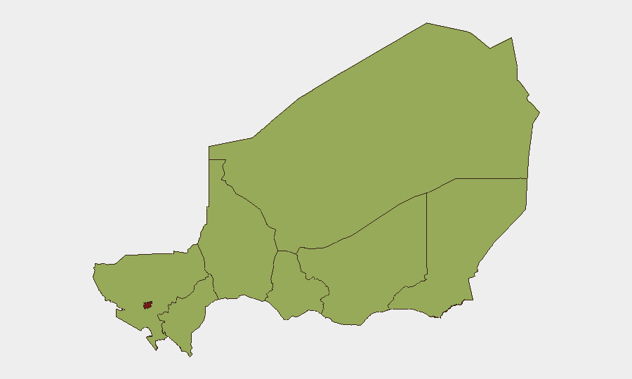
Niamey (80.5) dominates risk due to its role as the political and diplomatic hub; recent UK–France–AU engagement, public dissent, and demonstrated militant capability create compounded exposure. Agadez Region (56.4) ranks second, reflecting al Qaeda and other militant presence in the northern Sahara corridor. Diffa, Zinder, Tillabéri, Tahoua, Dosso, and Maradi regions (all ~50.5) form a band of sustained moderate-to-high risk, driven primarily by armed-group activity, cross-border instability, and limited state capacity. The clustering of non-capital regions around 50.5 suggests widespread rather than localized militant pressure; Diffa and Tillabéri remain particularly volatile due to proximity to Nigerian Boko Haram/ISWAP zones and Malian ungoverned space.
How GeoBit Would Assist
Security teams monitoring Niger should deploy AOI (Area-of-Interest) Monitoring & Early Warning on Niamey (diplomatic compounds, major thoroughfares, airports) and Agadez, Diffa, and Tillabéri regions (border crossings, supply routes) to detect real-time incidents and threat movement. Intel Sweep and X/Twitter & Telegram OSINT with multi-language filtering (French, Arabic, Hausa, Niger Arabic) will capture official statements, militant claims, and local civil-society signals faster than English-language news wires. Routing & Network Analysis supports duty-of-care teams by identifying alternative routes and safe corridors around active threat zones, while Satellite & Imagery analysis on key infrastructure (airports, diplomatic precincts, border posts) provides independent confirmation of disruptions.
7-Day Outlook
Expect continued diplomatic friction and public dissent in Niamey with low risk of immediate violent escalation in the capital. Militant activity in Agadez, Diffa, and Tillabéri will likely persist at current tempo; summer mobility and raiding patterns may drive small increases in ambushes and kidnapping attempts by mid-week. Monitor for secondary effects (border closures, telecom disruptions) if tensions between Niger and neighboring states (France, UK, Nigeria) sharpen.
Highest-Risk Areas — Ranked
| # | State / Region | Risk |
|---|---|---|
| 1 | Niamey | 80.5 |
| 2 | Agadez Region | 56.4 |
| 3 | Zinder Region | 50.5 |
| 4 | Diffa Region | 50.5 |
| 5 | Tillabéri Region | 50.5 |
| 6 | Tahoua Region | 50.5 |
| 7 | Dosso Region | 50.5 |
| 8 | Maradi Region | 50.5 |
Sources
Previous Daily Briefs
A new Niger brief is written every day — each with its own risk map and downloadable CSV. Here's the last week; use the calendar to go further back.
📅 Browse every day by calendar →
Highlighted days have a brief. Tap a day for that day's map & analysis, or “csv” for that day's dataset ($5).