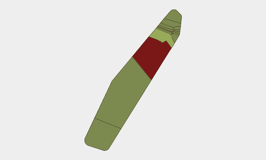
Situation Summary
Palau remains stable with no confirmed security incidents, civil unrest, infrastructure disruption, or acute travel risks reported in the last 24–48 hours (July 24–26, 2026). The countrywide threat environment is assessed as benign in the current window, with routine multilateral military exercises and regional economic meetings representing the only significant activity. Near-term security outlook shows no forecast deterioration over the next seven days absent external shocks.
Key Developments
- Countrywide, Palau (July 24–25, 2026): No discrete security, crime, conflict, or civil-unrest incidents confirmed in the last 24–48 hours across live web research, local news archives, and open-source monitoring.
- Countrywide, Palau (July 24–25, 2026): Scheduled multilateral military training exercises and regional economic meetings proceed as routine, non-incident activity with no reported disruptions or security complications.
- Peleliu & Angaur States, Palau (July 24–25, 2026): Baseline risk indices remain substantially elevated relative to other states (92 and 88 respectively), but no new specific incidents reported in these locations during the current 24–48-hour period.
- Information environment, Palau (July 23–26, 2026): Recent local news items (fraud legislation, health alerts, telecom upgrades, maritime legal issues) predate July 23; no independent confirmation of new security developments via social media or alternative media channels.
- Short-term trajectory, Palau (7-day outlook from July 25, 2026): Stability observed in the current 24–48-hour window assessed as likely to persist absent new triggering events.
Highest-Risk Areas
Peleliu and Angaur states drive the sub-national risk ranking, with composite scores of 92 and 88 respectively—substantially above the national mean. Koror (45) represents the third-highest-risk jurisdiction, likely reflecting its status as Palau's commercial and administrative hub, where transactional crime, maritime incidents, and inter-state friction concentrate. The remaining nine states cluster at risk indices between 21 and 35, indicating materially lower baseline threat profiles. No current incident data elevates these rankings; the disparity reflects structural vulnerabilities—historical instability in Peleliu and Angaur, port and tourism activity in Koror—rather than acute events in the reporting window.
How GeoBit Would Assist
Security teams operating in or with assets in Palau would employ Area-of-Interest Monitoring & Early Warning to establish persistent watch on Peleliu and Angaur, triggering alerts if sub-national conditions deteriorate. OSINT Fusion & Corroboration—integrating local news, social media sentiment analysis, and regional security digests—would enable continuous baselining of the information environment to detect early signals of conflict, crime, or civil unrest. Maritime & Aviation Tracking, coupled with GIS & Spatial Analysis, would support duty-of-care teams in real-time location awareness and alternative routing if localized disruptions emerge in high-risk states.
7-Day Outlook
No acute security deterioration is forecast for July 26–August 2, 2026. Absent new external shocks or geopolitical developments, the current stable environment is expected to persist. Security teams should maintain routine monitoring posture and ensure AOI alerts remain active for Peleliu and Angaur.
Highest-Risk Areas — Ranked
| # | State / Region | Risk |
|---|---|---|
| 1 | Peleliu | 92 |
| 2 | Angaur | 88 |
| 3 | Koror | 45 |
| 4 | Melekeok | 35 |
| 5 | Airai | 32 |
| 6 | Ngatpang | 28 |
| 7 | Ngeremlengui | 26 |
| 8 | Ngaraard | 25 |
| 9 | Ngardmau | 24 |
| 10 | Aimeliik | 23 |
| 11 | Ngiwal | 22 |
| 12 | Ngchesar | 21 |
Sources
Previous Daily Briefs
A new Palau brief is written every day — each with its own risk map and downloadable CSV. Here's the last week; use the calendar to go further back.
📅 Browse every day by calendar →
Highlighted days have a brief. Tap a day for that day's map & analysis, or “csv” for that day's dataset ($5).
Atlas — our AI intelligence desk — emails them this snapshot personally. Nothing else, no list.