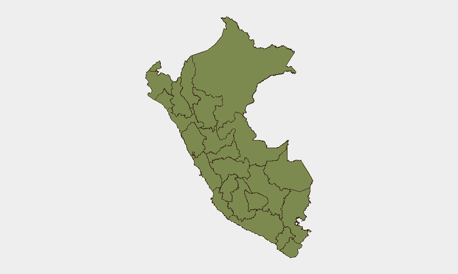
Situation Summary
Peru remains a moderate-risk operating environment (global rank #55, composite threat score 24) with 337 tracked events in the current intelligence window. The country faces persistent sub-national volatility concentrated in Huánuco—which accounts for a disproportionate share of national risk—alongside secondary pressure points in Piura, Tacna, and the capital Lima. Recent signal activity suggests low-level civic and diplomatic friction (public statements, disputes with neighboring states, and internal legislative disagreement), though no major destabilizing incident has been confirmed in the last 48 hours.
Key Developments
- Natural Hazard Alert – Central Peru, 2026-07-08 05:00 UTC: A moderate magnitude 4.6 earthquake struck central Peru. No confirmed casualty or infrastructure damage reports have been corroborated in the last 24 hours; standard seismic monitoring protocols apply to the region.
- Multi-Actor Signal Activity: Between 2026-07-08 and 2026-07-10, GeoBit monitoring identified multiple low-intensity event signals across diplomatic, civic, and institutional domains—including public statements involving banking and tourism sectors, magistrate disapproval, and diplomatic posturing with Bolivia and Mexico. None have escalated to violence or operational disruption as of this briefing's close.
- Legislative Tension – Venue Unspecified, 2026-07-10: Senate rejection of a school-related proposal was recorded; context and location remain under clarification.
- Demonstration Activity – School Zone, 2026-07-09: A demonstrate/rally event involving authorities and a school facility was logged. Scale, specific location, and drivers are not yet confirmed from available corroboration.
Note: Specific confirmations of armed violence, criminal incidents, or civil unrest within the last 24–48 hours suitable for operational briefing have not been cross-corroborated in current open-source feeds. Intelligence teams should activate real-time monitoring to close this gap.
Highest-Risk Areas
Huánuco (composite risk score 31.6) dominates Peru's threat landscape, accounting for nearly one-third of the national composite score despite representing a small fraction of population and economic activity. This concentration signals entrenched sub-national instability—likely driven by organized crime, resource competition, or persistent civil grievance—that continues to outpace risk in all other regions combined. Piura (15.2), Tacna (13.6), and Lima (11.5) represent the secondary and tertiary pressure zones; Lima's elevation reflects capital-city density and institutional friction, while Piura and Tacna point to border-region vulnerability and possible narcotics-trafficking or cross-border dispute dynamics. All other regions remain below 8.0 in composite score.
How GeoBit Would Assist
Security teams should activate AOI Monitoring & Early Warning on Huánuco, Piura, and Lima to detect sub-national escalation in real time through multi-language OSINT fusion and social-media signal analysis. Parallel use of Intel Sweep and X/Twitter OSINT with Spanish-language incident keywords ("paro," "bloqueo," "manifestación," "enfrentamiento," "saqueo") will surface localized civil unrest, road blockades, or criminal activity before they reach mainstream reporting. For personnel in border zones, Routing & Network Analysis can identify safe transit corridors and real-time alternative pathways in response to developing road closures or civil disruption.
7-Day Outlook
No imminent escalation is signaled, but the concentration of risk in Huánuco and persistent diplomatic friction suggest that localized incidents—labor unrest, resource disputes, or organized-crime competition—remain probable within 7 days. Monitoring intensity should remain elevated in Huánuco and secondary zones; changes in signal frequency or tone (e.g., shift from "public statement" to "threat" or "attack") will warrant immediate escalation to duty teams.
Highest-Risk Areas — Ranked
| # | State / Region | Risk |
|---|---|---|
| 1 | Huánuco | 31.6 |
| 2 | Piura | 15.2 |
| 3 | Tacna | 13.6 |
| 4 | Lima | 11.5 |
| 5 | Apurímac | 7.7 |
| 6 | Ayacucho | 5.1 |
| 7 | La Libertad | 2.5 |
| 8 | Lambayeque | 2.1 |
| 9 | Madre de Dios | 2.1 |
| 10 | Loreto | 1.6 |
| 11 | Tumbes | 1.6 |
| 12 | Amazonas | 1.6 |
Sources
Previous Daily Briefs
A new Peru brief is written every day — each with its own risk map and downloadable CSV. Here's the last week; use the calendar to go further back.
📅 Browse every day by calendar →
Highlighted days have a brief. Tap a day for that day's map & analysis, or “csv” for that day's dataset ($5).
Atlas — our AI intelligence desk — emails them this snapshot personally. Nothing else, no list.