Situation Summary
The Philippines maintains a composite national threat score of 37 (global rank #47), reflecting moderate residual risk across security, political stability, and regional volatility domains. Recent event signals point to elevated political and institutional tension—including parliamentary statements, arrests of political figures and activists, and judicial rejections of government actions—but open-source verification has not surfaced discrete security incidents, civil unrest, or infrastructure disruptions in the past 24–48 hours. Sub-national risk remains concentrated in maritime and resource-rich regions, particularly Mimaropa and the Visayas, where organized crime, inter-communal conflict, and weak enforcement persist.
Key Developments
No cross-confirmed security, civil-unrest, crime, political-instability, or travel-risk incidents meeting professional verification standards were identified in the Philippines over the last 24–48 hours (approximately 3–5 July 2026). Open-source monitoring, major news feeds, and social-media OSINT produced no reports of armed clashes, major arrests affecting travel or business continuity, infrastructure failures, or public-order disruptions in that window.
Political and institutional signals flagged in the event feed (arrests of parliamentary and Senate figures on 4–5 July, public statements and rejections of departmental actions on 3–4 July) require direct source confirmation and may reflect routine legislative or judicial processes rather than acute security events. Teams with personnel or assets in Manila and provincial government zones should continue routine duty-of-care monitoring.
Highest-Risk Areas
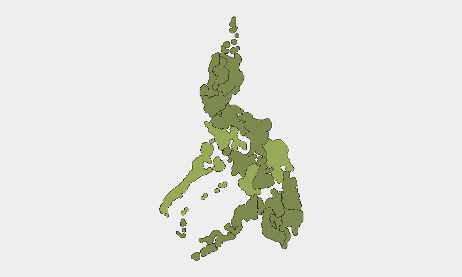
Mimaropa (risk 55.8) emerges as the single highest-risk region, driven by maritime piracy, kidnap-for-ransom networks, organized smuggling, and weak maritime law enforcement. Negros Island Region and Eastern Visayas (both 43.4) face similar threats—trafficking, inter-island organized crime, and localized insurgent activity. Metro Manila (36.2) remains moderately elevated due to petty crime, protest activity, and congestion-related risks, but organized violence is contained. Cordillera, Calabarzon, and Ilocos regions (30–28.4) track at lower but non-negligible levels, reflecting mining disputes, land conflicts, and criminal networks in remote zones. Bangsamoro and southern Mindanao regions (25.8) remain monitored for residual militant activity and inter-communal tensions, though major operations have not recurred recently.
How GeoBit Would Assist
Security and risk teams operating in the Philippines should employ Intel Sweep and OSINT fusion to track parliamentary and judicial developments in real time, flagging shifts toward political instability or regime pressure that could affect duty-of-care posture. AOI Monitoring & Early Warning on high-risk regions—particularly Mimaropa's maritime zones and Eastern Visayas—provides persistent detection of piracy, kidnap, or trafficking activity, enabling route and personnel planning. Conflict & Military network analysis combined with regime-stability assessment can distinguish routine institutional friction from genuine political risk that would warrant travel advisories or asset repositioning.
7-Day Outlook
Political activity is likely to remain elevated through mid-week as parliamentary and judicial proceedings continue; no acute security escalation is forecast unless institutional tensions translate into street-level protest or militant mobilization. Regional risks in Mimaropa and the Visayas are expected to persist at current levels—maritime crime and organized-crime activity remain endemic but not escalating. Teams should maintain heightened situational awareness in maritime and remote provincial zones and continue routine liaison with host-government security liaisons.
Highest-Risk Areas — Ranked
| # | State / Region | Risk |
|---|---|---|
| 1 | Mimaropa | 55.8 |
| 2 | Negros Island Region | 43.4 |
| 3 | Eastern Visayas | 43.4 |
| 4 | Metro Manila | 36.2 |
| 5 | Cordillera Administrative Region | 30 |
| 6 | Calabarzon | 28.9 |
| 7 | Ilocos Region | 28.4 |
| 8 | Bangsamoro | 25.8 |
| 9 | Caraga | 25.8 |
| 10 | Northern Mindanao | 25.8 |
| 11 | Soccsksargen | 25.8 |
| 12 | Davao Region | 25.8 |
Sources
Previous Daily Briefs
A new Philippines brief is written every day — each with its own risk map and downloadable CSV. Here's the last week; use the calendar to go further back.
📅 Browse every day by calendar →
Highlighted days have a brief. Tap a day for that day's map & analysis, or “csv” for that day's dataset ($5).
Atlas — our AI intelligence desk — emails them this snapshot personally. Nothing else, no list.